The landmark of the 5 lords (La Borne des Cinq Seigneurs)

A very varied loop north of Bona, towards the highest point of the Monts du Nivernais (445m).

Technical sheet

372685
Creation:
Last update:
Last review:
  • Walking
    Activity: Walking
  • ↔
    Distance: 12.23 km
  • ◔
    Average duration: 4h 10 
  • ▲
    Difficulty: Moderate

  • ⚐
    Return to departure point: Yes
  • ↗
    Vertical gain: + 245 m
  • ↘
    Vertical drop: - 246 m

  • ▲
    Highest point: 441 m
  • ▼
    Lowest point: 274 m

Photos

Description of the walk

In Bona, park in the car park opposite the cemetery.

(S/E) Head North on the D9. After about 100m, turn left off the main road. At the next junction, go straight ahead and follow a track to the West, which leads into the woods.

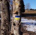
(1) Climb up to the woods, following the PR® signs. At the various junctions, turn right.

(2) Stay on the main path, North or North-North-West, and ignore all the side trails.

(3) Join a track coming from the left and follow it to the right as far as the Borne des Cinq Seigneurs.

(4) Then take the 2nd path on the right (East, then East-South-East). At the crossroads, continue straight ahead and descend into the Bois de Lichy.

(5) On leaving the wood, after passing through pastures, cross the hamlet to the D9, near the castle.

(6) Follow the D9 southwards for a few dozen metres, then turn left towards the pumping station. Continue until you reach a crossroads.

(7) Turn right and ignore the next track on the left. Go straight up to a reservoir, from which you have a very good view.

(8) Continue to the Agland hamlet and its old houses, and walk to the hamlet exit.

(9) Then take the path to the right (South-West). Follow it to a T-junction, then turn left. Cross the ford and rejoin the D958.

(10) Cross the road (with care) and follow the road almost straight ahead up to the church. Turn right to join the D9. Turn right again, cross the D958 and descend to the car park (S/E).

Waypoints

  1. S/E : km 0 - alt. 288 m - Car park opposite the cemetery
  2. 1 : km 1.15 - alt. 320 m - Talou Wood
  3. 2 : km 2.84 - alt. 432 m - Tick 432
  4. 3 : km 5.15 - alt. 433 m - Junction with a runway
  5. 4 : km 5.66 - alt. 438 m - Five Lords Bollard
  6. 5 : km 7.63 - alt. 331 m - Exit from Lichy Wood
  7. 6 : km 8.79 - alt. 296 m - Lichy crossroads, turn right then left
  8. 7 : km 9.29 - alt. 295 m - After the pumping station, turn right
  9. 8 : km 10.15 - alt. 374 m - Tank
  10. 9 : km 10.62 - alt. 336 m - Agland
  11. 10 : km 11.81 - alt. 282 m - Junction D958
  12. S/E : km 12.23 - alt. 288 m - Car park opposite the cemetery

Practical information

Shops, restaurant in Bona.

In the nearby area

16th-century Château de Lichy, Châteaux de Charry and de Huez.
Old houses in Aglan, Moulin de Huez.
Washhouses in Bona, Lichy and Huez.
13th-century Bona church, rebuilt in the 19th century.
Bona church.

 Always stay careful and alert while following a route. Visorando and the author of this walk cannot be held responsible in the event of an accident during this route.

The GR® and PR® markings are the intellectual property of the Fédération Française de Randonnée Pédestre.

Reviews and comments

4.3 / 5
Based on 19 reviews

Reliability of the description
4.2 / 5
Clarity of route map
4.2 / 5
Route interest
4.4 / 5
User 17239427

Overall rating : 4.3 / 5

Date of walk : May 28, 2025
Reliability of the description : ★★★★★ Very good
Clarity of route map : ★★★★☆ Good
Route interest : ★★★★☆ Good
Busy trail : No

Very nice forest circuit, pleasant when the weather is hot

Automatically translated

rambert
rambert

Overall rating : 5 / 5

Date of walk : Mar 09, 2025
Reliability of the description : ★★★★★ Very good
Clarity of route map : ★★★★★ Very good
Route interest : ★★★★★ Very good
Busy trail : Yes

A very pretty route for the eyes in a very wooded environment, which must be pleasant in summer. The difference in altitude makes it an interesting trail. Following the route on visorando is reassuring for avoiding the hard-to-find paths, but doesn't prevent hikers from looking for the tracks.

Automatically translated

Gabin_Cm
Gabin_Cm

Overall rating : 3.7 / 5

Date of walk : Feb 15, 2023
Reliability of the description : ★★★★☆ Good
Clarity of route map : ★★★☆☆ Average
Route interest : ★★★★☆ Good
Busy trail : No

Nice

Automatically translated

Bourdier2
Bourdier2

Overall rating : 4 / 5

Date of walk : Nov 11, 2022
Reliability of the description : ★★★★☆ Good
Clarity of route map : ★★★★☆ Good
Route interest : ★★★★☆ Good
Busy trail : No

This is a nice walk that takes place largely in the forest and is therefore not quite as varied as advertised in the description. Nice paths and gradients. A short section outside the woods with beautiful views of the mountains and the magnificent chateau at Luchy. Beware: ask about hunting drives (a general nuisance on weekends).

Automatically translated

Chnok
Chnok

Thank you for your appreciation.
I did this hike a few years ago and really enjoyed it.
That's why I suggested it on Visorando.
However, the environment is changing but I'm thinking of doing this hike again in a few months' time.
I will of course modify the information sheet accordingly (especially point 4...)
Best regards.
Chnok

Automatically translated

Fanfan 58
Fanfan 58

Overall rating : 4 / 5

Date of walk : Aug 21, 2021
Reliability of the description : ★★★★☆ Good
Clarity of route map : ★★★☆☆ Average
Route interest : ★★★★★ Very good
Busy trail : No

A very beautiful walk with magnificent panoramas... and I'd put my difficulty rating at medium +. The only downside was that point 4 wasn't explained very well, which meant that we had to get to the little village of Lichy very quickly, which meant a 9 km hike.

Automatically translated

henri57
henri57 ★
alff
alff

Overall rating : 4.3 / 5

Date of walk : May 31, 2020
Reliability of the description : ★★★★☆ Good
Clarity of route map : ★★★★☆ Good
Route interest : ★★★★★ Very good
Busy trail : No

As the map of the route wasn't available offline, we used it as the basis for the route on our GPS and then did the route based on the IGN25. As a result, you can see the differences with the original route, but it's still very easy.
It's a good thing there's a path so you don't have to walk on the track! Above all, don't miss the start on the right (As a result, it doesn't quite follow the route either, but you have to follow it with confidence and you'll get to the 5 lords!
It's a lovely walk, with well-tended woods? To be recommended on hot days
Thank you for the discovery and the good time.

Automatically translated

ac92
ac92

Overall rating : 4.3 / 5

Date of walk : Aug 17, 2019
Reliability of the description : ★★★★☆ Good
Clarity of route map : ★★★★★ Very good
Route interest : ★★★★☆ Good

A lovely, well-shaded walk, very pleasant in hot weather, and fortunately so, as the climbs are sometimes tough... Unfortunately, part of the route (between points 2 and 3) is virtually impassable following some rather haphazard forest cutting, with the path disappearing in places under the branches... You have to be optimistic to continue... Afterwards, we realised that there was a possible diversion, but we didn't see it signposted! Beautiful property at Lichy, lovely shady path between Agland and Bona, a really lovely and varied walk...

Automatically translated

Netra
Netra ★

Hello ticatam and thank you for your comments.

easy rather than medium category

I can imagine that this hike is not technically difficult. The rating depends on the distance and the difference in altitude. For Visorando's very large and diverse audience, the Medium rating is well suited to this hike.

Automatically translated

ticatam
ticatam
• Last modified:

Overall rating : 4.3 / 5

Date of walk : Jul 12, 2019
Reliability of the description : ★★★★★ Very good
Clarity of route map : ★★★★☆ Good
Route interest : ★★★★☆ Good

A fine walk, which should be classed as easy rather than medium.
Major work in the woods with a poorly signposted diversions that forced us to cross the pruning site: not great at all. It was only at the "dead man's grave" that we found our way back, as there was no GPS signal, so we had to make do...
There's also a detail to be added to the description, at point (4): "continue straight ahead"... it should read "turn right for 50 m to take the path on the left that descends into the Bois de Lichy".
Enjoy your hike
Ticatam

Automatically translated

ipol58
ipol58

Overall rating : 4.3 / 5

Date of walk : Mar 30, 2019
Reliability of the description : ★★★★★ Very good
Clarity of route map : ★★★★☆ Good
Route interest : ★★★★☆ Good

A pleasant hike, easily completed in less time than indicated, despite one major drawback ... the turn-off in the woods, which is quite badly signposted!

Thanks to the GPS, we managed to find our way back and land on our feet at the "dead man's spot" just before the 5 seigneurs milestone. At last we were back on the right track ... until we came across the logging road a few hundred metres further on, when it was impossible to take the path indicated by the application. We were therefore obliged to rejoin the road and land on our feet again at point 6 ...

A decision to be made with full knowledge of the facts, and possibly to be modified depending on the logging operations underway in the woods!

Automatically translated

Michael L
Michael L

Overall rating : 4.7 / 5

Date of walk : Aug 27, 2018
Reliability of the description : ★★★★☆ Good
Clarity of route map : ★★★★★ Very good
Route interest : ★★★★★ Very good

super

Automatically translated

mylinette
mylinette

Overall rating : 4.3 / 5

Date of walk : Aug 20, 2018
Reliability of the description : ★★★★★ Very good
Clarity of route map : ★★★★☆ Good
Route interest : ★★★★☆ Good

Very pleasant walk! yes, we didn't pay much attention to the turn-off in the woods, which wasn't very pleasant.
Some good climbs.

Automatically translated

naturophile
naturophile

Overall rating : 4 / 5

Date of walk : Apr 05, 2018
Reliability of the description : ★★★★☆ Good
Clarity of route map : ★★★★☆ Good
Route interest : ★★★★☆ Good

Very pleasant walk, already done last spring and autumn 17, and this 6 April 18.
yes, a hill to start with, but if you take your time, anyone can do it. However, there is a bigger problem just after arriving on the ridge on the path bordering the fir forest on the left and the oak forest on the right. The fir trees are being logged and skidded, so there is no path. You have to go through the wood, taking care not to stray far from the path as you follow it or guess at it. For me, having already done it, it was probably easier to guess!
This difficulty covers about 2 km, interspersed with a short return to the path.
The most difficult climb is the one just after the Yxeure pumping station!
Walk completed in 2h32 and as pleasant in autumn as in spring.

Automatically translated

For more walks, use our search engine .

The GPS track and description are the property of the author. Do not copy them without permission.