Tête de Sanguinière from Saint-Dalmas-le-Selvage

A summit in the Alpes-Maritimes that is rarely visited but is nonetheless well worth the detour. Long and steep, but with a gradual ascent and a magnificent route through one of the region’s most beautiful valleys, which apparently nearly became a ski resort before the creation of the Mercantour National Park.
You are in the Mercantour National Park; there are regulations to be observed, and failure to do so may result in a fine of up to €1,500 – see the practical information.

Details

9918397
Creation:
Last update:
Last review:
  • Walking
    Activity: Walking
  • ↔
    Distance: 11.11 mi
  • ◔
    Duration according to the author: 8 hrs 
  • ▲
    Difficulty: Very difficult

  • ⚐
    Back to start: Yes
  • ↗
    Ascent: + 4,698 ft
  • ↘
    Descent: - 4,672 ft

  • ▲
    Highest point: 9,370 ft
  • ▼
    Lowest point: 4,921 ft

Photos

Description of the walk

Park in the car park at the end of the village of Saint-Dalmas-le-Selvage.

(S/E) Head towards the Ruisseau de Sestrière and cross it via the bridge at marker 50. Continue on to reach the junction at marker 51.

(1) Be careful here: contrary to what is shown on the IGN map, once you reach the track, the path runs slightly downstream and is not easy to spot. To find it, cross the track and turn left to reach the multi-way junction at marker 63.

(2) Turn right at marker 63 and head slightly downhill until you rejoin the track. Turn right onto it and follow it until you reach marker 55.

(3) Leave the track here and head through the forest again until you reach marker 56. Join the track here and continue on to marker 57 and the sign marking the entrance to the Mercantour National Park, just before the Sestrière plateau.

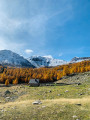
(4) Cross the bridge and continue left along a path to enter the magnificent Vallon de la Braïssa. The path is well signposted and easy to follow. Further on, you’ll reach the Braïssa torrent.

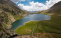
(5) Walk alongside it, keeping to the right-hand side, to reach the Cabane de la Braisse at a leisurely pace.

(6) Continue along the edge of the stream until you reach the edge of the forest at the stream’s source.

(7) Carry on along the well-marked path to reach the Col de la Braïssa, marked by signpost 59. Enjoy this unique view, which takes in both the Haute Tinée and the Haut Var, with Mont Pelat directly in front of you.

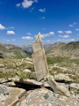
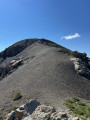
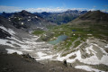
(8) Begin the final ascent by heading off-trail to the left along the ridge leading to the Tête de Sanguinière. Follow the few cairns marking the path here and there. It’s not particularly difficult, but do take care on the tricky scree slope.

(9) Take care here. Cross this scree slope: there are a few cairns here and there, but they aren’t necessarily placed very sensibly and/or are hard to spot amidst the scree. Keep the Tête de Sanguinière clearly in sight and head straight up towards it if you lose your way.
You’ll then reach more gentle, grassy terrain for a few metres before coming to asecond slightly tricky section where you’ll need to use your hands on the rock face. Nothing vertiginous or particularly complicated, though – don’t worry.
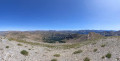
You’ll then reach the summit of the Tête de Sanguinière. Take a moment here to enjoy the panoramic view.

(10) Follow the same route back as on the way up to reach the car park in the village of Saint-Dalmas-le-Selvage (S/E).


Waypoints

  1. S/E : mi 0 - alt. 4,921 ft - Saint-Dalmas-le-Selvage car park
  2. 1 : mi 0.3 - alt. 5,308 ft - Sestrière trail
  3. 2 : mi 0.56 - alt. 5,771 ft - Marker 63
  4. 3 : mi 1.7 - alt. 6,017 ft - Marker 55
  5. 4 : mi 2.38 - alt. 6,467 ft - Sestrière Plateau
  6. 5 : mi 2.97 - alt. 6,762 ft - Braïssa Valley
  7. 6 : mi 3.46 - alt. 7,136 ft - Braisse Hut
  8. 7 : mi 4.1 - alt. 7,546 ft - Source of the Braïssa
  9. 8 : mi 4.92 - alt. 8,517 ft - Col de la Braïssa
  10. 9 : mi 5.26 - alt. 8,976 ft - Scree slope
  11. 10 : mi 5.55 - alt. 9,370 ft - Tête de Sanguinière
  12. S/E : mi 11.11 - alt. 4,921 ft - Saint-Dalmas-le-Selvage car park

Notes

Mercantour National Park regulations – full details via this link:
- Bivouacking and camping: permitted only more than an hour’s walk from road access points and the park boundaries, between 7.00 pm and 9.00 am. It is forbidden to spend the night in your vehicle in a car park or at the side of the road within the heart of the Mercantour National Park.
- Dogs are not permitted, even when kept on a lead
- Fires are prohibited in the core area of the park and also throughout the Alpes-Maritimes department
by prefectural decree.
- Parking may be prohibited at the start of certain hikes due to the risk of
torrential mudslides and rockfalls.

Much of the ascent follows the course of the Braïssa torrent; you can easily quench your thirst here if you have filter water bottles. There is also a drinking fountain at the start of the walk in the car park.

Worth a visit

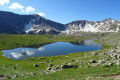
Between (3) and (4), the Sestrière Plateau is a lovely spot for a picnic and not yet too crowded.
Between (4) and (7) The Braïssa Valley has a certain magic about it, with its lovely path running alongside the stream through a dense, shady forest. It is certainly one of the most beautiful in the department.
(10) The Tête de Sanguinière offers a magnificent view of the Tinée and Var valleys.

Reviews and comments

5 / 5
Based on 2 reviews

Reliability of the description
5 / 5
Ease of following the route
5 / 5
Route interest
5 / 5
Seb-Dhen
Seb-Dhen
• Edited:

Overall rating : 5 / 5

Date of your route : Jul 12, 2026
Reliability of the description : ★★★★★ Very good
Ease of following the route : ★★★★★ Very good
Route interest : ★★★★★ Very good
Very busy route : Yes

Apart from the inevitable short stretches of road at the start, this walk is quite simply magnificent. The scenery changes as you climb, and you soon find yourself immersed in a genuine mountain atmosphere, with a very pleasant sense of seclusion.

As for finding your way, I didn’t encounter any difficulties. Even in the final section, after the Col de Braïssa, where the route might seem less obvious, the cairns are numerous, well-placed and visible from a distance. As long as you stay alert, it’s hard to go wrong.

The ascent is gradual, with no particular technical difficulties, which allows you to fully enjoy the scenery without feeling as though you’re climbing an endless slope.

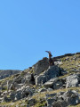
What struck me most was the tranquillity that reigns on this summit. I didn’t come across any other walkers after the pass; instead, the real masters of the place are the ibex. They seem to have found a haven of peace here, and it’s quite easy to spot them. A real privilege, provided you remain discreet, keep your distance and respect their peace and quiet.

For those wishing to shorten the hike, it’s possible to set off directly from the Sestrière mountain hut. This saves you around 500 metres of elevation gain and nearly 7 km of walking, whilst still covering most of the route and enjoying the magnificent panoramic views.

Machine-translated

jacquot 06
jacquot 06
• Edited:

Overall rating : 5 / 5

Date of your route : Aug 11, 2021
Reliability of the description : ★★★★★ Very good
Ease of following the route : ★★★★★ Very good
Route interest : ★★★★★ Very good
Very busy route : Yes

We set off from the car park at Sestrière, not from St Dalmas
The Braïssa valley is absolutely magnificent; you can simply head for the pass and carry on to the Col de Sanguinière without climbing to the summit
There were hikers in the valley and at the pass, but no one on the summit

Machine-translated

Other walks in the area

For more walks, use our search engine .

The GPS track and description are the property of this route's author. Please do not copy them without permission.