Tête de la Dame and Roc de Toulaud, starting from Pissenible

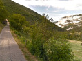
A slightly challenging hike, with the added bonus of panoramic views from the Col de la Bataille, Omblèze, the Trois Becs and the Roc de Toulaud.

Details

n°2996713
Creation:
Last update:
Last review:
  • Walking
    Activity: Walking
  • ↔
    Distance: 9.92 mi
  • ◔
    Average duration: 6h 40 
  • ▲
    Difficulty: Difficult

  • ⚐
    Back to start: Yes
  • ↗
    Ascent: + 2,431 ft
  • ↘
    Descent: - 2,425 ft

  • ▲
    Highest point: 5,177 ft
  • ▼
    Lowest point: 3,921 ft

Description of the walk

Park at the entrance to the Ravin de Pissenible.

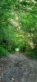
(S/E) Take the forest road of the same name. Red and white markings forthe GR®93.

(1) Leave the forest road and turn right to stay on the GR®. Reach the Col de la Bataille tunnel.

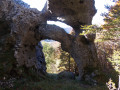
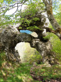
(2) Ignore the tunnel and continue climbing above it to cross the ridge and enjoy the panoramic view of the pass and the valleys. Descend back towards the road and reach the Col de la Bataille.

(3) Turn right onto theGR®, which is a track suitable for vehicles.
Reach the Pas du Gouillat.

(4) Leave theGR® and turn right, following the edge of the Ambel plateau towards the Tête de la Dame.
Reach the Sarnats crossroads.

(5) Continue up the steep slope to the left, then carry on to reach the Tête de la Dame.

(6) Head back in the opposite direction to the Pas du Gouillat crossroads.

(4) Ignore theGR® and head straight ahead towards the Roc de Toulaud. Continue past the green shepherd’s hut. At the Col de Toulau, take the well-marked track that climbs straight up the slope ahead. It becomes less visible in places, but the path, marked with cairns in its upper section, remains easy to follow. Reach the small summit plateau of the rock. Take in the panoramic views from here, including the Grand Veymont to the right. Follow the left-hand edge of this plateau towards the marker stone that marks the summit of the Roc de Toulau.

(7) At the Col de Toulau, take the well-marked track that climbs straight up the slope ahead. It becomes less visible in places, but the path, marked with cairns in its upper section, remains easy to follow. Reach the small summit plateau of the rock. Enjoy the panoramic views from here, including the Grand Veymont to the right. Follow the left-hand edge of this plateau towards the marker stone that marks the summit of the Roc de Toulau.

(8) Continue along this edge until you find the very steep descent path that winds down towards the foot of the rock. Reach the Col de la Bataille.

(3) Retrace your steps along the route you took on the way up to return to the Ravin de Pissenible car park (S/E).

Waypoints

  1. S/E : mi 0 - alt. 3,921 ft - Ravin de Pissenible car park
  2. 1 : mi 0.75 - alt. 4,301 ft - GR junction
  3. 2 : mi 1.56 - alt. 4,462 ft - Col de la Bataille Tunnel
  4. 3 : mi 1.78 - alt. 4,311 ft - Col de la Bataille
  5. 4 : mi 3.22 - alt. 4,347 ft - Pas de Gouillat
  6. 5 : mi 4.14 - alt. 4,537 ft - Les Sarnats crossroads
  7. 6 : mi 4.87 - alt. 4,911 ft - Tête de la Dame (1506m)
  8. 7 : mi 7.01 - alt. 4,531 ft - Col du Toulau (1387m)
  9. 8 : mi 7.45 - alt. 5,177 ft - Summit of Toulaud
  10. S/E : mi 9.92 - alt. 3,921 ft - Ravin de Pissenible car park

Always be cautious and plan ahead when you're outdoors. Visorando and the author of this route cannot be held responsible for any accidents occurring on this route.

The GR® and PR® markings are the intellectual property of the Fédération Française de Randonnée Pédestre.

Reviews and comments

4.7 / 5
Based on 1 review

Reliability of the description
5 / 5
Ease of following the route
5 / 5
Route interest
4 / 5
BARNAVON
BARNAVON

Overall rating : 4.7 / 5

Date of your route : Sep 13, 2021
Reliability of the description : ★★★★★ Very good
Ease of following the route : ★★★★★ Very good
Route interest : ★★★★☆ Good
Very busy route : No

The route is walked in reverse to avoid the dangerous descent from the Roc de Touleau to the Col de la Bataille. There are few visitors on the Roc de Touleau section.
It seems to me that it would be better to combine this route with the ‘Des rochers de la Sauuse’ and the Pas de Chovet to avoid retracing your steps along the same paths.

Machine-translated

Other walks in the area

For more walks, use our search engine .

The GPS track and description are the property of this route's author. Please do not copy them without permission.