Country:
 City:
City:


Park at the Lestrevet Beach car park.
(S/E) With your back to the car park, take the path through the dunes, running parallel to the road, and continue to the pedestrian crossing.
(1) Cross the road and take the access road opposite, leading to a campsite on your left, then continue along a grassy path. At the T-junction, turn left and continue along a wide path skirting the campsite. When you reach a road, head up to the right, skirt another campsite on your right, pass its swimming pool on your left and you’ll arrive opposite a small old house.
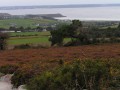
(2) Turn left, pass a beautiful property, continue straight on between fields and turn right onto a farm track leading up to a farm (view of Douarnenez Bay between Cap Sizun and Cap de la Chèvre on the Crozon Peninsula).
(3) Shortly afterwards, turn left onto a wide grassy track which leads to a road; take this road to the left towards the Chapelle Saint-Côme (early 16th century).
(4) Retrace your steps and begin a lovely climb straight on towards the D63. Cross it carefully and turn onto the small road opposite.
(5) When you reach a farm on your right, turn left onto a small road towards some houses and, at the right-angled bend, turn right onto the farm track which climbs straight up towards the D108.
(6) Follow this track to the left, passing the Saint-Nic–Pentrez municipal sports ground; ignore a road leading uphill to the right (cross) and arrive at the entrance to Saint-Nic near the old railway station visible on the left (with the characteristic chimneys of this type of building).
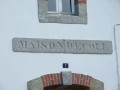
(7) Turn right onto the railway embankment and follow it until you reach a flight of steps on the left leading down to a cul-de-sac. At the main road, turn left and walk past the school (note the inscription on the pediment: “Maison d’école”).
(8) Take the sharp right-hand bend to leave the village and join theGRP® Tour de la Presqu’île de Crozon.
GRP marked in yellow and red
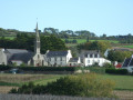
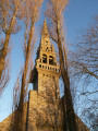
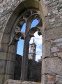
Turn left at the signpost and follow the path through the fields, which offers, to the east, a view of the village of Saint-Nic, dominated by its bell tower, and the two peaks of Ménez Hom, the final peaks of the Montagnes Noires. Walk past Moulin Bernal, a well-restored old mill, and reach the D108 road linking the village of Saint-Nic to Pentrez and its beach.
(9) Turn right onto this road and follow it for a few hundred metres; at the sign for “Rue Dahut – Rue Gradlon”, continue straight on and turn into the first street, Rue Gradlon, to descend gently towards the seaside, leaving theGRP® trail which branches off to the right.
No signposting
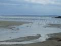
(10) Head down to the beach and follow it to the left. Pass an area reserved for sand yachts and, shortly afterwards, you’ll notice a small turret dating from the Second World War. Its two openings allowed the entire coastal area to be monitored.
Finally, head back up to the car park at Lestrevet Beach, which belongs to the municipality of Plomodiern (S/E).

 Visorando Member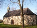

 Easy
Easy