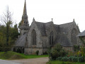
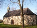
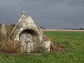
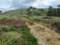
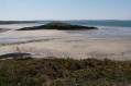
The chapels of Saint-Suliau and Saint-Côme from Lestrevet Beach

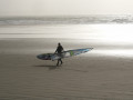
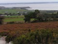
A route overlooking the Lieue de Grève with its two beaches, Lestrevet and Pentrez.
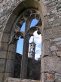
Along the route, two beautiful chapels: Saint-Suliau (late 12th century) and Saint-Côme (early 16th and mid-17th centuries).
A good breath of sea air guaranteed.

Details

n°2932919
Creation:
Last update:
Last review:
  • Walking
    Activity: Walking
  • ↔
    Distance: 7.38 mi
  • ◔
    Average duration: 3h 50 
  • ▲
    Difficulty: Moderate

  • ⚐
    Back to start: Yes
  • ↗
    Ascent: + 522 ft
  • ↘
    Descent: - 509 ft

  • ▲
    Highest point: 436 ft
  • ▼
    Lowest point: 16 ft
  • ⚐ Country: France
  • ⚐ City: Plomodiern (29550)
  • ⚑
    Start/End: N 48.17569° / W 4.290718°
  • ❏
    IGN map(s): Ref. 0518OT
  • Hour-by-hour weather

Photos

Description of the walk

Starting point: Lestrevet Beach car park in Plomodiern.
Yellow PR® signposts

(S/E) With your back to the sea, head up the small road opposite. Ignore the road on the left towards Breignou.
Shortly afterwards, turn right up a small path that crosses a wooded area and rejoins the road further on. Continue along this road, pass a junction and carry on to the next junction.

(1) Leave the road on the left via a path that crosses a stream. At the next junction, turn right towards Lezouyer.
Follow this path as it climbs, leaving Lezouyer on your right, then go round Moulin l’Abbé (an old mill) on the left to reach the D63.

Unmarked section

(2) Turn right and follow this road with care. Pass Lezivi Farm and take the first road on the left. About 100 metres further on, make a short detour to see the Chapel of Saint-Suliau or Sant Sulio (late 12th century) on the left.

(3) Retrace your steps and turn left onto the road which climbs steadily.

Yellow PR® signposting

Continue north-west, skirting a woodland, and pass the last houses of Ménez Yan.

(4) Turn left into the woodland and follow the path downhill. Further on, ignore thePR® signpost that heads down to the left.

No signposting

Carry on straight ahead along the edge of the woodland, then turn at a right angle onto the path that descends straight ahead between fields and leads to the D63.

(5) Follow it to the right with care for about a hundred metres, then, at the wide bend, leave it heading towards Maner Prad. At the next three-way junction, turn left then right, skirting the hamlet of Kervennec or Kervenneg. At the four-way junction, turn right towards Liavaen then left to rejoin the PR®.

Yellow PR® signposting

(6) Follow this grassy path to the right between the fields towards the Chapel of Saint-Côme, which you can see below. At the road, turn left, walk past a crêperie and arrive at the imposing chapel.

No signposting

(7) After a visit, turn right towards Cosquérou and, just before the farm, turn left onto the path between the fields. Head straight down to the hamlet of Béniel.

(8) Take the small road on the left, from where you can see, on your right, some blockhouses, remnants of the Atlantic Wall. Join the road coming from the hamlet of Saint-Côme and follow it to the right towards the beach.

GR®34signposting: white and red.

(9) Turn left to return to the car park where you started, either via the beach (at low tide) or via the dunes.
You can also follow the side of the road to reach the car park (S/E).


Waypoints

  1. S/E : mi 0 - alt. 16 ft - Lestrevet Beach car park
  2. 1 : mi 1.08 - alt. 98 ft - Turn left at the junction
  3. 2 : mi 2.13 - alt. 167 ft - D63 junction
  4. 3 : mi 2.56 - alt. 210 ft - Chapelle Saint-Suliau or Sant Sulio
  5. 4 : mi 3.16 - alt. 417 ft - Ménez Yann
  6. 5 : mi 4.07 - alt. 230 ft - D63 junction
  7. 6 : mi 4.85 - alt. 164 ft - PR junction
  8. 7 : mi 5.42 - alt. 118 ft - Chapelle Saint-Côme
  9. 8 : mi 5.95 - alt. 85 ft - Béniel
  10. 9 : mi 6.71 - alt. 16 ft - Coastal path
  11. S/E : mi 7.38 - alt. 16 ft - Lestrevet Beach car park

Notes

Toilets at the starting car park.
Alternative starting point: car park at (9)

Worth a visit

Saint-Sulliau Chapel.

Saint-Côme Chapel open in July and August: Monday to Friday from 11.00 am to 12.00 pm and from 4.00 pm to 6.00 pm. Sundays from 4.00 pm to 6.00 pm. In September, Monday to Friday from 4.00 pm to 6.00 pm.

The beaches at Lestrevet (windsurfing and kitesurfing) and Pentrez (sand yachting).

Always be cautious and plan ahead when you're outdoors. Visorando and the author of this route cannot be held responsible for any accidents occurring on this route.

The GR® and PR® markings are the intellectual property of the Fédération Française de Randonnée Pédestre.

Reviews and comments

4 / 5
Based on 2 reviews

Reliability of the description
4.5 / 5
Ease of following the route
4 / 5
Route interest
3.5 / 5
laurentlepage29
laurentlepage29

Overall rating : 4 / 5

Date of your route : Jun 12, 2022
Reliability of the description : ★★★★★ Very good
Ease of following the route : ★★★★☆ Good
Route interest : ★★★☆☆ Average
Very busy route : No

The St Sulliau Chapel certainly dates from after the 12th century. Otherwise, a good description.

Machine-translated

FLOCH
FLOCH ★

Hello,

The route follows part of the ‘Chapel Route’ but soon veers off it.
“There is also a dolmen near the trail and a garden in memory of Christoph Philipp” is not on this route, “The Chapels of Saint-Suliau and Saint-Côme from Lestrevet Beach”.

I have included them on another route: On the heights of Ménez Lié.

Kind regards.

Machine-translated

jeanyves29s
jeanyves29s

Overall rating : 4 / 5

Date of your route : Mar 09, 2021
Reliability of the description : ★★★★☆ Good
Ease of following the route : ★★★★☆ Good
Route interest : ★★★★☆ Good
Very busy route : Yes

Hello, I looked at several possible routes before finally choosing the one taking in the chapels. I used a guidebook for the walk and had no trouble finding my way. Note: it’s possible to leave the main road and take a path running parallel to it quite soon after setting off; there’s also a dolmen near the route, as well as a garden in memory of Christoph Philipp, a talented German cellist who passed away in 2005 at the age of 39, after a ten-year battle with heart cancer. He was very attached to the chapel and turned it into a venue for music, celebration and hope, fostering a sense of community around the chapel.
At first glance, this route corresponds to the one in the guidebook.

Machine-translated

Other walks in the area

For more walks, use our search engine .

The GPS track and description are the property of this route's author. Please do not copy them without permission.