In the footsteps of Louis d’Ars in Montlevicq

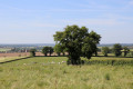
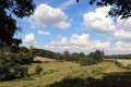
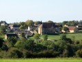
This walk combines two routes suggested by the Pays de George Sand. It will take you on a tour of the heritage of Montlevicq (its castle and church) and the surrounding area (the castles of Montveillé and Priches), from the Vic plateau to the Igneraie valley. Please note: for those who dislike tarmac, three-quarters of the route follows small country lanes...

Details

n°88969215
Creation:
Last update:
Last review:
–
  • Walking
    Activity: Walking
  • ↔
    Distance: 5.99 mi
  • ◔
    Average duration: 2h 50 
  • ▲
    Difficulty: Easy

  • ⚐
    Back to start: Yes
  • ↗
    Ascent: + 98 ft
  • ↘
    Descent: - 121 ft

  • ▲
    Highest point: 833 ft
  • ▼
    Lowest point: 722 ft
  • ⚐ Country: France
  • ⚐ City: Montlevicq (36400)
  • ⚑
    Start/End: N 46.578465° / E 2.070675°
  • ❏
    IGN map(s): Ref. 2227E
  • Hour-by-hour weather

Description of the walk

Follow the blue signposts.

(S/E) With your back to the town hall, take Rue des Tilleuls on the left, then carefully follow the D73 to the left to leave Montlevicq.

(1) At the stone cross, take the grassy path on the right.

(2) Follow the small road to the right. Continue straight on until you reach the outskirts of the hamlet of Priches. Ignore a road on the left and walk alongside the castle’s low wall until you reach a junction with a stone cross.

(3) Take the road on the left, then take the next left at the following junction.

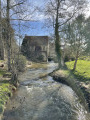
(4) At the next junction, turn right, cross a stream and pass through the hamlet of Le Petit Igneraie.

(5) At the end of the straight stretch, before the bend, leave the road and take a grassy path on the right (GRP® des Maîtres Sonneurs).
Cross the Rebesson stream. The path becomes suitable for vehicles. Leave the GRP® on your right and a path on your left, continuing straight ahead.

(6) When you reach a lay-by, follow the small gravel road to the right, heading due north. Join the GRP® again at a farm building and follow it straight ahead.

(7) At the first house, turn left for a 60-metre round trip to enjoy a view of Prisches Castle, then continue along the GRP® until you rejoin the road you took on the way out. Follow it to the left and arrive at the junction with the cross you passed on the way out.

(3) Carry on to the left along the road (GRP® des Maîtres Sonneurs) until you reach the outskirts of Montlevicq.

(8) At the junction with an iron cross, take the grassy path to the left. At the end, head up the D73b to the right as far as the church and Montlevicq Castle. At the Stop sign, turn left then right onto Rue des Tilleuls and follow it to the town hall (S/E).

Waypoints

  1. S/E : mi 0 - alt. 820 ft - Montlevicq Town Hall
  2. 1 : mi 0.2 - alt. 830 ft - Stone cross: on the right
  3. 2 : mi 0.91 - alt. 768 ft - Small road, on the right
  4. 3 : mi 1.86 - alt. 748 ft - Priches – castle (private). Common junction (there and back)
  5. 4 : mi 2.34 - alt. 748 ft - On the right, the Petit Igneraie - Igneraie (rivière) - Affluent de l'Indre
  6. 5 : mi 2.83 - alt. 764 ft - GRP des Maîtres Sonneurs on the right - Rebesson (ruisseau) - Affluent de l'Igneraie
  7. 6 : mi 3.49 - alt. 784 ft - Rest area: small road on the right
  8. 7 : mi 4.43 - alt. 732 ft - Return via the left-hand route
  9. 8 : mi 5.37 - alt. 794 ft - Iron cross: path on the left
  10. S/E : mi 5.99 - alt. 820 ft - Montlevicq Town Hall

Notes

No water source.

Make sure you have good shoes (suitable for different surfaces).

Worth a visit

Other walks in the area

For more walks, use our search engine .

The GPS track and description are the property of this route's author. Please do not copy them without permission.