On the slopes of Monte Grosso

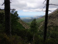
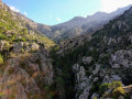
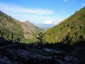
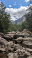
A lovely walk through the Calenzana hinterland on the slopes of Monte Grosso.

Details

n°1548158
Creation:
Last update:
Last review:
  • Walking
    Activity: Walking
  • ↔
    Distance: 6.62 mi
  • ◔
    Average duration: 5h 55 
  • ▲
    Difficulty: Difficult

  • ⚐
    Back to start: Yes
  • ↗
    Ascent: + 3,340 ft
  • ↘
    Descent: - 3,310 ft

  • ▲
    Highest point: 4,665 ft
  • ▼
    Lowest point: 1,362 ft

Photos

Description of the walk

The route starts from the car park at the A Flatta inn.

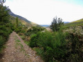
(S/E) Head south-east and take the track that climbs.

(1) Carry on straight ahead along the track, which continues to climb (ignore the turn-off to the right). The track continues to climb, winding its way up in several hairpin bends.

(2) The track becomes a path and you should come across an abandoned piece of construction machinery. Continue along this clearly visible path, following the cairns and a few red markings.

(3) Take the path branching off to the left (not shown on the map, also marked in red) and do not follow the one branching off to the right. Continue climbing, heading generally north-east (the dotted line on the IGN map is approximate here). Stop directly opposite Frassu, above the Fontaine du Capitaine.

(4) The descent follows the same route.

(3) Take care not to miss the junction on the right as you descend. Follow the path and then the track to A Flatta (S/E).

Waypoints

  1. S/E : mi 0 - alt. 1,362 ft - Auberge A Flatta
  2. 1 : mi 0.25 - alt. 1,539 ft - Junction
  3. 2 : mi 1.7 - alt. 2,320 ft - The track becomes a path
  4. 3 : mi 2.28 - alt. 2,992 ft - Junction
  5. 4 : mi 3.32 - alt. 4,665 ft - Directly above Frassu
  6. S/E : mi 6.62 - alt. 1,365 ft - Auberge A Flatta

Notes

Make sure you take plenty of water (I take 2 litres).

The path is not clearly marked on IGN maps but is visible on OpenStreetMap. It is marked with cairns and red markings in places.

At (4), it is possible to continue climbing by following the cairn-marked path leading to Candiloni and then on to Monte Grosso (the path is visible on OpenStreetMap). For Monte Grosso, allow an extra 2 hours to 2 hours 30 minutes for the ascent.

Worth a visit

This walk is a personal favourite, inspired by M.R. de Litardière’s account, which can be read here.

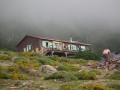
The A Flatta inn. Good food for hearty eaters. The area certainly has its charm.

Reviews and comments

3.4 / 5
Based on 3 reviews

Reliability of the description
4 / 5
Ease of following the route
3.7 / 5
Route interest
2.7 / 5
yves T
yves T

Overall rating : 2.3 / 5

Date of your route : Sep 16, 2024
Reliability of the description : ★★★☆☆ Average
Ease of following the route : ★★★☆☆ Average
Route interest : ★☆☆☆☆ Very disappointing
Very busy route : No

A challenging hike uphill as there were no landmarks; the path was badly damaged by wild boars, there were no red markings, and at the end (point 4) there was no view. I carried on to the fountain and then headed back down, as the descent was very, very difficult and strenuous. On the plus side, there were lovely woodlands and a beautiful forest.

Machine-translated

Seb09
Seb09

Overall rating : 4.7 / 5

Date of your route : Aug 26, 2024
Reliability of the description : ★★★★★ Very good
Ease of following the route : ★★★★☆ Good
Route interest : ★★★★★ Very good
Very busy route : No

An interesting route as it has remained quite wild.
The ascent is easy; follow the red and yellow markings, and at the top you’ll find trail markers.
After the 1,530-metre mark, where the fountain is located, continue along the clearly marked path; the end of the forest is very beautiful, then reach the ridge at a small pass at 1,780 metres, which offers a first beautiful view of Calvi Golf Course. (The path is visible on Garmin maps)
Continue along the visible path, which stays below the ridge heading east, to reach the western summit of Monte Grosso (1,930 m). From there, it’s just a short push eastwards to the flat summit of Monte Grosso (1,937 m).
Less than an hour from the fountain at 1,530m.
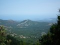
The view over the Balagne is magical on one side and Monte Cinto on the other. Beautiful cliffs overlooking Zilia.
The only thing to bear in mind is to make sure you follow the same path on the descent as you did on the ascent. When returning from the summit of Monte Grosso, be sure to head back towards the western pre-summit by climbing up towards it to avoid following the Melaja path, which forces you to cut across to the right at the same level to rejoin the western ridge path along a more natural route.
Allow for 1,580 metres of elevation gain from A Flatta to the summit.
A lovely hike.

Machine-translated

philippe_leca
philippe_leca

Overall rating : 3.3 / 5

Date of your route : Aug 14, 2021
Reliability of the description : ★★★★☆ Good
Ease of following the route : ★★★★☆ Good
Route interest : ★★☆☆☆ Disappointing
Very busy route : No

An interesting, challenging hike in stunning surroundings: there’s 1,000 metres of elevation gain over three hours, and the start of the return leg is very technical. At 1,700 metres, we even spotted a mouflon!
However, the route ends on a ridge that isn’t particularly interesting as it’s hemmed in by the valley: you’d need to carry on climbing for another hour or two to get a proper view of the Calenzana plain and Calvi Bay.
I’ll try to push on further next time to confirm the timing.

Machine-translated

Other walks in the area

For more walks, use our search engine .

The GPS track and description are the property of this route's author. Please do not copy them without permission.