In the hills above Saint-Pey-de-Castet

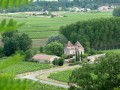
A fairly hilly route (2 hills) but with lovely views! Rural scenery, very few small, quiet roads.

Details

406035
Creation:
Last update:
Last review:
  • Walking
    Activity: Walking
  • ↔
    Distance: 4.15 mi
  • ◔
    Average duration: 2h 20 
  • ▲
    Difficulty: Easy

  • ⚐
    Back to start: Yes
  • ↗
    Ascent: + 472 ft
  • ↘
    Descent: - 469 ft

  • ▲
    Highest point: 308 ft
  • ▼
    Lowest point: 36 ft

Photos

Description of the walk

Park in the town hall car park, opposite the roundabout.

(S/E) Take the D18 towards Pujols (south-east) and, as you leave the stud farm, take the path that winds uphill to the right.

(1) Turn left towards the ruined mill and walk along the edge of the woodland.

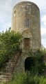
(2) Just before the end of the plot, turn right towards the water tower. Cross the road and continue straight on along the track to reach Pourjac.

(3) Cross the D126 and continue straight on towards La Houze. Follow the path down towards the Moulin de la Houze, join the road and continue to the right towards La Valade.

(4) At the Y-junction, turn left, passing through La Valade and then Loustalet.

(5) 100 metres further on, take the path on the right which climbs steeply up towards the woods and the hill (not shown on the IGN map). Climb up to Timbau and carry on towards Jean Ramond.

(6) At the T-junction, turn right, then take the first road on the left.

(7) At the junction, turn left towards the church, then, at the Y-junction, turn right to head down to the village. Turn left onto the D18 to return to the car park (S/E).

Waypoints

  1. S/E : mi 0 - alt. 39 ft - Town hall car park
  2. 1 : mi 0.5 - alt. 243 ft - Turn left towards the ruined mill
  3. 2 : mi 0.75 - alt. 266 ft - Turn right towards the water tower
  4. 3 : mi 1.39 - alt. 279 ft - Road, path ahead
  5. 4 : mi 2.11 - alt. 79 ft - Junction: turn left towards Loustalet
  6. 5 : mi 2.52 - alt. 59 ft - Path leading uphill to the right
  7. 6 : mi 2.92 - alt. 305 ft - T-junction, turn right
  8. 7 : mi 3.37 - alt. 276 ft - Crossroads: turn left towards the church
  9. S/E : mi 4.15 - alt. 36 ft - Town hall car park

Notes

Important:
It is strongly recommended that you either obtain the 1:25,000-scale IGN map or use the smartphone app, which will also allow you to be geolocated at all times, enabling you to track your progress accurately.
The route may cross or follow other signposted routes. It’s tempting to follow the signposts! Unless otherwise specified, do not stray from the route.
Using walking poles can prove very useful and reassuring; as well as providing stability, they help distribute the strain more evenly.

Worth a visit

St Peter’s Church, originally Romanesque (11th century), was largely rebuilt in the 14th century in the Gothic style and then refurbished towards the end of the 15th century or the beginning of the 16th; it is topped by a false bell wall, which is in fact a tower housing the bells; the building, together with the remains of an adjoining former priory, has been listed as a Historic Monument since 1999 (Source: Wikipedia).

Reviews and comments

4 / 5
Based on 3 reviews

Reliability of the description
4 / 5
Ease of following the route
3.3 / 5
Route interest
4.7 / 5
randodome05
randodome05
• Edited:

Overall rating : 4 / 5

Date of your route : Oct 18, 2020
Reliability of the description : ★★★★☆ Good
Ease of following the route : ★★★☆☆ Average
Route interest : ★★★★★ Very good
Very busy route : No

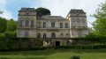
Firstly, the following needs correcting: “On leaving the stud farm, take the path that winds upwards to the right.” In fact, you should take the fairly wide path just before that, as the winding path is private and off-limits because it leads directly to the castle.
At point No. 5, you do indeed arrive near the woods and the hill. The path is still marked at the start, but to reach Timbau, the path has become somewhat overgrown following the fall of trees; however, you can make your way through the vegetation – which is sometimes rather overgrown – and over damp ground.

Machine-translated

Domino50
Domino50

Thank you, Bruno33500, for your reply
As I set off with just the GPX track, I made that comment because the route doesn’t take a detour to the church
But I’ll say it again: it’s a route that both I and my friends really enjoyed

Machine-translated

Bruno33500
Bruno33500

Thank you for these very detailed comments.
It’s been quite a while since I last had the chance to go on this walk.
So I’ll have to revisit it as soon as possible.
The route after the (6) does indeed pass right by the church, and a brief description can be found in the ‘Nearby’ section.
Bruno 33500

Machine-translated

Domino50
Domino50

Overall rating : 3.5 / 5

Date of your route : Apr 27, 2018
Reliability of the description : Not used / Not applicable
Ease of following the route : ★★★☆☆ Average
Route interest : ★★★★☆ Good

Hello,
This Friday, I completed the ‘Sur les Hauts de St Pey de Castets’ route using only the GPX track
Right from the start, there was a problem: you head towards the castle, but once you reach it, after a short climb, there’s no (or no longer any) way to carry on straight ahead, so I turned round and took the small road that’s a little before it
A section through the vineyards has also clearly been altered, but this isn’t a problem unless you’re glued to your GPS

And I do wish there was a detour included to take in the church at St Pey, which is well worth a visit both for the church itself and for the view over the surrounding countryside

Thank you, Bruno33500, because with these few adjustments, it was a lovely ride

Machine-translated

jiced
jiced

Overall rating : 4.3 / 5

Date of your route : Jul 30, 2017
Reliability of the description : ★★★★☆ Good
Ease of following the route : ★★★★☆ Good
Route interest : ★★★★★ Very good

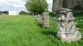
A short walk with no particular difficulties, offering lovely views and an encounter with a local resident who welcomed us into his garden for a very pleasant visit.

Machine-translated

Other walks in the area

For more walks, use our search engine .

The GPS track and description are the property of this route's author. Please do not copy them without permission.