Country:

 City:
City:



You can park at the end of Rue du Soultzbach in the village of Wegsheid.
Marked with Yellow Discs.
(S/E) Take the forest path heading to the right, towards Fuchsfels. Follow these markings until you reach the Fuchsfelsen viewpoint.
After passing a pink building on your right, about a hundred metres further on, you’ll reach a multi-way junction.
(1) Continue to the right along the same forest track until the next fork.
(2) Carry on along the forest track to the right and cross the stream. About a hundred metres further on, at another junction, take the path leading uphill to the left.
(3) Back on a forest track, head uphill by taking the track opposite, on the left. About a hundred metres further on, leave the forest track and take the path leading off to the left.
(4) At the natural viewpoint overlooking the Schlumpf ski run, head towards the junction 20 metres further on and continue up the path on the right.
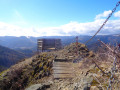
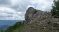
(5) At the Fuchsfelsen viewpoint, enjoy the view by climbing up onto the rock. Leaving the viewpoint, continue along the path leading uphill opposite. A few metres further on, after climbing the earthen steps, cross the forest track and continue along the path leading uphill, towards Rossberg.
Marked with a Yellow Rectangle.
(6) At the junction, turn right towards Rossberg.
Signposted with a red Rectangle crossed out in white.
(7) At the natural viewpoint overlooking the Fuchsfels, take the path leading uphill on the left, towards Rossberg. As you emerge from the forest, continue straight on to reach the summit opposite.
No signposting.
(8) At the low stone wall, continue to the right, following it to reach the summit of Rossberg.
(9) At the summit of the Rossberg, marked by a large rock, head down towards the various huts visible in the distance, following the fence until you reach the Rossberg Hut run by the Mulhouse Ski Club.
(10) Walk past it and head down towards the forest track visible below, leading into the woods on the left. At the track, turn left.
Red Triangle markings.
(11) Continue towards the Ferme Auberge du Gsang.
(12) Cross the farmhouse inn and continue along a path, passing through a small gate. Head towards Belacker, following the Red Triangle markings. Keep following these markings until you reach the Belacker farmhouse inn.
Signposted with a red Rectangle crossed out in white.
(13) Walk through the farmhouse inn, continue straight on towards Rimbach, keeping to the left. Continue along this path for 200 m until you pass through a large gate leading to a crossroads. At this point, take the path leading down towards the forest on the left, towards Wegsheid via Stahlberg. Follow these markings and this direction until you reach the Stahlberg mountain refuge.
Blue Triangle signposting.
(14) At the first junction with a forest track, take the track on the left. Further on, the track will split in two: take the track on the right, which leads downhill.
(15) At a large multi-way junction, at the far end opposite you, take the path leading uphill to the right towards Wegsheid via Stahlberg.
(16) At the Stahlberg Refuge, continue straight on along the forest track until you reach a path leading down to the left towards Wegsheid, still following the Blue Triangle markings. At the end of the winding path, when you reach a wider track, continue straight on downhill.
Marked with a Yellow Disc.
(1) At the junction you passed earlier on the route, turn right down the slope to return to the starting point at the car park (S/E).

 Visorando Member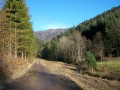
 Moderate