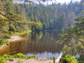
On the hills above Tonbach

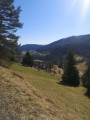
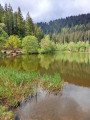
A lovely walk through the Tonbach Valley, then up through the hills on the way back.

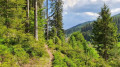
The walk begins along the River Tonbach, then the path climbs towards the game reserve. You may spot around twenty fallow deer in the vast enclosure. On the way back, you’ll pass along zigzag paths twice – a distinctive feature of this route.

Details

n°71296632
Creation:
Last update:
Last review:
  • Walking
    Activity: Walking
  • ↔
    Distance: 6.31 mi
  • ◔
    Average duration: 3h 35 
  • ▲
    Difficulty: Moderate

  • ⚐
    Back to start: Yes
  • ↗
    Ascent: + 787 ft
  • ↘
    Descent: - 781 ft

  • ▲
    Highest point: 2,359 ft
  • ▼
    Lowest point: 1,844 ft

Photos

Description of the walk

The route starts from the car park of the Waldlusthotel annexe in Tonbach.

(S/E) Head towards the “Haus des Gastes” at the far end of the car park.

(1) Turn left at this junction, towards the main road; once there, cross the road

(2)Take the small flight of steps leading down to the right. Take the small path on the right to begin your walk along the Tonbach stream.

(3) At this first junction, keep to the right. A little further on, cross the stream for the first time. Continue along the path.

(4) Turn left at this junction; then, a little further on, keep to the right.

(5) On the small meadow on the left, you’ll see the watermill. Keep left at the junction.

(6) At the end of this path, turn left onto the track leading to the “Seensteig”; the track follows the Tonbach stream for a while before heading up towards the hills to the right of the stream. You will climb up towards the game reserve, which you will walk alongside for nearly a kilometre.

(7) At the end of the game reserve, find a path on the right and take it to head back. 

(8) This is where the animals are fed and are very often gathered in ‘families’. Keep going straight ahead and, after a few strides, take the path on the right.

(9) Where the two main paths meet, take the path on the left to stay in the forest.

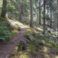
(10) Take the zigzag path uphill on your left

(11) At the end of the path, turn right.

(12) Turn left before leaving the forest

(13) At this junction, take the path on the left

(14) To head back down towards the hotel, take the zigzag path on your right. At the end of this path, turn right to cross the meadows and reach the car park of the Waldlusthotel (S/E).

Waypoints

  1. S/E : mi 0 - alt. 1,900 ft
  2. 1 : mi 0.04 - alt. 1,883 ft - Crossroads beneath the “Haus des Gastes”
  3. 2 : mi 0.13 - alt. 1,847 ft - Stairs leading down from the main road
  4. 3 : mi 0.44 - alt. 1,867 ft - Carrefour 3
  5. 4 : mi 0.8 - alt. 1,906 ft - Junction 4: bridge over the Tonbach
  6. 5 : mi 1.13 - alt. 1,949 ft - View of the watermill
  7. 6 : mi 1.81 - alt. 2,096 ft - Junction 6: change direction towards the forest
  8. 7 : mi 2.82 - alt. 2,290 ft - change of direction at the end of the game reserve
  9. 8 : mi 3.27 - alt. 2,247 ft - Feeding trough for the herd of fallow deer
  10. 9 : mi 4.1 - alt. 2,201 ft - Walk back up towards the forest
  11. 10 : mi 4.4 - alt. 2,149 ft - Start of the zigzag paths
  12. 11 : mi 4.61 - alt. 2,300 ft - Height of the zigzag path
  13. 12 : mi 5.12 - alt. 2,218 ft - Crossroads 13
  14. 13 : mi 5.25 - alt. 2,270 ft - Crossroads 14
  15. 14 : mi 5.89 - alt. 2,287 ft - Zigzag path for the descent
  16. S/E : mi 6.31 - alt. 1,896 ft - Hotel car park

Reviews and comments

4 / 5
Based on 2 reviews

Reliability of the description
4 / 5
Ease of following the route
4 / 5
Route interest
4 / 5
User 8482525

Overall rating : 3.3 / 5

Date of your route : Aug 05, 2026
Reliability of the description : ★★★☆☆ Average
Ease of following the route : ★★★☆☆ Average
Route interest : ★★★★☆ Good
Very busy route : No

An easy route with no difficulties whatsoever. To follow the route after the stairs, it’s best to follow the sign for ‘Wildgehege’ (which means ‘game reserve’ in German). On the way back from the park, follow the signs for Waldhusthotel, and at the end of the route, turn left and head up through the forest (you’ll pass a small outbuilding belonging to the hotel).

Machine-translated

DELABAROTTE
DELABAROTTE

Overall rating : 4.7 / 5

Date of your route : Dec 26, 2025
Reliability of the description : ★★★★★ Very good
Ease of following the route : ★★★★★ Very good
Route interest : ★★★★☆ Good
Very busy route : No

A pleasant walk for Boxing Day. No difficulty, even though the ground was a little icy in places. Walking around the enclosure at the end of the circular path to see some wild animals (deer) adds a little interest.

Machine-translated

Other walks in the area

For more walks, use our search engine .

The GPS track and description are the property of this route's author. Please do not copy them without permission.