Suc de la Lauzière

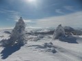
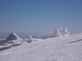
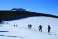
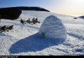
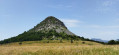
The ascent of the Suc de la Lauzière (1,582 m) in the snow offers a superb 360° panorama of the Mezenc and the Estables, the Gerbier de Jonc, and all the surrounding knolls.
This route is a shortened version of the ‘Quatre Sucs’ hike, designed to let you enjoy the magnificent snow-covered landscapes.

Details

901859
Creation:
Last update:
Last review:
  • Snowshoeing
    Activity: Snowshoeing
  • ↔
    Distance: 5.12 mi
  • ◔
    Duration according to the author: 4 hrs 
  • ▲
    Difficulty: Moderate

  • ⚐
    Back to start: Yes
  • ↗
    Ascent: + 778 ft
  • ↘
    Descent: - 755 ft

  • ▲
    Highest point: 5,213 ft
  • ▼
    Lowest point: 4,590 ft

Photos

Description of the walk

Park at the side of the D378 at the Pradoux junction.

(S/E) Head north-west along the path that forms part of theGR®3, 73 and 420 routes, as well as theGRP® trail through the Mézenc – Gerbier des Joncs massif. After Montouse, you’ll reach the junction with theGR®7.
Turn left onto this path to reach another junction.

(1) Carry on straight ahead, ignoring the path on the right. You’ll emerge onto a vast meadow and reach another crossroads of paths.

(2) Carry on to the right, following theGR®3, which runs alongside theGRP® mentioned earlier. Reach the foot of the Knoll de Séponet; stay on theGR® to reach another junction.

(3) Here, leave the red and white markings and turn right onto the path; after a short climb, you’ll reach the summit of the knoll of the Lauzière with its 360° panorama.

(4) From the summit, head straight down northwards towards the meadow on the left-hand edge of the forest. Pass a footpath on your left and continue straight ahead to join theGRP® de la Montagne Ardéchoise.

(5) Turn right onto this path and follow it back to the original junction.

(1) Follow the same route back to the car park where you started (S/E).
Waypoints

  1. S/E : mi 0 - alt. 4,590 ft - Car park on the D378. Near the source of the - Aigue Nègre (ruisseau) - Affluent de la Loire
  2. 1 : mi 0.72 - alt. 4,810 ft - Junction of the circular loop. Near the source of the - Veyradeyre (cours d'eau) - Affluent de la Loire
  3. 2 : mi 1.23 - alt. 4,836 ft - Meadow junction
  4. 3 : mi 2.54 - alt. 4,839 ft - Crossroads towards the knoll of the Lauzière
  5. 4 : mi 3.24 - alt. 5,148 ft - Suc de la Lauzière (1582m)
  6. 5 : mi 3.61 - alt. 4,941 ft - GRP junction
  7. S/E : mi 5.12 - alt. 4,590 ft - Car park on the D378

Worth a visit

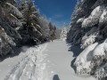
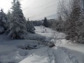
This route was completed in 60 to 80 cm of fresh snow. The GPS track will be very useful as there are no markings under the snow and only the signposts are visible.
With such a deep layer of snow and no tracks, progress is a bit slow.

Always be cautious and plan ahead when you're outdoors. Visorando and the author of this route cannot be held responsible for any accidents occurring on this route.

The GR® and PR® markings are the intellectual property of the Fédération Française de Randonnée Pédestre.

Reviews and comments

4.4 / 5
Based on 3 reviews

Reliability of the description
4.3 / 5
Ease of following the route
4.3 / 5
Route interest
4.7 / 5
JuliaM
JuliaM

Overall rating : 4.7 / 5

Date of your route : Aug 20, 2024
Reliability of the description : ★★★★★ Very good
Ease of following the route : ★★★★☆ Good
Route interest : ★★★★★ Very good
Very busy route : No

A lovely walk to do in summer, with some sections in the sun and others in the shade of the woodland. A pleasant trail. An easy climb offering a superb 360° panorama against a backdrop of pink heather, blueberry bushes and rocky outcrops. A real treat!
I got it wrong:
- at point 3: no signposting, but look out for a cut log on the ground with a smile drawn on the end – in other words, take the path furthest to the right.
- after point 4: I turned left onto the path towards the knoll of Taupernas (I didn’t check the route description or my position on Visorando!), but I was able to find point 5 easily.
Thank you so much for sharing this walk. I highly recommend it!

Machine-translated

Labase
Labase

Overall rating : 4 / 5

Date of your route : Jul 23, 2019
Reliability of the description : ★★★★☆ Good
Ease of following the route : ★★★★☆ Good
Route interest : ★★★★☆ Good

We went on this walk on Sunday 21 July 2019. We really enjoyed it because:
- It was varied, with woodland, meadows and a viewpoint
- It was peaceful as there were no steep climbs on this walk (we didn’t fancy tackling any that day)

Just two comments:
At point 3: you come to a junction with three paths leading off (signpost)
=> Make sure you take the first one on the right, which takes you slightly back the way you came. Look for the GR cross and the orange cross on the tree on the right
- Do not take the GR straight ahead
- Do not take the PR

At the start, you can head straight on opposite the car park towards the Ville Vieille stopover lodge to extend the route slightly and complete a circular route without passing the same spot twice

Machine-translated

sifio
sifio

Overall rating : 4.7 / 5

Date of your route : Mar 07, 2018
Reliability of the description : ★★★★☆ Good
Ease of following the route : ★★★★★ Very good
Route interest : ★★★★★ Very good

A magnificent snowshoe route, done today, with a stunning view from the top of the knoll;
A small mistake at point 3: don’t follow the yellow and white markings, but instead take the path that branches off to the right (orange cross on a post).
If you know of any other snowshoe routes, we’d love to hear about them!!!!

Machine-translated

For more walks, use our search engine .

The GPS track and description are the property of this route's author. Please do not copy them without permission.