Snowshoeing around the Tourte rock

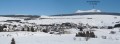
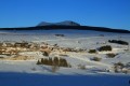
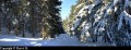
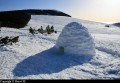
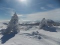
With snowshoes on your feet, explore the landscapes of the forest undergrowth, frozen solid by the cold, and the vast expanses of the Mézenc plateau, reshaped for winter by the snow, the ‘burle’ (the local name for the north wind that blows in winter) and the frost.

Details

2485
Creation:
Last update:
Last review:
  • Snowshoeing
    Activity: Snowshoeing
  • ↔
    Distance: 6.32 mi
  • ◔
    Duration according to the author: 4 hrs 
  • ▲
    Difficulty: Moderate

  • ⚐
    Back to start: Yes
  • ↗
    Ascent: + 604 ft
  • ↘
    Descent: - 630 ft

  • ▲
    Highest point: 4,652 ft
  • ▼
    Lowest point: 4,285 ft

Photos

Description of the walk

(S/E) Starting from the square opposite the tourist office, cross the D36. Follow the road down behind the tourist office. Cross the bridge over the Gazeille.

(1) Shortly after passing the house on your left (Chyere), leave the road by taking the path on the right. Then put on your snowshoes.

Quickly leave the path to climb up the slope towards Mont Rechausseyre. Follow the edge of the forest.

(2) At the junction with a track, turn right to stay along the edge of the forest below Mont Rechausseyre. Veer to the right as if you were going to go round it.

At the edge of a spruce plantation, head straight on between pastures and woodland to reach the Chemin de Peyrot. Turn right onto it and follow it to the edge of the Bois du Clergeat (signposted ‘Forêt du Mézenc’).

(3) Then climb a path that ascends to your left. Follow it to go round the Rocher Tourte through the undergrowth.
At the edge of the forest, take the path leading towards Johanel Farm.

(4) Once you’ve passed the farmhouse, join a road and follow it. Then leave the road to pass beneath the Bru farm halfway up the slope and cross the fields to reach a path leading into the forest. Join another path.

(5) Follow it to the right until you reach a crossroads. Head straight on to return to Mont Rechausseyre.

(2) Turn right to return to the starting point, following the path in the opposite direction to the outward journey (S/E).

Waypoints

  1. S/E : mi 0 - alt. 4,386 ft - The bar is situated opposite the tourist information office
  2. 1 : mi 0.22 - alt. 4,308 ft - Bridge over the - Gazeille (rivière)
  3. 2 : mi 1.11 - alt. 4,580 ft - Crossroads below Rechausseyre
  4. 3 : mi 1.84 - alt. 4,495 ft - Carrefour Peyrot
  5. 4 : mi 3.64 - alt. 4,557 ft - Johanel
  6. 5 : mi 4.65 - alt. 4,560 ft - Forest crossroads
  7. S/E : mi 6.32 - alt. 4,386 ft - The bar is located opposite the tourist information office

Notes

-> You can hire snowshoes by the day from one of the three shops in the village of Les Estables that offer this service. All three are close to the start of the walk:
- Phonolithe (ski, snowshoe and sledge hire).
- Michel Sports (ski and snowshoe hire) located near the Vival grocery shop.
- 3 Kite (kitesurfing and snowshoe hire/sales) near the restaurant Les 3 Monts.

-> Given the altitude and in bad weather, it can get very cold. Wrap up warm and don’t forget to take gloves, warm socks and a hat to protect your extremities.

-> Walking with snowshoes requires more effort than a summer hike. You’ll also need to manage your time carefully for the route, as the days are short in winter.

-> After braving the elements – and because every effort deserves a reward – you can seek refuge in the warmth of a bar in the village of Les Estables for a hot drink.

Worth a visit

- The family-friendly resort of Les Estables offers downhill skiing on the slopes of Mont Alambre. For beginners, the lower slopes feature facilities designed for learning to ski (tow lifts and baby ski areas).

- Numerous cross-country ski trails starting from the Maison Forestière car park.

- Before reaching the Col des Boutières, there’s the snowkiting area.

You can also enjoy the snow without putting on skis, on the toboggan runs.

Reviews and comments

4.8 / 5
Based on 2 reviews

Reliability of the description
Not used
Ease of following the route
5 / 5
Route interest
4.5 / 5
Kélig07
Kélig07
• Edited:

Overall rating : 5 / 5

Date of your route : Dec 27, 2024
Reliability of the description : Not used / Not applicable
Ease of following the route : ★★★★★ Very good
Route interest : ★★★★★ Very good
Very busy route : No

I completed this hike on cross-country skis in brilliant sunshine. I’d already done it on foot a few years ago, in autumn, in fog so thick you could cut it with a knife.
The route is easy to follow. Setting off from Chyère, I chose to follow the GR40, which takes a slight detour via Le Rechausseyre.
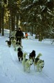
I was surprised to come across only two people on this walk. Apart from the tracks left by a dog sledge, I saw virtually no snowshoe tracks. And yet it hasn’t snowed for several days, and the sun has been shining throughout these Christmas holidays.
Truly beautiful scenery on the high plateaus.
A walk with no difficulty at all. Just lots of fence wires to step over. A pulka can be used on this route.
And at the end of the walk, what a treat to enjoy a small Ambré on tap at the local brewery, ‘La Pastorale’.

Machine-translated

keri
keri

Overall rating : 4.5 / 5

Date of your route : Jan 17, 2022
Reliability of the description : Not used / Not applicable
Ease of following the route : ★★★★★ Very good
Route interest : ★★★★☆ Good
Very busy route : No

A lovely walk; it was snow-covered except for the stretch of road after 4 and before Bru. I think we would have had a few more views in the first half if it hadn’t been foggy in the morning.

Machine-translated

For more walks, use our search engine .

The GPS track and description are the property of this route's author. Please do not copy them without permission.