At the summit of Rocher Tourte

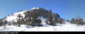
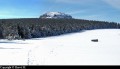
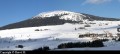
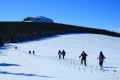
This snowshoe hike through snow-covered meadows and woodland takes you to the summit of Mont Tourte, which offers a 360° view of the surrounding mountain ranges.

Details

n°20451
Creation:
Last update:
Last review:
  • Snowshoeing
    Activity: Snowshoeing
  • ↔
    Distance: 5.58 mi
  • ◔
    Duration according to the author: 3 hrs 
  • ▲
    Difficulty: Very difficult

  • ⚐
    Back to start: Yes
  • ↗
    Ascent: + 988 ft
  • ↘
    Descent: - 994 ft

  • ▲
    Highest point: 5,036 ft
  • ▼
    Lowest point: 4,281 ft

Photos

Description of the walk

Starting from the square opposite the tourist office, cross the D36.
(S) Follow the road down behind the tourist office.

(1) Cross the bridge over the Gazeille.

Shortly after passing the house on your left (Chyere), leave the road and take the path on the right. Then put on your snowshoes.

Quickly leave the path to climb up the slope towards Mont Rechausseyre. Follow the edge of the forest. At the junction with a track, turn left to stay along the edge of the forest below Mont Rechausseyre. Turn right as if you were going to go round it.

At the edge of a spruce plantation, go straight on between pastures and woodland to reach the Peyrot track. Leave it on your right and continue straight on along the edge of the forest.

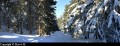
Enter the woods and climb gradually amongst the trees. At the foot of the Tourte rock, take the fork to the left and follow its base as if you were going round it. As you emerge from the forest and reach a flat area, veer to the right to continue skirting the summit on the left. Then climb gradually towards the summit.

(2) Descend from the summit via the same route. Below the summit, continue in a straight line down towards the woodland. Follow the edge of the woodland.

(3) Take the first path on the left to enter the woods. Stay on this main path until you reach a large crossroads. At this point, carry on straight ahead.

Return to Mont Rechausseyre and back to the starting point by following the same route as on the way up (E).


Waypoints

  1. S/E : mi 0 - alt. 4,386 ft - The square is opposite the tourist information office
  2. 1 : mi 0.26 - alt. 4,304 ft - Bridge over the - Gazeille (rivière)
  3. 2 : mi 2.82 - alt. 5,036 ft - Rocher Tourte (1535m)
  4. 3 : mi 3.29 - alt. 4,770 ft - Sous Rechausseyre
  5. S/E : mi 5.58 - alt. 4,386 ft - The square opposite the tourist information office

Notes

This is a very difficult hike as part of the route (below the Tourte rock and the ascent up it) takes you off the beaten track through the woods.

You can hire snowshoes by the day from one of the three shops in the village of Les Estables that offer this service. All three are close to the start of the walk:
- Phonolithe (ski, snowshoe and sledge hire).
- Michel Sports (ski and snowshoe hire) located near the Vival grocery shop.
- 3 Kite (kitesurfing and snowshoe hire/sales) near the restaurant Les 3 Monts.

Given the altitude and in bad weather, it can get very cold at the summit, especially as it’s often windy. Wrap up warm and don’t forget to take gloves, warm socks and a hat to protect your extremities.

Walking in snowshoes requires more effort than a summer hike. You’ll also need to manage your time carefully for the route, as the days are short in winter.

After braving the elements, you can seek refuge in the warmth of a bar in the village of Les Estables for a hot drink. What a relief for frozen hands and feet!

Worth a visit

The family-friendly resort of Les Estables is the place to go for downhill skiing on the slopes of Mont Alambre. For beginners, the lower slopes offer facilities suitable for learning to ski (tow lifts and baby ski runs).

There are numerous cross-country ski trails starting from the Maison Forestière car park.

Before reaching the Col des Boutières, there’s the snow-kite area.

Reviews and comments

3.7 / 5
Based on 3 reviews

Reliability of the description
3.3 / 5
Ease of following the route
3.3 / 5
Route interest
4.3 / 5
guydurand01
guydurand01

Overall rating : 3 / 5

Date of your route : Mar 05, 2025
Reliability of the description : ★★★☆☆ Average
Ease of following the route : ★★☆☆☆ Disappointing
Route interest : ★★★★☆ Good
Very busy route : Yes

Near the Toutre rock, the route through the trees is a bit haphazard, and I’d recommend taking the path at the end of the field, which is easier for a group of snowshoe walkers.
Furthermore, waypoint No. 3 is below the Tourte rock rather than below Rechausseyre, which is at the start of the walk.

Machine-translated

Saint alban
Saint alban

We tried to walk all the way round Tourte Rock, but it was too long for an afternoon

Thanks

Machine-translated

CCOURT
CCOURT

Overall rating : 4.7 / 5

Date of your route : Feb 03, 2015
Reliability of the description : ★★★★☆ Good
Ease of following the route : ★★★★★ Very good
Route interest : ★★★★★ Very good

Due to very poor weather conditions, we only managed to walk round the Rechausseyre and cut the route short via the PR between elevations 1376 and 1375.

Machine-translated

GGteam83
GGteam83

Overall rating : 3.3 / 5

Date of your route : Feb 24, 2014
Reliability of the description : ★★★☆☆ Average
Ease of following the route : ★★★☆☆ Average
Route interest : ★★★★☆ Good

A lovely walk with plenty of paths through the woods; it’s nice to walk out of the wind when the gale is blowing. However, the route is quite difficult to follow for someone unfamiliar with the area, mainly because the signposting is far too sparse.

Machine-translated

MALRIF
MALRIF
• Edited:

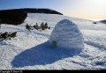
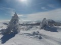
I completed the route a few days after you, on 17 February 2013, which is when the photos were taken. I was luckier than you as the weather was fine. What makes this snowshoe hike so enjoyable is the contrast between the dense woodland scenery, with the snow clinging to the trees, and the open, white spaces with vast expanses of sky overhead.

Machine-translated

gvince
gvince

A superb walk on 11 February 2013. It certainly wasn’t easy; it had been snowing for two days and we had to break trail through 30 to 40 cm of snow for most of the route. In some places where the wind had blown the snow into drifts, the snow was at least 80 cm deep, particularly at the base of the Tourte rock. However, there were no views to be had that day; the entire walk took place in the clouds.
Kind regards

Guy Vincent

Machine-translated

Other walks in the area

For more walks, use our search engine .

The GPS track and description are the property of this route's author. Please do not copy them without permission.