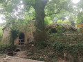
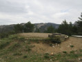
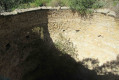
Under the deciduous trees of Saint-Pons

A walk, largely in the shade during hot weather, around the wonderful Parc de Saint-Pons. Only 1,500 metres of the trail are in full sun. However, it is best done in the morning during the summer.

Details

56843416
Creation:
Last update:
Last review:
  • Walking
    Activity: Walking
  • ↔
    Distance: 4.62 mi
  • ◔
    Average duration: 3h 05 
  • ▲
    Difficulty: Moderate

  • ⚐
    Back to start: Yes
  • ↗
    Ascent: + 1,089 ft
  • ↘
    Descent: - 1,089 ft

  • ▲
    Highest point: 1,677 ft
  • ▼
    Lowest point: 587 ft

Photos

Description of the walk

Standard start from the Parc de Saint-Pons car park, near Gémenos, on the Route de la Sainte-Baume.

(S/E) Walk eastwards to the Pont des Tompines. The park entrance is immediately on the other side of the D2.

(1) Follow the wooden walkway which leads uphill towards the entrance to the old paper mill.

(2) Turn left towards its restored ruins, then follow the path running alongside the Torrent du Fauge for 800 metres to reach the Saint-Pons mill.

(3) Turn right past the waterfall, towards some stone steps. Begin the climb towards Le Brigou, joining thePR® on the right 150 metres further on. Continue climbing for approximately 1,200 metres to reach a signposted junction.

(4) Turn right and walk for 200 m, ignoring a path branching off to the left a little further on, until you reach a track.

(5) Turn right towards the north and, at the next fork, keep left on this track.

(6) At the junction with another track, carry on straight ahead along the track until you reach a crossroads where tracks meet paths.

(7) You’ll notice a path on the right leading down towards the north-east. Take this path to begin the descent – which is quite steep (trekking poles are useful) – back towards the starting point.

(8) Turn left onto a well-marked path, though overgrown with wild grass, and continue to the next junction.

(9) Turn right (north). Keep to the right at the next three-way junction and continue to a new junction.

(10) Turn left to continue the descent until you reach the rest area at the Pont des Tompines. Turn right onto the D2 for about 20 metres.

(1) Cross it carefully and turn left onto the path leading to the car park (S/E).

Waypoints

  1. S/E : mi 0 - alt. 587 ft - Saint-Pons car park - Fauge (cours d'eau) - Affluent de la Huveaune
  2. 1 : mi 0.32 - alt. 676 ft - D2
  3. 2 : mi 0.41 - alt. 705 ft - Paper mill junction
  4. 3 : mi 1.01 - alt. 781 ft - Saint-Pons Mill
  5. 4 : mi 1.85 - alt. 1,404 ft - Signposted junction, turn right
  6. 5 : mi 1.98 - alt. 1,506 ft - Track on the right
  7. 6 : mi 2.77 - alt. 1,657 ft - Junction, go straight on
  8. 7 : mi 3.31 - alt. 1,460 ft - Junction of tracks and paths, on the right
  9. 8 : mi 3.47 - alt. 1,348 ft - Turn left
  10. 9 : mi 3.61 - alt. 1,240 ft - Path leading down to the right
  11. 10 : mi 4.01 - alt. 807 ft - Junction, on the left
  12. S/E : mi 4.62 - alt. 587 ft - Saint-Pons car park

Always be cautious and plan ahead when you're outdoors. Visorando and the author of this route cannot be held responsible for any accidents occurring on this route.

The GR® and PR® markings are the intellectual property of the Fédération Française de Randonnée Pédestre.

Reviews and comments

4.7 / 5
Based on 2 reviews

Reliability of the description
5 / 5
Ease of following the route
4.5 / 5
Route interest
4.5 / 5
Gargani
Gargani

The park was closed, so no hiking.

Machine-translated

phildaix
phildaix

Overall rating : 5 / 5

Date of your route : Mar 26, 2025
Reliability of the description : ★★★★★ Very good
Ease of following the route : ★★★★★ Very good
Route interest : ★★★★★ Very good
Very busy route : No

Today, bright sunshine and the Fauge torrent swollen by the rain of the past few days; waterfalls and cascades; the result was a magnificent walk to point 3, just like in a film. What’s more, there were some stunning views, particularly of Marseille. What more could you ask for?
Yes, the descent is a bit steep, mainly because you slip (due to the damp after the rain) on loose stones.
No problems with finding your way.
The circular route is actually quite different in atmosphere from the one called ‘Around Saint-Pons’, although it’s very close by.

It’s only busy at the car park at lunchtime.

Machine-translated

Michel13400
Michel13400

Overall rating : 4.3 / 5

Date of your route : Mar 17, 2025
Reliability of the description : ★★★★★ Very good
Ease of following the route : ★★★★☆ Good
Route interest : ★★★★☆ Good
Very busy route : No

A lovely, enjoyable walk to get fit; from point 3 onwards it’s very easy to follow using GPS – otherwise there are no signposts. We struggled a bit to find point 3. The start is in Saint-Pons Park, which I didn’t find particularly interesting, but I really enjoyed it from point 3 onwards. No trouble getting over any obstacles, even for teenagers. Worth doing again.

Machine-translated

Bernard E.
Bernard E.

hike not completed

Machine-translated

Other walks in the area

For more walks, use our search engine .

The GPS track and description are the property of this route's author. Please do not copy them without permission.