Country:

 City:
City:



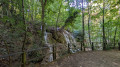

The walk starts from the car park at Saint-Pons Park, accessible from Gémenos via the D2 leading to the Col de l’Espigoulier, approximately 1 km after leaving the town.
(S/E) With your back to the car park, head left towards the Maison du Parc.
(1) Just past this, turn left to cross the Fauge and continue eastwards. You’ll reach a roundabout; carefully follow the road down to the park entrance.
(2) Turn left into the park and walk along a small leisure area for about a hundred metres.
(3) Turn left towards the old paper mill.
(4) Follow the Torrent du Fauge for 600 metres eastwards.
(5) Turn left onto a small bridge to cross the Fauge again.
(6) At the fork in the return path, carry on straight ahead on the GRP®.
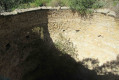
(7) Leave the GR®, and take a path signposted ‘Gour de l’Oule’ on the right. Walk up the stream – which is currently dry – to the cave.
(8) Turn back to the fork you passed on the way out.
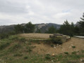
(6) Turn left 600 m further down towards a small clearing with an enclosure. Walk alongside it, then join the track leading to the abbey. Walk round the abbey to the Saint-Pons spring and head back towards the small bridge.
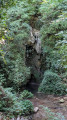
(9) Go down the small flight of steps to the side, then pass under the bridge. Take in the scenery, including a pretty waterfall which shares its waters with those of the Saint-Pons mill.
(10) Head towards the mill and continue along the track until you reach the junction of the lower circular loop that you passed on the way out.
(5) Head back towards the park entrance, following the route in the opposite direction to your outward journey.
(2) Cross the road carefully to take the winding path opposite.
(1) Continue straight ahead, heading in the opposite direction to your outward journey, and return to the car park (S/E)
 Visorando Member
 Difficult
 Association / Club / Walk leader
 Moderate