Sources de l’Huveaune and Castelette Cave

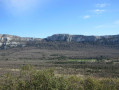
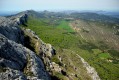
A varied landscape and magnificent views characterise this challenging hike to the Sources de l’Huveaune. The route passes via the Chemin des Rois (or Roys) and its wayside shrines, the ruins of Vieux Nans and Sainte-Croix Hill. After reaching the Huveaune – which you’ll cross at a ford, where you’ll need to take off your shoes – the climb up alongside the river to the springs is simply spectacular. Finally, after visiting the Castelette cave, the return route over the ridges – the steepest and most challenging part of the route – takes you back to the Hôtellerie de la Sainte-Baume and the starting point. This route is best undertaken at the end of winter or after heavy rain to make the most of the beautiful scenery.

Details

47574751
Creation:
Last update:
Last review:
  • Walking
    Activity: Walking
  • ↔
    Distance: 8.85 mi
  • ◔
    Average duration: 5h 50 
  • ▲
    Difficulty: Difficult

  • ⚐
    Back to start: Yes
  • ↗
    Ascent: + 2,037 ft
  • ↘
    Descent: - 2,031 ft

  • ▲
    Highest point: 2,516 ft
  • ▼
    Lowest point: 1,306 ft

Photos

Description of the walk

On the D80 coming from Le Plan d’Aups, park on the right in the car park just past the Hôtellerie de la Sainte-Baume.

(S/E) Cross the road carefully and follow theGR®®9trail (marked in white and red) heading north-east. Return to the D80, follow it to the left for about 100 m, then rejoin theGR®®9on the right. Follow the signs for Nans-les-Pins and Saint-Zacharie, indicated on an old sign at elevation 679. Pass to the right of a barrier, then alongside a fire hydrant marked NPS9

(1) Keep left at a Fork in the road and you’ll reach the oratory no. 3, known as the Miette Oratory, at an elevation of 701.

(2) (optional: take a round trip to the Miette Tumulus, where only a pile of stones remains).
- After a bend to the left, rejoin the D80 (elevation 624).

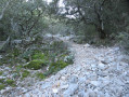
(3) Cross the road with care and continue along theGR®®9. The rugged path winds downwards in hairpin bends and passes two further wayside shrines. You’ll reach a junction with the Chemin des Aumèdes.

(4) Turn right onto this path, which becomes tarmac and runs alongside the Sermax factory. You’ll reach an open area with a signpost.

(5) Follow the signs to the left for Nans-les-Pins, marked with red and white markings. Join the Chemin de l’Orge and turn right. Pass by a few abandoned houses and continue northwards. You’ll reach a crossroads and a wayside shrine.

(6) Turn left onto the path that climbs up to the ruins of Vieux Nans. Explore the site by following the chronological order of the various descriptions. At the end, head to the right of the castle (Caution: entry inside the castle is prohibited – danger). Look out for a path on the right that leads downhill.

(7) Follow this path as it winds its way through the trees, keeping to the right of the rocks. You’ll reach the Marcelle Castinel Botanical Trail, marked with blue signs and featuring benches. Further on, you’ll come to a Fork in the road.

(8) Leave the botanical trail, turn right and begin a steep climb leading to the summit of Sainte-Croix Hill. Admire the 360° view. Turn back and immediately look out for a path on the right that descends steeply down a scree slope.

(9) The descent is tricky but levels out quickly as you reach the valley. Join aPR®® path and turn left. Pass by a fire tank (No. NPS11) at elevation 515 and continue straight on between two posts, marked with yellow signposts. The path turns left at the ruins of Mantelette.

(10) Keep to the right at a fork in the road. Note a sign on a post indicating a cross-country ski trail, then reach a ford across the Huveaune.

(11) During periods of heavy rain, you’ll need to take off your shoes to cross the river. There are no particular difficulties; the riverbed is flat and concrete-lined. Continue straight ahead on theGR®®9, marked with red and white signs. Walk for about 300 metres until you reach a Y-junction.

(12) Turn left and follow the long straight stretch alongside the river. You’ll reach a Y-junction and a blue fire hydrant.

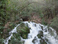
(13) Turn right onto the track, then turn left onto the signposted path that follows the river. Follow the instructions. From this point onwards, the scenery becomes spectacular: waterfalls, potholes and stunning views from the viewing platforms. You’ll reach a bridge and the junction of two resurgences of the Huveaune.

(14) Cross the bridge and follow the path heading east towards a magnificent waterfall. Turn back.

(14) Before the bridge, take the path on the left which climbs through the woodland. It can be slippery: take care. You’ll reach another resurgence of the river. Continue climbing through the woodland until you reach a fork in the road.

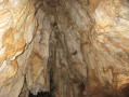
(15) Below on the right is the Castelette Cave, which is easy to access and well worth a visit. This is another resurgence point; the floor of the cave may be flooded. Retrace your steps.

(15) Turn right, heading north, and tackle a steep, slippery climb up the scree. This is the most difficult part of the route. Take great care. At the top, there are lovely views of Sainte-Baume and Saint-Pilon.

(16) Turn left and follow the ridge. You’ll come to an X-shaped junction.

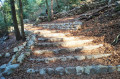
(17) Turn sharp right and head down over large, flat slabs. The path then levels out through the oak trees. Continue straight on, passing the PAS6 fire hydrant on your right.

(18) Turn left and head down towards the Hôtellerie. Turn left onto the D80 and head for the car park (S/E).


Waypoints

  1. S/E : mi 0 - alt. 2,198 ft - L'Hôtellerie car park
  2. 1 : mi 1 - alt. 2,260 ft - Fork in the road
  3. 2 : mi 1.13 - alt. 2,310 ft - Oratory
  4. 3 : mi 1.82 - alt. 2,041 ft - Elevation 624
  5. 4 : mi 2.69 - alt. 1,447 ft - Chemin des Aumèdes
  6. 5 : mi 2.91 - alt. 1,375 ft - Signpost
  7. 6 : mi 3.6 - alt. 1,460 ft - Oratory
  8. 7 : mi 4.03 - alt. 1,811 ft - Castle ruins
  9. 8 : mi 4.17 - alt. 1,745 ft - Fork in the road
  10. 9 : mi 4.6 - alt. 2,103 ft - Steep descent
  11. 10 : mi 5.3 - alt. 1,598 ft - Fork in the road
  12. 11 : mi 5.76 - alt. 1,306 ft - Fording
  13. 12 : mi 5.92 - alt. 1,342 ft - Y-junction
  14. 13 : mi 6.49 - alt. 1,378 ft - Y-junction. Blue fire marker
  15. 14 : mi 7.17 - alt. 1,532 ft - Bridge. Source of the - Huveaune (fleuve)
  16. 15 : mi 7.52 - alt. 1,916 ft - Fork in the road. Castelette Cave
  17. 16 : mi 7.86 - alt. 2,513 ft - Ridge
  18. 17 : mi 8.12 - alt. 2,241 ft - Crossroads in the shape of an X. Rocky slabs
  19. 18 : mi 8.49 - alt. 2,208 ft - Towards the Hôtellerie
  20. S/E : mi 8.85 - alt. 2,198 ft - Hotellerie car park

Notes

For reference: the author’s time for this route was 5 hours 15 minutes (excluding breaks).

The Huveaune is formed by several resurgences, the flow rates of which can vary considerably depending on the season.

A head torch is required to visit Castelette Cave.

Alternative route to avoid the very strenuous section through the scree between (15) and (17): retrace your steps after Castelette Cave, and at the junction, head east for about 500 m to take the first path on the right, which climbs steeply but is not slippery. The path is circular and loops southwards then westwards, rejoining point (17)

Worth a visit

At (14), if the flow isn’t too strong, you can follow a track to the left of the spring which leads to the Grotte des Moulins. Take care: there is a steep drop and slippery sections.

At (18), you can turn right and make a round trip to the large cross at Notre-Dame des Adieux.

Always be cautious and plan ahead when you're outdoors. Visorando and the author of this route cannot be held responsible for any accidents occurring on this route.

The GR® and PR® markings are the intellectual property of the Fédération Française de Randonnée Pédestre.

Reviews and comments

4.2 / 5
Based on 3 reviews

Reliability of the description
4.3 / 5
Ease of following the route
3.7 / 5
Route interest
4.7 / 5
User 29314247

Overall rating : 4 / 5

Date of your route : May 10, 2026
Reliability of the description : ★★★★☆ Good
Ease of following the route : ★★★★☆ Good
Route interest : ★★★★☆ Good
Very busy route : No

Hello,

Please note

Dogs are not permitted in the Sources de l'Huveaune – Vallon de la Castelette area, even if kept on a lead.
Please respect the regulations in force within the nature reserve.

The Sainte Baume Regional Nature Park

Machine-translated

RandoMichou
RandoMichou

Overall rating : 4 / 5

Date of your route : Apr 07, 2024
Reliability of the description : ★★★★☆ Good
Ease of following the route : ★★★☆☆ Average
Route interest : ★★★★★ Very good
Very busy route : No

I’ve been a bit late in posting a review of this very enjoyable and rather unusual walk, given the variety of landscapes and the beauty of the Huveaune’s green waters.
I was very pleased to see that the route had been reclassified from ‘moderate’ to ‘difficult’, particularly between points 14 and 16, where the slope is dangerous for several tens of metres; it’s easy to lose your balance and fall backwards, with an extremely steep slope devoid of vegetation to hold on to and loose gravel that causes you to slip…
I don’t think I’ll be doing it again and would advise against it for inexperienced walkers.

Machine-translated

Jean-Claude Clémens
Jean-Claude Clémens

Overall rating : 4.7 / 5

Date of your route : Apr 22, 2024
Reliability of the description : ★★★★★ Very good
Ease of following the route : ★★★★☆ Good
Route interest : ★★★★★ Very good
Very busy route : No

A very pleasant walk, with few people about except near the source of the Huveaune. The climb between points 14 and 16, which comes after a few hours’ walk, is quite steep and justifies the ‘difficult’ rating. In response to AUDO13, there are no private properties marked on the route.

Machine-translated

AUDO13
AUDO13

Hello, it seems there aren’t many signposts on this route! Doesn’t it cross private property? Thank you.

Machine-translated

Other walks in the area

For more walks, use our search engine .

The GPS track and description are the property of this route's author. Please do not copy them without permission.