Pesqué Nature Trail

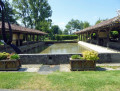
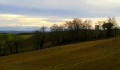
Discover the pond, the tree and its rural surroundings. As you walk, information boards will introduce you to the flora and fauna found in the Perchède Forest.

Details

10719514
Creation:
Last update:
Last review:
  • Walking
    Activity: Walking
  • ↔
    Distance: 2.81 mi
  • ◔
    Average duration: 1h 30 
  • ▲
    Difficulty: Easy

  • ⚐
    Back to start: Yes
  • ↗
    Ascent: + 246 ft
  • ↘
    Descent: - 223 ft

  • ▲
    Highest point: 397 ft
  • ▼
    Lowest point: 285 ft

Description of the walk

To get to the start from Houga, follow the D6 towards Nogaro. Once you’ve left the village, take the first road on the right (Route de la Forêt), which starts at the corner of a detached house. Follow this road and park in the gravel car park where you’ll find the signs describing the walk.

(S/E) Walk up the Route de la Forêt for a few dozen metres. Take a path on the right which, after a bend to the right, leads you towards the pond; walk alongside it until you reach the road.

(1) Turn left and cross the pond’s embankment; a few metres further on, take a path on the right.

(2) At the fork, turn right and walk through the poplar forest. Continue to the right along the road.

(S/E) Once back at the car park where you started, turn left and take the path under the trees. You’ll reach the junction of a forest road and a path on the right.

(3) Follow this path for about 250 m, then veer left to rejoin the forest track. Turn right until you reach the crossroads, where you turn left and walk a few metres.

(4) Turn right onto the road leading to the main road at Perchède. A signpost indicates the direction to Perchède.

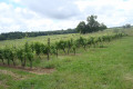
(5) At the vineyard, turn right and take the path that runs alongside the vines. Then follow the Route de l’Étang to the right to return to your starting point after crossing the dyke again (S/E).

Waypoints

  1. S/E : mi 0 - alt. 302 ft - Gravel car park
  2. 1 : mi 0.38 - alt. 305 ft - Dike of the - Étang de Perchède
  3. 2 : mi 0.56 - alt. 292 ft - Poplar forest
  4. 3 : mi 1.27 - alt. 312 ft - Junction
  5. 4 : mi 1.72 - alt. 394 ft - Route de Perchède
  6. 5 : mi 2.16 - alt. 394 ft - Vineyard Path
  7. S/E : mi 2.81 - alt. 302 ft - Gravel car park

Reviews and comments

4.4 / 5
Based on 3 reviews

Reliability of the description
4.7 / 5
Ease of following the route
4.7 / 5
Route interest
4 / 5
Mardavmaéans
Mardavmaéans

Overall rating : 4 / 5

Date of your route : Jul 28, 2026
Reliability of the description : ★★★★☆ Good
Ease of following the route : ★★★★☆ Good
Route interest : ★★★★☆ Good
Very busy route : No

A short, easy walk with a few shaded sections, ideal for families.

Machine-translated

Mofe
Mofe

Overall rating : 4.7 / 5

Date of your route : Jun 06, 2022
Reliability of the description : ★★★★★ Very good
Ease of following the route : ★★★★★ Very good
Route interest : ★★★★☆ Good
Very busy route : No

As for visitor numbers, I don’t have an opinion.
Thank you

Machine-translated

bartoche
bartoche

Overall rating : 4.7 / 5

Date of your route : Oct 24, 2021
Reliability of the description : ★★★★★ Very good
Ease of following the route : ★★★★★ Very good
Route interest : ★★★★☆ Good
Very busy route : No

Although you couldn’t really call it a hike, it’s a short walk (nature trail) that mostly runs through the woods, with an arboretum along the route where you can learn about the origins and other details of the different tree species you come across.
There are several routes on the same site, each marked with different colours – it’s very well organised.
A walk that lets you enjoy nature for just under an hour.

Machine-translated

Other walks in the area

For more walks, use our search engine .

The GPS track and description are the property of this route's author. Please do not copy them without permission.