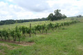
A short tour of Nogaro

This short, easy walk winds through a landscape of vineyards before reaching the bullring and the Romanesque church (frescoes) in Nogaro.

Details

899915
Creation:
Last update:
Last review:
  • Walking
    Activity: Walking
  • ↔
    Distance: 5.51 mi
  • ◔
    Average duration: 2h 50 
  • ▲
    Difficulty: Easy

  • ⚐
    Back to start: Yes
  • ↗
    Ascent: + 335 ft
  • ↘
    Descent: - 335 ft

  • ▲
    Highest point: 486 ft
  • ▼
    Lowest point: 322 ft

Description of the walk

Start from the Place de l’Église.

(S/E) Go down the steps and turn left, then right towards the cemetery.

(1) Walk along the right-hand side of the cemetery. Continue along the path that climbs and cross the Parc des Marnières (follow the signposts carefully). On exiting, take the road on the left.

(2) At the junction, go up the road on the right, pass the two farms and ignore the turn-off on the left for the La Haille farm.

(3) At the crossroads, turn right along the edge of the vineyards, passing Lacaze.

(4) Cross the N124, walk alongside the wine cooperative (tastings and sales), cut across the road (the old Voie Royale), then take the path on the left. Head straight down towards the Jurane valley. At the fork in the vineyard track, continue straight on along the grassy path. Then walk along the right-hand side of the Jurane stream.

(5) Head back up the small road on the right (Chemin de Saint-Jacques-de-Compostelle).

(6) Take the D143 to the right for 750 metres (take care). At the start of a right-hand bend, turn left onto the local track and follow it to the D147.

(7) Turn right and continue straight on along the D147. At the bullring, head right towards the centre of Nogaro and, via Rue Principale, return to the church (S/E).

Waypoints

  1. S/E : mi 0 - alt. 361 ft - Place de l’Église - Collégiale Saint-Nicolas (Nogaro)
  2. 1 : mi 0.12 - alt. 348 ft - Cemetery
  3. 2 : mi 0.81 - alt. 351 ft - At the fork in the road, take the road on the right
  4. 3 : mi 1.4 - alt. 476 ft - On the right, at the edge of the vineyards
  5. 4 : mi 1.91 - alt. 476 ft - Crossing the N124
  6. 5 : mi 3.04 - alt. 328 ft - Small road on the right
  7. 6 : mi 3.64 - alt. 479 ft - D143 on the right
  8. 7 : mi 4.93 - alt. 341 ft - D147 on the right
  9. S/E : mi 5.51 - alt. 361 ft - Place de l’Église

Notes

YellowPR®1signposting

Worth a visit

Nogaro: 11th-century Romanesque church (frescoes); bullring typical of the ‘course landais’.

Always be cautious and plan ahead when you're outdoors. Visorando and the author of this route cannot be held responsible for any accidents occurring on this route.

The GR® and PR® markings are the intellectual property of the Fédération Française de Randonnée Pédestre.

Reviews and comments

4.1 / 5
Based on 3 reviews

Reliability of the description
4 / 5
Ease of following the route
4.3 / 5
Route interest
4 / 5
bartoche
bartoche

Overall rating : 4.7 / 5

Date of your route : Aug 31, 2024
Reliability of the description : ★★★★★ Very good
Ease of following the route : ★★★★★ Very good
Route interest : ★★★★☆ Good
Very busy route : No

A easy route, mostly through woods and vineyards.
It’s a shame that the trail summarising the history of vines and wine through the seasons isn’t looked after; many of the information boards are illegible, as they’re either damaged or lost amongst the brambles… and sometimes both.
A circular loop completed at a leisurely pace in two hours.

Machine-translated

philippetalenton
philippetalenton

Overall rating : 3.7 / 5

Date of your route : Jan 01, 2024
Reliability of the description : ★★★★☆ Good
Ease of following the route : ★★★★☆ Good
Route interest : ★★★☆☆ Average
Very busy route : Yes

Route followed using GPS. All clear

Machine-translated

mcstruye
mcstruye

Overall rating : 4 / 5

Date of your route : May 25, 2020
Reliability of the description : ★★★☆☆ Average
Ease of following the route : ★★★★☆ Good
Route interest : ★★★★★ Very good
Very busy route : No

It’s fairly easy to follow, apart from when you leave the park.
We couldn’t work out, from the directions, exactly where it was, and we got a bit lost.
We found it by studying the map with a magnifying glass!
Otherwise, it was a very pleasant walk, which we’ve recommended whilst pointing out the problem we encountered.
Kind regards,

Machine-translated

Other walks in the area

For more walks, use our search engine .

The GPS track and description are the property of this route's author. Please do not copy them without permission.