


 Country:

 City:


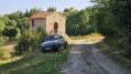
The walk starts from the car park below the village of Merle, where you can easily park.
There is a sign in this car park to help you find your bearings before setting off. It also features a QR code that allows you to download the walk onto your mobile phone and enjoy the benefits of Visorando.
The route is clearly signposted with “Lavoir” signs, supplemented by yellow and green markings – the colours of the local council.
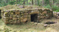
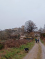
(S/E) From the car park, head uphill to cross the departmental road and continue by following the signs for “four à poix” and “lavoir ”. Carry on straight ahead at the junction. As you leave the village, on the right, perched high above, a cross overlooks the village. Follow the yellow and green markings, then turn left towards Tardivier.
(1) In the hamlet, at the top of the village, take the path on the left: this is off the main route and, 20 metres further on to the right, you will find a stone cairn and a cross. Enter the Bois des Monnets and continue to a junction.
(2) Turn left onto the signposted path. After about 400 metres, you’ll come to a second Fork in the road.
(3) Leave the main path and follow the signposting to the right into the woods. At the bottom of the steps, turn right onto the compacted track, then leave it to take a signposted path on the right which leads to a tarmac road. Turn right, then left towards L’Espinasse.
(4) In the hamlet, the route continues through the meadows on the left. Then take the small road on the right (sign for “lavoir”). Follow this road to the right: on the left, there is a well topped by a stone cross. Walk alongside the River Andrable and join the departmental road at La Plagne.
(5) Turn left, then cross the departmental road and turn right onto the path that runs more or less parallel to it, heading towards the sewage treatment works. Continue until you reach the iron cross on the left.
(6) Turn left onto the signposted path running alongside the Chansson stream to the wash house. Cross the departmental road again, keeping to the left-hand side, and take the path on the right which leads back to the village. Walk past the church and its cross, which is listed as a Historic Monument.
(7) Carry on, cross the departmental road again, then head for the car park (S/E).

 Visorando Member

 Moderate
 Local authority
 Difficult

