Circular walk around the lake starting from Merle-Leignec

A walk starting from Merle-Leignec, passing through Saint-Hilaire and the Reffiecq lake, returning via Leignecq and Alpinac. This is a walk with no major difficulties in terms of elevation gain, mostly through woodland and in shaded areas. There are several places to stop, and the lake is the perfect spot for a picnic. Be sure to follow the GPX track closely (the Visorando app is recommended) as, otherwise, you may get confused by the various signposts. 
Beautiful scenery, lovely countryside, a lovely region. I hope you enjoy this little trip; please do share your thoughts with me.

Details

n°74444294
Creation:
Last update:
Last review:
  • Walking
    Activity: Walking
  • ↔
    Distance: 9.69 mi
  • ◔
    Average duration: 5h 25 
  • ▲
    Difficulty: Moderate

  • ⚐
    Back to start: Yes
  • ↗
    Ascent: + 1,109 ft
  • ↘
    Descent: - 1,119 ft

  • ▲
    Highest point: 3,199 ft
  • ▼
    Lowest point: 2,828 ft

Description of the walk

Park in the hamlet of Le Mont.

(S/E) Head due west along the Route du Ham du Mont; you’ll soon reach the junction with the GR®3 Variante.

(1) Take the path uphill to the left, then follow the red and white markings. Pass through woods and fields to reach the hamlet of Chazourne. 

(2) Continue along the GR® path, skirting the fields, until you come out onto the D104. 

(3) Turn right onto it for a few metres, then turn left. You will then reach the village of Saint-Hilaire-Cusson-la-Valmitte.

(4) Leave the GR® here, continue along the main road, then turn left into the narrow lane leading to the church and a lovely square. Cross a car park; at the far end, turn left. Walk past the hamlet of La Maisonneuve at a distance, cross the road (D14) serving it, then join the D14.4.

(5) Cross it carefully, find a new road, turn left onto it, and reach a Y-shaped junction. Turn right at the junction and follow this road for about 200 metres before reaching a path junction.

(6) Take this path to the right. At the junction of the three roads, continue along the one opposite, heading west, to reach the village of Reffiecq.

(7) Take the shaded, stony path down to the left to reach the lake, then head left for about 100 metres.

(8) Continue to the right, heading due north, following the GPX track, to find the correct path through the woods and, after a gentle climb, reach the junction of the GR®3 and GR®765East.

(9) Turn right onto these paths to reach the charming village of Leignecq.

(10) Keep left on the GR® routes, marked in white and red, until you reach the hamlet of Combreau.

(11) Leave the GR® here (the IGN map background is incorrect); continue straight ahead up a gentle slope to reach the village hall in Apinac.

(12) Take the road on the right in front of the charming village church, rejoin the GR® route, and follow it to the right to reach a four-way junction at Bois du Roy.

(13) Turn right onto the GR®3 Liaison and head down to the D44.

(14) Cross it carefully, keeping the GR® straight ahead; at the Merle cemetery, continue to the right and then return to the original crossroads you passed on the way out.

(1) Turn left and follow the route you took on the way there in the opposite direction to return to the car park at the hamlet of Le Mont (S/E).
Waypoints

  1. S/E : mi 0 - alt. 3,159 ft - Car park at the hamlet of Mont
  2. 1 : mi 0.21 - alt. 3,058 ft - Crossroads at the end of the circular loop
  3. 2 : mi 1.34 - alt. 3,087 ft - Chazourne
  4. 3 : mi 1.79 - alt. 2,992 ft - D104
  5. 4 : mi 2.16 - alt. 2,999 ft - Saint-Hilaire-Cusson-la-Valmitte
  6. 5 : mi 2.66 - alt. 2,976 ft - D14.4
  7. 6 : mi 3.13 - alt. 3,015 ft - Trail junction
  8. 7 : mi 3.72 - alt. 3,084 ft - Reffiec
  9. 8 : mi 4.06 - alt. 2,946 ft - Lake
  10. 9 : mi 4.7 - alt. 3,100 ft - GR3
  11. 10 : mi 4.89 - alt. 3,179 ft - Leignecq - Église de l'Immaculée Conception (Leignecq)
  12. 11 : mi 5.71 - alt. 2,867 ft - Combreau
  13. 12 : mi 6.52 - alt. 3,074 ft - Apinac
  14. 13 : mi 7.71 - alt. 3,146 ft - Four-way crossroads
  15. 14 : mi 8.46 - alt. 2,907 ft - D44
  16. S/E : mi 9.69 - alt. 3,156 ft - Car park at the hamlet of Mont

Notes

Several villages where you can get water (ask in a bar); the route is mostly shaded, ending along a road for the return journey.
(12) You can quench your thirst at the bar.

Worth a visit

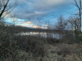
(8) Lake: the perfect spot to relax, with plenty of picnic tables; it’s best to do this walk in April–May to avoid the mosquitoes.
Make the most of it and have a swim in the lake if it’s allowed.

Always be cautious and plan ahead when you're outdoors. Visorando and the author of this route cannot be held responsible for any accidents occurring on this route.

The GR® and PR® markings are the intellectual property of the Fédération Française de Randonnée Pédestre.

Reviews and comments

5 / 5
Based on 1 review

Reliability of the description
5 / 5
Ease of following the route
5 / 5
Route interest
5 / 5
anne ubrig
anne ubrig
• Edited:

Overall rating : 5 / 5

Date of your route : Jun 05, 2025
Reliability of the description : ★★★★★ Very good
Ease of following the route : ★★★★★ Very good
Route interest : ★★★★★ Very good
Very busy route : No

It's a lovely walk, taking in some charming little hamlets nestling around a stone church. There were a few too many tarmac sections for my liking, but I really enjoyed the route. On the other hand, my two applications give the mileage as 17.40 and 17.28, whereas visorando gives 15.59. A mystery.

Machine-translated

Other walks in the area

For more walks, use our search engine .

The GPS track and description are the property of this route's author. Please do not copy them without permission.