Bois de la Croix in Leignecq

A very easy route along forest tracks and then along the road through the hamlet of Leignecq, a picturesque spot perched on a rocky outcrop where the village and its church are situated. There are lovely views in a natural, rural setting, featuring a village typical of this region.

Details

101982665
Creation:
Last update:
Last review:
  • Walking
    Activity: Walking
  • ↔
    Distance: 2.94 mi
  • ◔
    Average duration: 1h 40 
  • ▲
    Difficulty: Easy

  • ⚐
    Back to start: Yes
  • ↗
    Ascent: + 374 ft
  • ↘
    Descent: - 397 ft

  • ▲
    Highest point: 3,179 ft
  • ▼
    Lowest point: 2,822 ft

Photos

Description of the walk

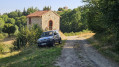
Access by car from the D104 or D12 via the Route de Cubelle from Leignecq. Easy parking near the Saint-Roch Chapel or opposite it.

(S/E) From the small chapel, continue along the track and head through the woods until you reach a fork.

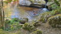
(1) Take the forest track on the right, head down to the bottom of the valley and, a few metres to the left, near the River Andrable, you’ll come to a beautiful waterfall.

(2) Continue along the track that runs alongside the river and head for the next fork.

(3) Take the track that climbs to the right up to a three-way junction.

(4) Carry straight on and ignore the narrower path leading down to the left. Continue until you come to a path on the right.

(5) Ignore it and carry on along the track until you reach the road.

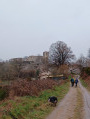
(6) Follow it to the right, cross the village and head for the cemetery. Turn left onto Rue du Château and head for the church and the ruins of Leignecq Castle.

(7) Return to the cemetery and continue along the road to the left until you reach the Chapelle Saint-Roch (S/E).

Waypoints

  1. S/E : mi 0 - alt. 3,133 ft - Chapelle Saint Roch
  2. 1 : mi 0.8 - alt. 3,114 ft - Junction
  3. 2 : mi 1.44 - alt. 2,844 ft - Waterfall - Andrable (rivière) - Afluent de l'Ance
  4. 3 : mi 1.62 - alt. 2,828 ft - Junction
  5. 4 : mi 1.92 - alt. 2,936 ft - Junction
  6. 5 : mi 2.13 - alt. 3,048 ft - Path on the right
  7. 6 : mi 2.29 - alt. 3,094 ft - Junction - Château de Leignecq
  8. 7 : mi 2.62 - alt. 3,179 ft - Église de l'Immaculée Conception (Leignecq)
  9. S/E : mi 2.94 - alt. 3,110 ft - Chapelle Saint Roch

Notes

Water is available in the village (Auberge du Chato).

(5) You can take the path leading uphill to the right, but if you do, you will not pass through the hamlet.

Other walks in the area

For more walks, use our search engine .

The GPS track and description are the property of this route's author. Please do not copy them without permission.