Bois Fradin Trail via the diversion

The Bois Fradin Trail was opened by the municipality of Aizenay in July 2026. There is a diversion at the end of the route, which will be removed as soon as possible. The permanent signposting will be installed in 2027.

Details

107218052
Creation:
Last update:
Last review:
  • Walking
    Activity: Walking
  • ↔
    Distance: 6.34 mi
  • ◔
    Average duration: 3h 00 
  • ▲
    Difficulty: Moderate

  • ⚐
    Back to start: Yes
  • ↗
    Ascent: + 135 ft
  • ↘
    Descent: - 108 ft

  • ▲
    Highest point: 118 ft
  • ▼
    Lowest point: 39 ft
  • ⚐ Country: France
  • ⚐ City: Aizenay (85190)
  • ⚑
    Start/End: N 46.763701° / W 1.668143°
  • ❏
    IGN map(s): Ref. 1226O
  • Hour-by-hour weather

Description of the walk

The route begins at a place called Le Bois Fradin in the commune of Aizenay, at a car park built in 2026 for this purpose. At the starting point, there is a sign describing the trail.

(S/E) Facing La Vie, take the path on the left until you reach a junction with the Route de Maché.

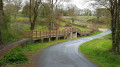
(1) Cross the bridge on the right via the D50.

(2) Once at the end, head down to the right. The path runs alongside La Vie in the commune of Maché, following the Vendée Vélo cycle route for a large part of the way, including through the commune of La Chapelle-Palluau. Continue to the road at La Marchandière.

(3) Carry on straight ahead, then turn left to reach the large roundabout.

(4) Stay on the D40 road to the right and pass through Petite Boulogne.

(5) Take the path on the right.

(6) At the junction, turn right towards La Vie and head for another junction.

(7) Head right towards La Normandière, leaving the Vendée Vélo route. Before reaching the hamlet, turn right down the path and cross La Vie.

(8) Take the path on the right, cross a small tributary of La Vie and head for the hamlet of La Plissonnière.

(9) Cycle through the hamlet, go round the small ponds, then carry straight on at the junction.

(10) Before the four-lane road, turn right, cross the bridge and walk alongside the greenhouses. Join the Chemin du Bois Fradin.

(11) Follow it to the right, keep to the right at the three-way junction and head towards the four-lane road to return to the banks of the River Vie.

(12) Walk alongside the river to round off this lovely walk and return to the car park where you started (S/E).

Waypoints

  1. S/E : mi 0 - alt. 46 ft - Car park - Vie (fleuve)
  2. 1 : mi 0.9 - alt. 52 ft - Route de Maché. D50 - Vie (fleuve)
  3. 2 : mi 1.03 - alt. 52 ft - End of the bridge, on the right - Vie (fleuve)
  4. 3 : mi 2.36 - alt. 92 ft - La Marchandière
  5. 4 : mi 2.55 - alt. 115 ft - Roundabout. D40
  6. 5 : mi 3.06 - alt. 56 ft - Leave the road, take the path on the right
  7. 6 : mi 3.51 - alt. 79 ft - Junction, turn right
  8. 7 : mi 3.84 - alt. 79 ft - Junction, on the right
  9. 8 : mi 3.96 - alt. 43 ft - Junction, turn right - Vie (fleuve)
  10. 9 : mi 4.3 - alt. 75 ft - La Plissonnière
  11. 10 : mi 4.91 - alt. 102 ft - Turn right at the fork
  12. 11 : mi 5.38 - alt. 112 ft - The Bois Fradin
  13. 12 : mi 5.92 - alt. 59 ft - Banks of the River Vie - Vie (fleuve)
  14. S/E : mi 6.34 - alt. 46 ft - Car park - Vie (fleuve)

Worth a visit

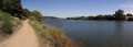
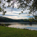
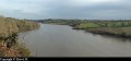
Banks of the La Vie.

Wildlife and flora.

Other walks in the area

For more walks, use our search engine .

The GPS track and description are the property of this route's author. Please do not copy them without permission.