Circular walk around the Logis de la Chauvinière in Saint-Georges-de-Pointidoux

A circular route with only around 10 per cent macadam. You’ll appreciate the peace and safety of our paths, which have very little elevation gain. Suitable for cycling or pushing a pushchair.

Details

4121772
Creation:
Last update:
Last review:
  • Walking
    Activity: Walking
  • ↔
    Distance: 3.32 mi
  • ◔
    Average duration: 1h 35 
  • ▲
    Difficulty: Easy

  • ⚐
    Back to start: Yes
  • ↗
    Ascent: + 33 ft
  • ↘
    Descent: - 30 ft

  • ▲
    Highest point: 210 ft
  • ▼
    Lowest point: 164 ft

Description of the walk

Park in the car park by the community hall.

(S/E) Head towards the church and cross the road at the pedestrian crossing. Leave the church behind you by turning left, walk past the town hall and continue down the street for approximately 200 metres. Leave Rue du Bas Gazon on your right, continuing straight ahead along the path beside the road until you reach the hamlet known as Le Reynoux.

(1) Turn left onto the tarmac road, then take the first path on the right. Ignore the first path on the left and carry on straight ahead.

(2) Turn left and, at the first junction, take the path on the left (GR®-marked section). Pass the buildings of the Grand Dairy Farm and reach a four-way crossroads.

(3) Turn left onto the land consolidation track, then keep to the right, staying on the main track and ignoring the signposted path on your left. Follow the track for 100 m, then continue along the country road, leaving the Logis de la Chauvinière on your left.

(4) Ignore the tarmac road on the left and follow the path opposite (leaving the new house on your right). After about 300 metres, you’ll enter a hamlet. Do not take the signposted path opposite, but turn left, staying on the tarmac road, and continue to another crossroad, Rue du Bocage.

(5) Turn left, staying on the paved side of the road, then turn left again to follow a paved path back to the community hall (S/E).

Waypoints

  1. S/E : mi 0 - alt. 194 ft - Car park for the multi-purpose hall
  2. 1 : mi 0.34 - alt. 174 ft - Le Reynoux, on the left
  3. 2 : mi 0.88 - alt. 190 ft - Marked path to the left
  4. 3 : mi 1.79 - alt. 197 ft - Crossroads
  5. 4 : mi 2.7 - alt. 203 ft - Path opposite
  6. 5 : mi 2.95 - alt. 210 ft - Rue du Bocage
  7. S/E : mi 3.32 - alt. 197 ft - Car park multi-purpose hall

Worth a visit

Saint-Georges Church in Pointidoux: the church, which belonged to the Abbey of Sainte-Croix de Talmont in the 11th century, is characterised by the variety of architectural styles incorporated during successive alterations. Of the sanctuary built in the 12th century, the chancel and the square bell tower remain. The barrel-vaulted nave was built in the 17th century, the church having been burnt down by the Huguenots in 1568.

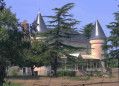
(3) Logis de la Chauvinière: This is the last remaining vestige of the seigneury of the same name. Until 1571, the lords of La Chauvinière were undoubtedly also the lords of the entire parish.
The noble family subsequently embraced the Reformation; from 1571 onwards, the fief came under the jurisdiction of the Lordship of La Maurière.

Always be cautious and plan ahead when you're outdoors. Visorando and the author of this route cannot be held responsible for any accidents occurring on this route.

The GR® and PR® markings are the intellectual property of the Fédération Française de Randonnée Pédestre.

Reviews and comments

4.3 / 5
Based on 2 reviews

Reliability of the description
5 / 5
Ease of following the route
5 / 5
Route interest
3 / 5
Aurelienquoi
Aurelienquoi

Overall rating : 4.3 / 5

Date of your route : Aug 26, 2024
Reliability of the description : ★★★★★ Very good
Ease of following the route : ★★★★★ Very good
Route interest : ★★★☆☆ Average
Very busy route : No

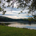
This walk consists of two sections: the first is really rather dull as we follow the tarmac road and cross the main road three times. The (short) section that winds down along the river, on the other hand, is very pleasant.
Thank you for this walk

Machine-translated

Aurelienquoi
Aurelienquoi

Overall rating : 4.3 / 5

Date of your route : Aug 21, 2024
Reliability of the description : ★★★★★ Very good
Ease of following the route : ★★★★★ Very good
Route interest : ★★★☆☆ Average
Very busy route : No

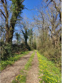
The walk began along a road where cars travel at high speed. This was followed by straight paths of little interest in themselves, apart from the fact that we could walk at a very leisurely pace, away from the traffic, without meeting anyone, with our dog, and often in the shade of the trees – which was very welcome in August…
A walk completed in 1 hour at a fairly brisk pace
Thank you for this walk

Machine-translated

Other walks in the area

For more walks, use our search engine .

The GPS track and description are the property of this route's author. Please do not copy them without permission.