Country:
 City:
City:


Parking available at the side of the road.
Yellow MTB trail marker no. 15 / Sections of the trail shared with footpaths.
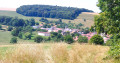
(S/E) In front of the church, Place de Termes, head right of the start sign and pass to the left of the church. Cross the upper part of the village, continuing straight ahead. On leaving the village, at a large crossroads, go straight ahead then turn right onto the D15 towards Grandpré. Ride for about 500 metres until you reach a track on the left.
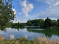
(1) Leave the D15 and head up to the left through the fields. Keep following the track, passing close to a pond, and continue. After a steep climb to the left, you’ll reach a road (D41).
(2) Turn right and head downhill to the junction with the D946. Cross it carefully and continue along the track opposite. Keep going straight up to the national forest. Enter the forest and keep going straight along the track. Never turn off at any junctions and continue to the top of the climb.
(3) Turn right downhill. At the junction with a white track, head straight along it and descend to the Route Forestière du Mariage, which is tarmac.
(4) Turn right and you’ll reach a junction with paths on the left, after the right-hand bend. Take a sharp left-hand hairpin bend and head straight up the climb. When you reach the plateau, continue straight ahead. Don’t miss the turn-off, on a technical descent with a slight camber at the edge of the national forest. Veer slightly to the right to take this turn-off. After the descent, the path climbs, veers slightly to the right, then opens out onto a plateau before descending steeply straight ahead.
(5) At the junction, turn left and continue straight on. Turn right at the crossroads between the trees on a descent, cross a small stream (depending on the time of year, there may be more or less water). After this, make a first turn left then right and head back up the track towards the Route Forestière du Grand Bourgogne.
(6) At the road, turn left and continue for about 150 metres. Leave the track by turning right to climb into the woods (an ascent of about 1.3 km). Follow this winding path without leaving it, until you reach the Route Forestière du Petit Bourgogne, above on the plateau.
(7) At the junction with the Petit Bourgogne Forest Road, take the track on the left, then the one on the right 200 m further on, where it joins the GR®14. Continue straight on to the left and follow the GR®14 to the next junction.
(8) Turn left, then immediately right 40 m further on. Continue straight ahead, rejoin the Route Forestière du Rocan and follow it to the left where it meets the track. Carry on straight ahead, pass the Rocan forest gate and begin a descent of about 1 km. After crossing the stream, you’ll reach a large crossroads. Turn left and climb for about 600 m, staying on this road.
(9) At the 90° left-hand bend, turn right onto the straight grassy path and continue straight on until you reach the edge of the national forest, at the top of the hill.
(10) Turn left and, at the next junction 200 m further on, continue straight ahead following the sign for the alternative route, until you reach the tarmac Route Forestière du Mariage.
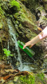
(11) Turn left, walk 100 m and take the grassy path down to the left below the forest road. Follow the long descent and, at the junction, turn right. Continue along the path that runs alongside a stream at the bottom of the valley and then emerges at the Source picnic area. La Source is accessible via a small dead-end path at the picnic area.
(12) To continue, head up to the right onto the Route Forestière du Mariage and turn right. At the large hairpin bend, turn left and take a path bordered by a limestone cliff. After a climb, you’ll reach a junction where you should turn left, then right. Continue straight ahead, then descend to the left down a long, winding path.
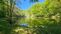
(13) At the Route Forestière du Bois de Ham, cross the large lay-by and head straight on. Then turn left onto a short, steep descent before reaching Étang Demoiselle, where you can stop for a picnic. Follow the edge of the pond to the other side. Turn right to head back up towards the Route Forestière du Chêne Pâté.
(14) At the forest road, turn left and cycle for about 800 m before the next junction. At the junction of the Route forestière du Chêne Pâté and the Route forestière des Bois de Termes, turn right and then right again a few metres further on to continue through the woods. Keep going straight ahead on the flat plateau, then turn slightly right onto a descent of about 800 m.
(15) At the bottom of the descent, turn right, then immediately left. Take care at the hairpin bend to access the path below. This section remains damp for part of the year. Continue straight on, cross a stream, then climb slightly towards the edge of the woods to rejoin the Chêne Pâté Forest Road. Continue straight ahead on the road, which winds before reaching a crossroads.
(16) At this large junction between the Route Forestière du Chêne Pâté and the Route Forestière de la Noue Marion, proceed into the junction then turn left to continue following the Route Forestière de la Noue Marion to its end, taking all the bends in this road without leaving it.
(17) At the end of the road, turn right onto the forest track and head downhill until you reach the edge of the woods. Continue along the track between the fields to Beaurepaire. Cross the hamlet and you will reach a road.
(18) Cross the main road (D946) with care and head up the path opposite. After a steep climb, the path turns left then right along the edge of the woods. Continue climbing straight ahead until you reach the entrance to the Bois de la Sarte. Ride straight through the woods.
(19) At the junction, turn right and, after a few metres on level ground, the path descends, leading to a forest track. Follow it to the left, going all the way up, pass the forest gate and continue to a crossroads.
(20) Turn left and follow the winding road down to the church in the village of Termes (S/E).
 Local authority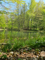

 Moderate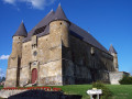
 Easy
Easy