Resistance Trail, Les Saulières

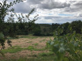
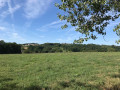
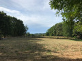
A beautiful themed walk starting from Sainte-Féréole along a wide, well-shaded path through the forest.
The route is signposted in yellow and features information boards on the theme of the Resistance.

Details

2426208
Creation:
Last update:
Last review:
  • Walking
    Activity: Walking
  • ↔
    Distance: 4.57 mi
  • ◔
    Average duration: 2h 35 
  • ▲
    Difficulty: Moderate

  • ⚐
    Back to start: Yes
  • ↗
    Ascent: + 561 ft
  • ↘
    Descent: - 574 ft

  • ▲
    Highest point: 1,391 ft
  • ▼
    Lowest point: 846 ft

Photos

Description of the walk

Park in the car park next to the church in Sainte-Féréole. The start is shared by three routes, all marked in yellow.

(S/E) Head north, then turn right down Rue du Onze Novembre. Take the first left. At the bottom of the hill, turn left onto Avenue du Huit Mai – take care. Pass the Vacherie route on your right and continue straight on.

(1) On leaving the village, at the junction of three streets, take the middle one towards the Resistance route. Follow the road to the car park.

(2) At the car park, take the ‘Sentier de la Résistance’ on the right. At the first junction, turn left and at the second junction, carry on straight ahead.

(3) At the third junction, carry on straight ahead along a wide path, then head down a steeper slope via a path on the left.

(4) At the junction, head down towards the Trou du Loup. Then retrace your steps.

(4) Follow the path to the right and cross the Ruisseau des Saulières. As you come off the bridge, turn left and follow the stream on your left-hand side (path not shown on the map).

(5) At the junction, turn sharply right and head slightly uphill.

(6) At the junction, continue climbing to the left (north-east). Pass a small hill and head back down.

(7) Take the path on the left immediately after joining the road.

(8) Once in the village, carry on straight ahead along the road, then head left towards the water tower via the D25e. Turn right to reach the church (S/E).

Waypoints

  1. S/E : mi 0 - alt. 1,388 ft - Church of Sainte-Féréole
  2. 1 : mi 0.56 - alt. 1,276 ft - Leaving the village
  3. 2 : mi 1.26 - alt. 1,204 ft - Car park
  4. 3 : mi 1.9 - alt. 1,020 ft - Wide path
  5. 4 : mi 2.44 - alt. 873 ft - Access to Le Trou du Loup
  6. 5 : mi 2.68 - alt. 899 ft - Junction
  7. 6 : mi 2.86 - alt. 1,017 ft - Turn left at the fork
  8. 7 : mi 3.7 - alt. 1,263 ft - Path at the junction with the road
  9. 8 : mi 3.99 - alt. 1,312 ft - Village entrance
  10. S/E : mi 4.57 - alt. 1,388 ft - Church of Sainte-Féréole

Notes

You can extend the route by km via a detour between this point and Sainte-Féréole.

Worth a visit

Le Trou du Loup: the Resistance fighters’ hideout.

Reviews and comments

3.7 / 5
Based on 5 reviews

Reliability of the description
3.6 / 5
Ease of following the route
4 / 5
Route interest
3.6 / 5
BUBU33
BUBU33

Overall rating : 4.7 / 5

Date of your route : Jan 14, 2023
Reliability of the description : ★★★★★ Very good
Ease of following the route : ★★★★★ Very good
Route interest : ★★★★☆ Good
Very busy route : No

Hello
A lovely little walk not far from my parents’ home. It’s a shame I didn’t discover it sooner!
Well worth a visit if you’re in this part of Corrèze
Kind regards

Machine-translated

caporal
caporal

Overall rating : 2.3 / 5

Date of your route : Apr 15, 2022
Reliability of the description : ★★★☆☆ Average
Ease of following the route : ★★★☆☆ Average
Route interest : ★☆☆☆☆ Very disappointing
Very busy route : Yes

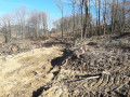
I’m really unhappy because the path has been dug up by a machine used for felling trees. There used to be trees there – it was lovely – but now everything’s been torn up. The paths are in a right state in places, to the point where you could twist your ankle, and it’s not certain whether the emergency services could even get there. Or perhaps in a 4x4, but not a VSAB.A machine that uproots trees and destroys everything in its path – it’s so bad that it frightens me just to hear that huge beast. Some people aren’t very friendly, which isn’t pleasant. I hope this path will be maintained; I’m so sad to see this state of the environment.


Machine-translated

Huguette puyjalon
Huguette puyjalon

Overall rating : 3 / 5

Date of your route : Mar 28, 2021
Reliability of the description : ★★☆☆☆ Disappointing
Ease of following the route : ★★★☆☆ Average
Route interest : ★★★★☆ Good
Very busy route : Yes

There’s a mistake at the start. You shouldn’t take Rue du 11 Novembre, but Rue du Presbytère.
It should be noted that in wet weather, a section of the path is impassable.
We would have liked to see yellow markings all along the route; these are very few and far between.
And as there are three different directions, all signposted in yellow, more signposts would be welcome.
We came across lots of people who, like us, didn’t know which way to go.
It would also be nice to have signs explaining the maquis at Sainte-Féréole. The signs we came across contained only general information that can be found in books.

Machine-translated

thegilbert
thegilbert

Overall rating : 5 / 5

Date of your route : Sep 10, 2020
Reliability of the description : ★★★★★ Very good
Ease of following the route : ★★★★★ Very good
Route interest : ★★★★★ Very good
Very busy route : Yes

A lovely walk, with several alternative routes. A stunning view of Brive

Machine-translated

pazkale
pazkale

Thanks 🤴

Machine-translated

Netra
Netra ★

Hello Pascale, and thank you for your comments.

I’ve re-read the description at the ‘problematic’ point and I must say it wasn’t entirely clear… I’ve moved WP4 and placed WP5 at the point where you leave the stream. I’ve reworded the description to make it clear that, after crossing the stream, you need to turn left, as you pointed out.

Machine-translated

pazkale
pazkale
• Edited:

Overall rating : 3.7 / 5

Date of your route : Sep 16, 2019
Reliability of the description : ★★★☆☆ Average
Ease of following the route : ★★★★☆ Good
Route interest : ★★★★☆ Good

Hello, this route is very good, but there is a mistake at waypoint 5:
(5) Cross the Saulières stream, then follow the path – which is only partially marked on the map – as it turns to the right.
It seems as though you’re supposed to turn right after the stream, when in fact you should turn left
Especially as, after the stream, there are two signposts for Sainte-Féréole: one on the right for 4 km and one on the left for 3 km.
Perhaps this warrants a correction
Thank you for creating this walk so close to where I live

Machine-translated

Other walks in the area

For more walks, use our search engine .

The GPS track and description are the property of this route's author. Please do not copy them without permission.