Country:
 City:
City:


Park at the Bardonnière car-sharing area.
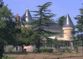
(S/E) Cross the road carefully towards the restored old house and, at the corner, take the tarmac road
(1) Cross the main road with care and, after 50 metres, take the first path on your right; 100 metres further on, cross the road again, then head straight ahead, staying on the tarmac road (you may walk on the grass verge if you prefer, as it is more pleasant)
(2) Cross the main road again and head towards the houses in the village opposite, La Renelière. Stay on the tarmac section and you’ll reach the pond (which you’ll walk alongside on the path), then veer right to return to the tarmac road. Turn left and walk along the road for 250 metres on the paved section.
(3) Turn left onto a path signposted in yellow. Follow the yellow markings for 2 km. When you reach the end of a road, first turn left then right. Further on, you’ll join a road.
(4) Follow it to the right. Cross the Auzance over the pretty little stone bridge (picnic table).
(5) Leave the yellow trail by turning right at the first junction, then, after 100 m, turn right again along the road (paved section); after 300 m, at Le Reynoux, turn left onto the tarmac road and follow it for 300 m.
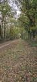
(6) Leave the tarmac road and take the path on your right; then, after 300 m, turn left onto the sunken track.
(7) At the junction, turn right to rejoin the yellow signposting (follow this for the next 4 kilometres). At the next junction, turn right again.
(8) Turn right onto a sunken path for 1 km, then turn left, keeping to the yellow markings (in winter, there are two 10-metre sections that are sometimes wet and tricky but not impassable).
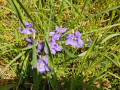
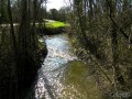
(9) Take the small path on the right between the two houses (yellow markings) and, after a 30-metre descent, you’ll reach the tarmac road – which you don’t even have to take: immediately turn right, stay on the verge for 10 metres and turn right again (still following the yellow markings) to take a lovely path along the Auzance ( a river that sometimes runs dry in the height of summer). In spring, you’ll enjoy the primroses, wood hyacinths… Further on, the path veers away from the river.
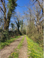
(10) You’ll come to a tarmac road. Turn left, leaving the yellow markings on your right. After 80 metres, take the shaded path on your right. When you reach a road, head towards the junction 30 metres ahead on the right.
Take care when crossing, using the safest possible angle of visibility (there is no pedestrian crossing and the road is quite busy) to reach the hard shoulder along the road; turn left towards the car-sharing area car park, 50 m away (S/E).

 Visorando Member
 Tourist office