Allenjoie Nature Trail

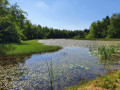
A very pleasant nature trail in the heart of the Allan Valley’s sensitive natural area. A very easy walk offering beautiful scenery near the wetland.

Details

n°63480573
Creation:
Last update:
Last review:
  • Walking
    Activity: Walking
  • ↔
    Distance: 1.20 mi
  • ◔
    Average duration: 0h 35 
  • ▲
    Difficulty: Easy

  • ⚐
    Back to start: Yes
  • ↗
    Ascent: + 16 ft
  • ↘
    Descent: - 16 ft

  • ▲
    Highest point: 1,086 ft
  • ▼
    Lowest point: 1,063 ft
  • ⚐ Country: France
  • ⚐ City: Allenjoie (25490)
  • ⚑
    Start/End: N 47.527933° / E 6.887816°
  • ❏
    IGN map(s): Ref. 3621OT
  • Hour-by-hour weather

Description of the walk

The route starts at the car park on Chemin des Combes de Bois in Allenjoie. This trail is less than 15 km from Belfort, Delle and Montbéliard.

(S/E) From the car park, cross the Rhône–Rhine Canal via the footbridge on the EuroVelo EV6 cycle route.

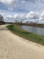
(1) Just after the bridge, turn left, go down a few steps and walk along the canal heading east. Along the route, there are some very interesting information boards.

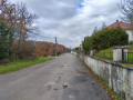
(2) Turn right and cross a stream via the small bridge. Just after this, turn round to see the information board. Continue along the path which runs below the D209 road

(3) Turn right again and follow a branch of the River Allan. The path runs alongside pastures.

(4) Cross the footbridge and continue alongside a copse. When you reach the cycle path, take the sharp right-hand bend and go up the ramp leading to the bridge.

(1) Cross the bridge to return to the starting point (S/E)

Waypoints

  1. S/E : mi 0 - alt. 1,079 ft - Car park located on Chemin des Combes de Bois in Allenjoi
  2. 1 : mi 0.03 - alt. 1,076 ft - Junction of the circular loop
  3. 2 : mi 0.35 - alt. 1,070 ft - Small bridge
  4. 3 : mi 0.52 - alt. 1,070 ft - Continue to the right
  5. 4 : mi 0.87 - alt. 1,063 ft - Footbridge
  6. S/E : mi 1.2 - alt. 1,079 ft - Car park located on Chemin des Combes de Bois in Allenjoi

Notes

There are several benches and picnic tables along the route.
You can also start the walk at point (3). There is a flight of steps leading up from the county road.

Worth a visit

A lovely wetland area where you can spot beautiful flowers and birds.

Reviews and comments

4.7 / 5
Based on 1 review

Reliability of the description
5 / 5
Ease of following the route
5 / 5
Route interest
4 / 5
User 25816625

Overall rating : 4.7 / 5

Date of your route : May 19, 2025
Reliability of the description : ★★★★★ Very good
Ease of following the route : ★★★★★ Very good
Route interest : ★★★★☆ Good
Very busy route : No

A pleasant route, part of which runs alongside the water.
Be careful on hot days, as the route is almost entirely in the sun.

Machine-translated

Other walks in the area

For more walks, use our search engine .

The GPS track and description are the property of this route's author. Please do not copy them without permission.