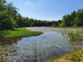
Grand Tour of the Ponds at the Pays de Montbéliard Leisure Centre

Long walk around the lakes of Brognard, Dambenois, Chatenois-les-Forges and Nommay.
Starting from the Pays de Montbéliard water sports centre and continuing to the Verte Comtoise business park. Return to the starting point along the River Savoureuse and the Basse Vallée de la Savoureuse Nature Reserve.

Details

3047311
Creation:
Last update:
Last review:
  • Walking
    Activity: Walking
  • ↔
    Distance: 4.98 mi
  • ◔
    Average duration: 2h 20 
  • ▲
    Difficulty: Easy

  • ⚐
    Back to start: Yes
  • ↗
    Ascent: + 26 ft
  • ↘
    Descent: - 26 ft

  • ▲
    Highest point: 1,093 ft
  • ▼
    Lowest point: 1,053 ft
  • ⚐ Country: France
  • ⚐ City: Brognard (25600)
  • ⚑
    Start/End: N 47.528444° / E 6.856461°
  • ❏
    IGN map(s): Ref. 3621OT
  • Hour-by-hour weather

Photos

Description of the walk

Park in the car park at the Pays de Montbéliard Leisure Centre.

(S/E) Cross the road then turn right towards the reception.

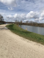
(1) Continue to the right towards the gymnastics equipment and join the cycle path. Follow the path alongside the Étang du Pâquis.

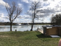
(2) Head straight on towards the Dambenois gravel pit, which is now used as a lake for water skiing. Carry on to the end of the lake, join a small tarmac track and walk a few metres to the left.

(3) Cross Rue de Nommay (D424) with care to join the path opposite. Then turn left to walk alongside the pond and, at the junction, carry on straight ahead for about twenty metres.

(4) You are now at the edge of the Nommaysienne’s private pond. Turn right and walk along the edge through the grass; at the far end, head diagonally left then right to reach a crossroads.

(5) Turn right, then keep to the left. From this point onwards, there is no longer a road suitable for vehicles. The path may be muddy if it has rained recently, so it is best to wear waterproof walking shoes. At the T-junction, turn left and carry on until you reach a gravel path.

(6) Turn right and walk alongside the pond on your left. When you reach the junction marking the entrance to the Verte Comtoise industrial estate, turn left.

(7) Turn left again and carry on straight ahead, passing two ponds in succession that you saw on the way out.

(5) Carry on straight ahead. Cross the D424 again, taking the same care, to take the path opposite, slightly to the right, which joins the cycle path a little further on.

(8) Turn right. When you reach the junction near a car park, veer left then immediately keep right to pass between the Savoureuse on your right and a pond on your left.

(9) Carry on straight ahead, following the Étang du Pâquis, past the volleyball courts and then the beach at the Base de Loisirs.

(1) Turn right at the leisure centre’s reception, then cross the road to return to the starting car park (S/E).

Waypoints

  1. S/E : mi 0 - alt. 1,066 ft - Leisure Centre car park
  2. 1 : mi 0.06 - alt. 1,063 ft - Reception, Pays de Montbéliard Leisure Centre
  3. 2 : mi 0.51 - alt. 1,070 ft - Étang du Pâquis, straight ahead
  4. 3 : mi 1.21 - alt. 1,086 ft - D424. Near the - Canal de Montbéliard à la Haute-Saône
  5. 4 : mi 1.39 - alt. 1,079 ft - The Nommaysienne’s private lake
  6. 5 : mi 1.69 - alt. 1,076 ft - Crossroads: A/ turn right – R/ go straight on. Near - Savoureuse (rivière)
  7. 6 : mi 2.04 - alt. 1,083 ft - Back onto the gravel path, straight ahead
  8. 7 : mi 2.67 - alt. 1,086 ft - Crossroads; turn left
  9. 8 : mi 3.89 - alt. 1,070 ft - Cycle path, on the right
  10. 9 : mi 4.41 - alt. 1,073 ft - Étang du Pâquis, straight ahead
  11. S/E : mi 4.98 - alt. 1,066 ft - Leisure Centre car park

Notes

Walk along a gravel cycle path.
A section along a grassy path. Make sure you wear waterproof shoes in wet weather.

A walk for the whole family, including dogs.

(1) Here, you can find out about all the activities available around the water sports and leisure centre. You can also hire bikes or use the toilets

The leisure centre gets very busy on sunny days, especially on Saturday and Sunday afternoons.

Worth a visit

You can watch the birds on the ponds and see the various water sports on offer.
These ponds are also fishing spots.

Reviews and comments

4 / 5
Based on 4 reviews

Reliability of the description
4.3 / 5
Ease of following the route
4 / 5
Route interest
3.8 / 5
fredmotard
fredmotard

Overall rating : 3.7 / 5

Date of your route : Mar 30, 2026
Reliability of the description : ★★★★☆ Good
Ease of following the route : ★★★★☆ Good
Route interest : ★★★☆☆ Average
Very busy route : Yes

Nothing special, just a quiet stroll

Machine-translated

User 27132752

Overall rating : 4.3 / 5

Date of your route : Aug 20, 2025
Reliability of the description : ★★★★★ Very good
Ease of following the route : ★★★★☆ Good
Route interest : ★★★★☆ Good
Very busy route : Yes

A lovely little route, which can be done entirely with an all-terrain pushchair, but avoid point 5 (parish specific to Brittany, very narrow, unmaintained and full of brambles...!!). Instead, turn right a little further on (between the two ponds) and you will come back to point 6.

Machine-translated

Randogrieg67116
Randogrieg67116

Overall rating : 4 / 5

Date of your route : Aug 17, 2025
Reliability of the description : ★★★★☆ Good
Ease of following the route : ★★★★☆ Good
Route interest : ★★★★☆ Good
Very busy route : No

I completed the entire hike in good weather and on dry ground. At point 4, I didn't have to walk through the grass. At point 5, the rest of the route is a little harder to find because there are several paths. After that, the path is no longer passable by vehicle and is very overgrown with brush and brambles. Even the T-junction is difficult to see. It's a beautiful walk through greenery and along ponds. It's a shame that there is constant noise from the motorway. Apart from these two details, and with the Visorando app, it's difficult to get lost.

Machine-translated

lecomtois
lecomtois

Overall rating : 4 / 5

Date of your route : Jul 24, 2023
Reliability of the description : ★★★★☆ Good
Ease of following the route : ★★★★☆ Good
Route interest : ★★★★☆ Good
Very busy route : No

We didn’t complete the whole route – we had some knee pain – but it’s a lovely place

Machine-translated

Régine Gozzi
Régine Gozzi

Easy walks… It’s a shame about the noise from the nearby motorway

Machine-translated

Other walks in the area

For more walks, use our search engine .

The GPS track and description are the property of this route's author. Please do not copy them without permission.