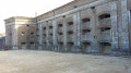
From Bourogne to Allenjoie, between canals and woodland

You’ll pass through Bourogne, where a route of small information boards explains the castle ruins and the Neolithic cemetery. You’ll cross the Bourogne arboretum. You’ll then enter the pine forests until you reach the canal, and follow the cycle path to Allenjoie.
You’ll pass through the village before heading back up into the forest and joining the Sentier des Bornes, which marks the boundary of the former County of Montbéliard.

Details

4729923
Creation:
Last update:
Last review:
  • Walking
    Activity: Walking
  • ↔
    Distance: 6.57 mi
  • ◔
    Average duration: 3h 30 
  • ▲
    Difficulty: Moderate

  • ⚐
    Back to start: Yes
  • ↗
    Ascent: + 584 ft
  • ↘
    Descent: - 584 ft

  • ▲
    Highest point: 1,394 ft
  • ▼
    Lowest point: 1,076 ft
  • ⚐ Country: France
  • ⚐ City: Bourogne (90140)
  • ⚑
    Start/End: N 47.560929° / E 6.908905°
  • ❏
    IGN map(s): Ref. 3621OT
  • Hour-by-hour weather

Description of the walk

Park on Rue Bernardot, at the entrance to the woods.

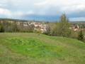
(S/E) Return along Rue Bernardot towards the village. Walk past the Bernadot wash house, then turn right to walk past the castle’s wash house. At the junction of Rue Sous la Côte and Rue Basse, take the dirt track on the right up the hillside. Enjoy the view of the village and the information on the signposts: Neolithic cemetery, local flora, waste incineration plant.

(1) Take the path on the left, further down, which leads into the forest and later crosses the arboretum.

(2) At this junction, turn left onto the path which will take you down to the Bourbeuse. Once on the riverbank, follow the path on your right until you reach the cycle path.

(3) Carry on straight ahead, staying on the same side of the canal ((4) confluence of watercourses), until you reach Lock No. 8 at Les Fontenelles, near Allenjoie.

(5) Head up Rue de l’Écluse on the right until you reach the departmental road, passing the car park for the municipal workshops. Turn right after the workshops, continue up to the restaurant and turn right into Rue de Bourogne. Follow this street straight on, ignoring the side streets.

(6) Just before the pumping station, take the road on the right, which turns into a stony track. Pass a farm and a stable, then follow the track up to the next junction where several marked paths meet.

(7) Turn left and set off along the Sentier des Bornes, marked with a blue circle.

(8) At the Trois Bornes junction, continue straight ahead, heading diagonally. Ignore the numerous paths branching off to the left and carry on to the Bois Dessus junction.

(9) Take the path on the right which crosses a less wooded area and joins the stone path. Once on this path, follow it straight ahead, slightly uphill, whilst continuing to follow the Blue Ring markings.

(10) Go straight on and follow the road down to the village to return to the starting point (S/E).

Waypoints

  1. S/E : mi 0 - alt. 1,168 ft - Rue Bernardot
  2. 1 : mi 0.48 - alt. 1,188 ft - Turn left at the fork
  3. 2 : mi 1.39 - alt. 1,175 ft - Crossroads: turn left towards the - Bourbeuse
  4. 3 : mi 1.69 - alt. 1,093 ft - Cycle path. Confluence of the canal and - Allaine (rivière)
  5. 4 : mi 2.3 - alt. 1,083 ft - Confluence of the Canal and - Allan (rivière)
  6. 5 : mi 2.88 - alt. 1,083 ft - Allenjoie, Rue de l’Écluse. Lock No. 8 - Canal du Rhône au Rhin
  7. 6 : mi 3.48 - alt. 1,122 ft - Pumping station, on the right
  8. 7 : mi 4.41 - alt. 1,224 ft - Sentier des Bornes, on the left
  9. 8 : mi 4.69 - alt. 1,362 ft - Croisement des Trois Bornes
  10. 9 : mi 5.28 - alt. 1,240 ft - Bois Dessus junction, turn right
  11. 10 : mi 6.35 - alt. 1,253 ft - Junction, go straight on
  12. S/E : mi 6.57 - alt. 1,168 ft - Rue Bernardot

Notes

A fairly moderate walk, with no major difficulties, taking in a mix of woodland, cycle path and stony forest track.

There are two parking options: in the car park at the municipal workshops in Allenjoie, or in Bourogne, on Rue Bernardot, before the entrance to the woods just after the last houses. You’ll also find parking in the village centre, but the streets are rather narrow.

In the event of flooding, the path leading to the cycle path (3) may be flooded; you will need to walk through the woods off the path for about 50 metres.

If you’re doing the walk in wet weather, make sure you wear a good pair of shoes: the paths will be muddy.

(7) If you get tired, you can shorten the route by heading straight on. You will then join the route described at .

Worth a visit

The Castle

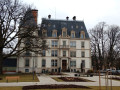
The 16th-century Renaissance-style castle was still inhabited by the Valbert family before the First World War. As its upkeep became too costly, it was abandoned by its owners.
It was then used as a quarry, with most of the stones being used by builders for the village houses. All that remains is the cellar, where the owner stored beetroot in the 1950s.
A corbelling that once adorned a corner tower is still visible today.

The castle’s washhouse and fountain, 1847

This covered fountain consists of a wellhead surmounted by four arches supporting a pavilion-style roof.
The trough is usually filled with gravel and sand, which serve to retain rainwater. The arches are surmounted by pilasters and a Tuscan-style entablature. The fountain has multiple uses: one section is reserved for human consumption, another for livestock with a drinking trough, and finally, a washhouse and a rinsing trough complete the complex.

All these sections are carefully separated to prevent the spread of disease and epidemics. (I. M. H. 1980).

Reviews and comments

3.9 / 5
Based on 4 reviews

Reliability of the description
3.3 / 5
Ease of following the route
4.3 / 5
Route interest
4.3 / 5
Marysette
Marysette

Overall rating : 4 / 5

Date of your route : Nov 08, 2024
Reliability of the description : ★★★★☆ Good
Ease of following the route : ★★★★☆ Good
Route interest : ★★★★☆ Good
Very busy route : No

A fine run

Machine-translated

Bapou
Bapou

Overall rating : 5 / 5

Date of your route : Jul 08, 2024
Reliability of the description : Not used / Not applicable
Ease of following the route : ★★★★★ Very good
Route interest : ★★★★★ Very good
Very busy route : No

A lovely walk, not too many tarmac roads, which is perfect. The only thing missing is a bit of maintenance on the information boards about the Neolithic cemetery. The forest sections are brilliant, although a bit too busy with mountain bikes. But then again, there’s no trouble between users. A bit of courtesy and everything goes smoothly. The forest paths are very pleasant, with soft ground, sometimes muddy and with a few slippery patches. That’s part of the charm of the walk.
As I’m 1.90m tall, I often found myself bent double to get through the forest; a bit of maintenance would be welcome. I recommend this walk, which is not at all difficult.

Machine-translated

Arphi
Arphi

Overall rating : 4.3 / 5

Date of your route : Oct 02, 2023
Reliability of the description : ★★★★☆ Good
Ease of following the route : ★★★★☆ Good
Route interest : ★★★★★ Very good
Very busy route : No

A very pleasant walk. Clear signposting, supplemented by GPS, so absolutely no problems. Some lovely stretches through the woods; the path along the canal was busy on this Sunday as it was shared with a large number of cyclists. We took a slight detour at the end to avoid walking back along the road. We turned left onto Chemin de Feuilletiere 50 metres before the road, walked along the fields and rejoined the fitness trail in the woods to return to the starting point.
Always a lovely walk. Thank you for suggesting this route.

Machine-translated

koukinet
koukinet

Overall rating : 3 / 5

Date of your route : Sep 27, 2021
Reliability of the description : ★★☆☆☆ Disappointing
Ease of following the route : ★★★★☆ Good
Route interest : ★★★☆☆ Average
Very busy route : No

The route description lacks precision or simple, useful details.
Examples:
- At the junction of Rue Sous-la-Côte and Rue Basse, the instructions state to ‘take the dirt track on the right up the hillside’. We spent a long time looking for this dirt track, only to realise in the end that it is actually a narrow path winding its way up through the trees...
- The sign indicating that you are crossing into a different department (Territoire de Belfort – Doubs) as you reach the cycle path is not mentioned; this would have been useful and interesting.
- After Lock No. 8, the guide states: ‘+GO UP Rue de l’Ecluse on the right’, but as there are several adjacent streets also called Rue de l’Ecluse which lead uphill, it should have specified to ‘follow Rue de l’Ecluse for about 500 metres, on level ground, until you reach the departmental road’."
Furthermore, walking along the cycle path for a long distance isn’t very pleasant for pedestrians (and especially with a dog), as you have to be constantly on your guard against cyclists who often come hurtling along at high speed in both directions.

Machine-translated

Other walks in the area

For more walks, use our search engine .

The GPS track and description are the property of this route's author. Please do not copy them without permission.