Saumane – Col de la Roche

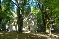
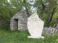
Above the village of Saumane, the Montagne de Lure was once a major centre for pastoralism. There are a large number of sheepfolds here, most of which were built in the 19th century. All constructed using dry stone from locally sourced materials, they are magnificent examples of a specialised technique executed to a very high standard.

This walk is part of a multi-day hike: Montagne de Lure - le Mont Ventoux

Details

n°112134
Creation:
Last update:
Last review:
  • Walking
    Activity: Walking
  • ↔
    Distance: 6.49 mi
  • ◔
    Average duration: 4h 55 
  • ▲
    Difficulty: Easy

  • ⚐
    Back to start: No
  • ↗
    Ascent: + 2,211 ft
  • ↘
    Descent: - 794 ft

  • ▲
    Highest point: 5,033 ft
  • ▼
    Lowest point: 2,867 ft

Photos

Description of the walk

Start from Saumane. From Banon, head to the village of Saumane via the D12 and park in Saumane, in the square by the town hall and the church.

(S) We take the initially tarmac road heading east, which turns into a track and heads north, following the red and yellow markings ofthe GR® de Pays du Tour on the Montagne de Lure.

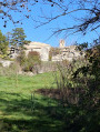
Pass through “Les Chaumettes”, which offers a lovely view of the village and the surrounding farms; on the ascent, there is a drystone shelter on the right. The route is lined with wildflowers, amidst the broom. A little further up on the left, we’ll stop at the wild boar enclosure, where around thirty sows with their piglets and some male boars are kept in a natural wooded setting. Carry on until you reach a plateau. Walk alongside a field of lavender on the right and, a little further on, another field of lavender on the left. Continue along theGR® until you reach a crossroads.

(1) Take the track branching off to the left and leave theGR®. About 100 metres further on, take a path on the right, pass a mobile home and continue to a ruin (2). Explore this ruin, overgrown with vegetation, with its well, numerous outbuildings and cut-stone frames. At the entrance to the ruins, head straight north-west to rejoin a track below and follow it up to the right. After a long climb, you’ll reach a flat area.

(3) Leave the track and take a narrow path that climbs to the right towards the Piton de La Tour (1,225 metres). Leave this path and turn right to reach the La Tour viewpoint, from where the view takes in the whole region (4). Retrace your steps and rejoin a path, which you follow straight on to descend through a forest. You’ll rejoin the track you left to climb up to the viewpoint, which you’ll follow back up to the right.

Cross another forest before reaching the high plateau of Le Clapier at an altitude of nearly 1,200 metres and its Jas du Clapier, which lies by the track on the left (5). Then, continue along the track until you reach a three-way junction.

(6) Take the track on the left. A little further on, ignore the path on the right. You will cross a large green area, surrounded by pine trees and strips of woodland, and come to a three-way junction.

(7) Turn left to reach, a little further on, the ruins of Guilhem, about fifty metres from the path on your left. This is an old sheepfold, with its dwelling and well, which has also been overtaken by vegetation.

Retrace your steps back to the three-way junction (7). Turn left and, a few metres further on, take the small path on the left. It rejoins the track a little further on. Follow the track and take a short detour to the right to visit some ruins. A little further along the Jas de Borel track, note the ruins of Chapellane Basse on the left, at an altitude of 1,270 metres – a sheepfold still used in the spring (8). Continue along the track to reach Chapellane Haute.

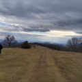
Head east to quickly rejoin a path and follow it uphill to the left. When the path disappears, head up to the right towards the north-east. To find your way, head towards where the gradient is gentle. You’ll rejoin the ridge path at Treboux.

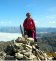
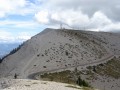
(9) Turn left and carry on to the Col de la Roche, a camping spot.

Waypoints

  1. S : mi 0 - alt. 2,874 ft - Saumane
  2. 1 : mi 1.22 - alt. 3,360 ft - At the junction, leave the GR and turn left
  3. 2 : mi 1.47 - alt. 3,451 ft - Ruins
  4. 3 : mi 2.1 - alt. 3,839 ft - Take the path on the right
  5. 4 : mi 2.4 - alt. 3,980 ft - La Tour, viewpoint
  6. 5 : mi 3.07 - alt. 3,953 ft - Jas du Clapier
  7. 6 : mi 3.24 - alt. 3,963 ft - Three-way junction, on the left
  8. 7 : mi 3.68 - alt. 4,088 ft - Three-way junction, on the left
  9. 8 : mi 4.27 - alt. 4,219 ft - Ruins of Chapellane Basse
  10. 9 : mi 5.59 - alt. 5,033 ft - Ridge Trail, on the left
  11. E : mi 6.49 - alt. 4,291 ft - Col de la Roche,

Notes

Suitable for keen walkers, but not difficult. Take something to drink with you; in sunny weather, allow 1.5 to 2 litres of water, as much of the route is in direct sunlight. Please note! The weather can change very quickly: make sure you also bring a poncho for the rain and for the wind, which can be chilly.

Worth a visit

Visit the sheepfolds and the Jas du Contras; nearby are the Contadour sheepfolds. You are in the land of Giono, where he drew inspiration from these landscapes to write his works, which I invite you to read… (book: ‘A Literary Walk in the Footsteps of Jean Giono’)

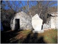
The Jas du Clapier, a complex comprising a well-preserved tunnel-style sheepfold, covered by a long, narrow chain-vault, with its row of corbels that once supported the wooden formwork, and the remains of a hut, a cistern and other ancillary structures. The entrance is surmounted by a wooden lintel and a carved stone on the façade bearing the date 1889. The long building is covered with slate slabs, concealing the interior vault, and is gradually being overtaken by vegetation.

The Jas de Borel in Chapellane Basse, at 1,270 metres: a sheepfold still used in the spring, comprising a shepherd’s hut with a corbelled vault, a well and a sheepfold covered by a tunnel vault of radiating clamped stones (constructed on formwork). Like the previous sheepfold, this long building is roofed with slate slabs, concealing the interior vault. A few remains of outbuildings are overgrown with vegetation.

Always be cautious and plan ahead when you're outdoors. Visorando and the author of this route cannot be held responsible for any accidents occurring on this route.

The GR® and PR® markings are the intellectual property of the Fédération Française de Randonnée Pédestre.

Reviews and comments

4.2 / 5
Based on 2 reviews

Reliability of the description
4 / 5
Ease of following the route
4 / 5
Route interest
4.5 / 5
JeanLuberon
JeanLuberon

Overall rating : 4 / 5

Date of your route : Nov 21, 2016
Reliability of the description : ★★★★☆ Good
Ease of following the route : ★★★★☆ Good
Route interest : ★★★★☆ Good

A lovely autumn walk

Machine-translated

mimibob04
mimibob04

Overall rating : 4.3 / 5

Date of your route : Nov 07, 2016
Reliability of the description : ★★★★☆ Good
Ease of following the route : ★★★★☆ Good
Route interest : ★★★★★ Very good

As this walk wasn’t circular, we extended the route a little. We climbed up to Chapellanne Haute for a picnic, then headed back down towards the Jas de Guilhem to reach Saumane via the Jas de Gardette – a walk of 18 km
There are numerous ‘jas’ dotted along this route, each one more magnificent than the last (for those who love dry stone walls).

Machine-translated

Other walks in the area

For more walks, use our search engine .

The GPS track and description are the property of this route's author. Please do not copy them without permission.