Country:

 City:
City:


Park in the church car park or in a public car park about a hundred metres away.
(S/E) With the church on your right, head east along Rue des Fontaines.
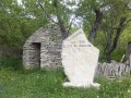
(1) Turn left, passing the Chapelle Saint-Claude and the cemetery on theGRP® Tour de la Montagne du Lure trail, marked with yellow and red signs. Follow the markings to the Colet du Champon.
(2) Leave the marked trail and head down to the right via La Combe until you reach a crossroads.
(3) Take the path opposite towards Bouiron. The hamlet is a few hundred metres beyond a ford.
(4) Go straight on at the junction and follow the road to a T-junction shaped like an inverted Y.
(5) Take the sharp left-hand bend and head for Les Bisques.
(6) Carry on straight ahead towards Ongles. Stay on the same road, ignoring any roads joining from the left, and enter the village.
(7) Turn right towards the church. Ride past it on your right, then carry on straight ahead until you reach the Verdets junction.
(8) Turn right and head for the D951.
(9) Cross the road carefully and take the path opposite. Keep going in the same direction, cross the Ruisseau de Jaïncel and continue to the D950.
(10) Cross carefully and continue along the path opposite towards Château d’Alliance.
(11) The path becomes rocky for a few hundred metres and reaches a junction where you should turn right to rejoin theGRP® Tour de la Montagne de Lure trail.
(12) Turn right and join the D950.
(13) Cross the road carefully and head straight on towards Seygne, then Curel.
(14) Turn left. Pass Les Ganas and then Les Taillas, then turn right, following the signposts to reach the D12 at Combe Crue.
(15) Cross the D12 and stay on the GRP®. Further on, rejoin the D12 and follow it to the right towards Lardiers.
(1) Keep left to reach the church car park (S/E).


 Visorando Member
 Difficult
 Easy
Easy 
 Association / Club / Walk leader