Sant Antonio from Colle di Gritta

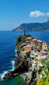
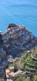
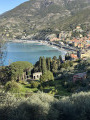
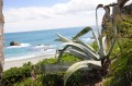
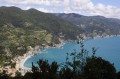
An original approach to this beautiful peak west of Monterosso. Here, we follow a wide circular ridge path passing via Monte Negro (444 m) and Monte Focone (486 m). The views are spectacular on both the northern side (Levanto) and the southern side (Monterosso). The Verde Azzurro path is only used for the return journey.

Details

n°571567
Creation:
Last update:
Last review:
  • Walking
    Activity: Walking
  • ↔
    Distance: 3.83 mi
  • ◔
    Average duration: 2h 20 
  • ▲
    Difficulty: Moderate

  • ⚐
    Back to start: No
  • ↗
    Ascent: + 705 ft
  • ↘
    Descent: - 1,762 ft

  • ▲
    Highest point: 1,496 ft
  • ▼
    Lowest point: 16 ft
  • ⚐ Country: Italy
  • ⚐ City: Levanto 
  • ⚑
    Start: N 44.163085° / E 9.649261°
  • ⚑
    End: N 44.145722° / E 9.648985°
  • Hour-by-hour weather

Photos

Description of the walk

Starting point and access:
The walk starts at Colle di Gritta.
To get there, you’ll need to take a Cinque Terre shuttle bus from Monterosso railway station, which is also the end point of the walking route.
N.B. The shuttle buses are included in the Cinque Terre Pass.
As you leave the station, facing the sea, turn right and walk for about 200 metres. You’ll leave the pedestrian zone, pass a set of traffic lights, and arrive at the bus stop. Stay on the right-hand side of the road (opposite, next to the large car park, the bus stop is more clearly marked. There are timetables, but they’re not easy to read).
The shuttle buses are signposted ‘Colle di Gritta’, but don’t hesitate to ask the driver. Get on board for a few kilometres’ climb. The driver will tell you where to get off at the pass.

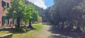
(S) At the pass, enter the hostel car park and turn left to follow the well-signposted N591 path west-south-west. After about 800 metres, pass a path on your right that descends towards Levanto and climb Monte Negro, the highest point of the walk.

(1) Descend on the other side to Colle Bagari, ignoring the signposted paths branching off to the right towards Levanto.

(2) Continue south-west along the slope of Monte Focone, climbing slightly. Follow the ridge line and then descend in a south-easterly direction. Join the Verdeazzurro path coming from the right and reach a junction.

(3) Carry on southwards until you reach the ruins of the old semaphore station (view of the Cinque Terre). Retrace your steps.

(3) Take the Verdeazzurro path to the right (north) towards Monterosso. The path gradually turns eastwards and descends steeply via numerous steps. Well signposted and well-maintained, it is quite steep.

(4) You’ll reach a tarmac road at an altitude of 120m, near the Suisse Bellevue Hotel, and should alternate between the road and footpaths to cut across the bends. The red and white markings are consistently clear. Finish with a section leading to Rue de la Plage. On your right, note the statue of the giant, a beautiful sculpture carved into the rock. Carry on and head back to the town.

(5) Walk past the bus stop where you caught the shuttle to the starting pass and head to Monterosso station (E).

Waypoints

  1. S : mi 0 - alt. 1,099 ft - Colle di Gritta
  2. 1 : mi 0.85 - alt. 1,496 ft - Monte Negro
  3. 2 : mi 1.28 - alt. 1,198 ft - Colle Bagari, a well-signposted junction
  4. 3 : mi 2.44 - alt. 988 ft - Access to the old semaphore station
  5. 4 : mi 3.16 - alt. 410 ft - Route
  6. 5 : mi 3.68 - alt. 16 ft - Bus stop
  7. E : mi 3.82 - alt. 33 ft - Monterosso railway station

Notes

There is no water along the route, nor is there any shelter apart from the inn at Colle di Gritta. No special equipment is required, apart from shoes with good soles – preferably high-top – walking poles, a cap and sunglasses… the usual stuff.
The route is well signposted; the park map with the trail numbers might be sufficient, but there are two numbering systems in use (one series from 1 to 10, and a three-digit series, e.g. 182).

Worth a visit

There are plenty of scenic views to admire or photograph along the way. Of course, Monterosso is well worth a visit; the town is divided into two parts, with the second part lying further away from the station – you’ll need to go through a pedestrian tunnel or walk along the coastal road to reach it.

Reviews and comments

5 / 5
Based on 1 review

Reliability of the description
5 / 5
Ease of following the route
5 / 5
Route interest
5 / 5
Yves Dautremer
Yves Dautremer

Overall rating : 5 / 5

Date of your route : Mar 31, 2025
Reliability of the description : ★★★★★ Very good
Ease of following the route : ★★★★★ Very good
Route interest : ★★★★★ Very good
Very busy route : No

une route de crêts avec des vues magnifiques

Machine-translated

Other walks in the area

For more walks, use our search engine .

The GPS track and description are the property of this route's author. Please do not copy them without permission.