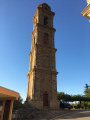
San Cesaro – Chiesa Nera – San Michele from Murato

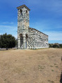
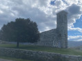
This lovely walk, starting from Murato in Haute-Corse, begins near the Church of the Annunciation and climbs up to the higher parts of the village. The route takes you to the Chiesa Nera, of which only ruins remain, and to the Church of San Michele di Murato, one of the most beautiful churches in Corsica. This Pisan-style church, situated in the commune of Piève, offers a splendid view of Mount Bevinco. Along the way, you’ll enjoy a beautiful panorama of Saint-Florent Bay.

Details

n°110204813
Creation:
Last update:
Last review:
–
  • Walking
    Activity: Walking
  • ↔
    Distance: 6.68 mi
  • ◔
    Average duration: 4h 10 
  • ▲
    Difficulty: Moderate

  • ⚐
    Back to start: Yes
  • ↗
    Ascent: + 1,257 ft
  • ↘
    Descent: - 1,234 ft

  • ▲
    Highest point: 2,241 ft
  • ▼
    Lowest point: 1,289 ft
  • ⚐ Country: France
  • ⚐ City: Murato (20239)
  • ⚑
    Start/End: N 42.57891° / E 9.32855°
  • ❏
    IGN map(s): Ref. 4348OT, 4349OT
  • Hour-by-hour weather

Description of the walk

Enter the village of Murato and park near the town hall and the Church of the Annunciation.

(S/E) Start your walk by turning right onto Piazza Pasquale Paoli. Follow the road to the left until you reach the bend leading to the sewage treatment works.

(1) Just before the bend, leave the road and take the path on your left. Follow the River Bevinco until you reach the Church of San Michele.

(2) Take the road to the cemetery, then follow the path on the left until you reach Chemin di u Vergherete.

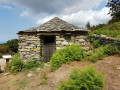
(3) Turn right at the junction, then left to leave the main road. Carry on straight ahead until you reach the San Cesaro Chapel.

(4) Carry on and turn left, heading due south. Pass Salicelli and you’ll come to a fork in the road.

(5) Turn right and head towards the ruins of the Chiesa Nera.

(6) Retrace your steps back to the fork in the road.

(5) Follow the path on the right which joins the D5.

(7) Continue left along this road until you reach the Croix aux Quatre Vents.

(8) Leave the road and take a path, before rejoining it further on.

(9) Cross the departmental road carefully and follow the track which joins a street; continue straight on.

(10) Go round the village on the left and follow Rue Chassu Di U Peru, which leads to the car park in front of the Church of the Annunciation (S/E).

Waypoints

  1. S/E : mi 0 - alt. 1,667 ft - Car park in front of the Church of the Annunciation - Fontaine de Murato
  2. 1 : mi 0.26 - alt. 1,473 ft - Road exit at the sewage treatment works - Bevinco (fleuve)
  3. 2 : mi 0.94 - alt. 1,549 ft - Église Saint-Michel (Murato)
  4. 3 : mi 1.35 - alt. 1,749 ft - Chemin di u Vergherete
  5. 4 : mi 2.76 - alt. 1,722 ft - San Cesaro Chapel - Chapelle San Césaro
  6. 5 : mi 4.2 - alt. 2,129 ft - T-junction. Return
  7. 6 : mi 4.35 - alt. 2,165 ft - Chiesa Nera
  8. 7 : mi 5.16 - alt. 1,772 ft - D5 junction
  9. 8 : mi 5.69 - alt. 1,745 ft - Cross of the Four Winds
  10. 9 : mi 6.02 - alt. 1,729 ft - Crossing the D5
  11. 10 : mi 6.41 - alt. 1,729 ft - T-junction
  12. S/E : mi 6.68 - alt. 1,667 ft - Car park in front of the Church of the Annunciation - Fontaine de Murato

Notes

The village of Murato is a long, narrow village with few car parks; some of the slopes can be quite steep.

Worth a visit

Other walks in the area

For more walks, use our search engine .

The GPS track and description are the property of this route's author. Please do not copy them without permission.