Refine your search for walks in Sals (rivière) - Affluent de l'Aude
Sals (rivière) - Affluent de l'Aude walks


 Between salt and glass in Sougraigne, La Sals and its history.
 Visorando Member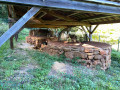
 3.07 mi
 +656 ft
 -656 ft
 2h 00
2h 00
 Moderate
 Departure from Sougraigne (Aude)
In Sougraigne, in the heart of the Hautes Corbières, springs the Sals, a saltwater spring which has long attracted the attention of neighbouring communities.
Today, the Salicorne association brings together the surrounding villages around a shared project. It invites you to discover this unique site, once frequented by a variety of tradespeople: glassmakers, jet miners, charcoal burners, woodcutters, shepherds, pedlars and, of course, smugglers and customs officers from the Ferme Générale hot on their heels.
The Source of the Agly and the Salt Spring
 8.76 mi
+1,978 ft
-1,939 ft
5h 45
8.76 mi
+1,978 ft
-1,939 ft
5h 45
 Difficult
Departure from Camps-sur-l'Agly (Aude)
Difficult
Departure from Camps-sur-l'Agly (Aude)
A very pleasant hike, but best avoided in summer.
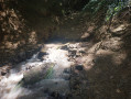
Beautiful views of Bugarach and the Corbières. Along the route, you can see the site of the old glass furnaces and taste the saltwater spring.
The hike is classified as difficult because you need to know how to find your way, read a map and/or follow the GPS track.
The GPS track and map are almost essential as there are many paths and the trails are not always well marked.
The drystone shelters trail in Couiza
 5.72 mi
+774 ft
-755 ft
3h 20
Moderate
Departure from Couiza (Aude)
5.72 mi
+774 ft
-755 ft
3h 20
Moderate
Departure from Couiza (Aude)
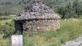
Departure from Couiza and its 16th-century Château des Ducs de Joyeuse. You will wind your way along paths lined with dry stone walls and several drystone shelters, passing through the villages of Cassaignes and Coustoussa with its ruined castle.
This trail takes you to the heights of Montaut and Les Planèses, where you can admire the peaks of Pic de Bugarach, Brau and the Pyrenees.
There are alternative routes and you can start from Cassaignes or Coustoussa.
Pech Cardou from Rennes-les-Bains
7.13 mi
+1,808 ft
-1,834 ft
4h 50
Moderate
Departure from Rennes-les-Bains (Aude)
Part of the route is through woodland. 360° view from the summit of Pech Cardou. At the end of the hike, you can take a dip in the natural hot springs.
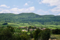
Pas de Capelan, archaeological remains, Sougraigne, La Pourteille from Bugarach
 10.77 mi
+2,710 ft
-2,726 ft
7h 20
Moderate
Departure from Bugarach (Aude)
10.77 mi
+2,710 ft
-2,726 ft
7h 20
Moderate
Departure from Bugarach (Aude)
A lovely circular discovery walk. A GPX track is required. Although there are various markings and signposts, these do not necessarily correspond to this circular route; furthermore, the IGN base map does not always match the actual terrain.
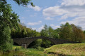
The Pech Cardou circular tour from Rennes-les-Bains
 7.39 mi
+2,178 ft
-2,182 ft
5h 20
Moderate
Departure from Rennes-les-Bains (Aude)
7.39 mi
+2,178 ft
-2,182 ft
5h 20
Moderate
Departure from Rennes-les-Bains (Aude)
A circular route starting from Rennes-les-Bains to climb up to Pech Cardou. Can be done in the suggested direction or in reverse, starting from either Rennes-les-Bains or Serres.Please note: there is no IGN route map for the Pech Cardou area. You must follow the directions provided.⚠️ Following a comment on 20 July 2026. Reminder ==> follow the OSM base map and the suggested GPX track, which is essential. A concrete marker indicates the route of the Méridienne Verte at the foot of the listed bridge at Serres sur Le Rialsesse.Yellow markings are fairly common, but watch out for various changes in direction ==> various directional posts which do not necessarily relate to the proposed walk.Allow 5 hours for the walk.
Walks near Sals (rivière) - Affluent de l'Aude
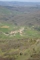
Cubières-sur-Cinoble – Caudiès-de-Fenouillède
 13.53 mi
+3,714 ft
-3,963 ft
9h 25
Difficult
Departure from Cubières-sur-Cinoble (Aude)
13.53 mi
+3,714 ft
-3,963 ft
9h 25
Difficult
Departure from Cubières-sur-Cinoble (Aude)
Day two: return to Caudiès-de-Fenouillède via the Pic or Pech de Bugarach.
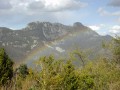
Caudiès-de-Fenouillèdes - Cubières-sur-Cinoble
 15.07 mi
+3,287 ft
-3,009 ft
9h 45
Difficult
Departure from Caudiès-de-Fenouillèdes (Pyrénées-Orientales)
15.07 mi
+3,287 ft
-3,009 ft
9h 45
Difficult
Departure from Caudiès-de-Fenouillèdes (Pyrénées-Orientales)
First stage of a 2-day circular route starting from Caudiès-de-Fenouillèdes, taking you to Cubières-sur-Cinoble on thefirst day.
This is a fairly long stage with a significant elevation gain. It is possible to adapt the route as you wish, as there are numerousPR®,GR® 36, Cathar TrailGR®367- 367A andGRP® Tour des Fenouillèdes paths.
The Agly and the Bugarach
28.61 mi
+6,995 ft
-6,972 ft
2 days
Difficult
Departure from Caudiès-de-Fenouillèdes (Pyrénées-Orientales)
Here is a 45 km circular route that will allow you to explore the former natural border between France and Spain, between the Aude and the Pyrénées-Orientales, as well as the upper Agly valley and its magnificent Galamus Gorges, before climbing up to the Pic de Bugarach.The route starts from Caudiès-de-Fenouillèdes towards Duilhac-sous-Peyrepertuse, then descends towards Cubières-sur-Cinoble.On the second day, approach and climb up to the Pech de Bugarach, then descend and return to Caudiès.