Country:

 City:
City:


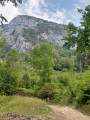
Park in the centre of the village of Saint-Pierre-d’Entremont, near the town hall (on the Savoie side).
(S/E) Head towards the bridge over the Cozon, cross it and turn left for 50 m.
(1) Take the first path leading uphill to the right. Join the road and immediately take another path (marked yellow) with a few rocks just after the hairpin bend. Continue to the upper bend in the road.
(2) Take the path leading uphill to the right towards Roche Veyrand and climb to the fork.
(3) Leave the main track and take a path on the right. Just before reaching the point (4), if the path is blocked by a wire fence, there is still a gap on the right between two trees. You’ll reach the Mollats junction.
(4) Continue along the steep path opposite and reach the start of the cable-assisted section.
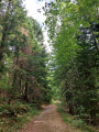
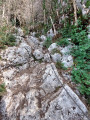
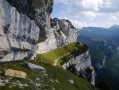
(5) Carry on up the steep slopes, where you’ll need to use your hands on the rock or hold onto the cable, though it’s not actually climbing.
(6) Continue along the path to the right (yellow markings). The sign for “Accessto Part2 ” refers only to the via ferrata; carry on to the summit.
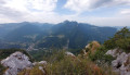
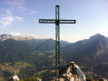
(7) Take in the view over the heart of the Chartreuse: to the east, the Pinet followed by the Grand Manti (above the Cirque de Saint-Même) and the Lances de Malissard; to the south, the Dent de Crolles and the Grand Som; and a little to the west, the Grande Sûre. Descend a few metres to the signpost and head left towards the Grand Jet.
(8) Take this undulating forest track on the left up to the Col du Cucheron.
(9) Continue straight on, heading due north along the small road, until you reach the D45 at the Col de la Cluse.
(10) Turn left and walk along the left-hand side of the road for about 430 m.
(11) Leave the road and take a path leading down to the left (yellow markings + yellow and red GRP® markings). When the path rejoins the road, cross it and follow a track across the meadow just below a row of trees.
(12) Cross the road again, walk a few metres along a wide dirt track and quickly leave it to take a path on the right through the grass.
(13) At the Les Cruz junction, follow the path on the left towards Les Mathés and Corbel via the GRP®. At Les Mathés, walk about a hundred metres along the road, then rejoin the GRP® towards Les Fiolins.
(14) At Les Fiolins, turn left towards the Pas de la Coche.
(15) Pass through the Pas de la Coche and begin the final descent by following the path opposite. The path widens until it becomes a forest track.
(16) Follow the path on the right which descends towards Saint-Pierre-d’Entremont and rejoin the junction you passed on the way up.
(3) Descend via the path you took on the way up.
(2) Either head down via the same path you took on the way up, or take the road to the village centre (S/E).

 Visorando Member
 Moderate
 Tourist office
 Easy
Easy 
 Extremely difficult