Saint-Imoges, Sermiers, Villers-Allerand, Rilly-la-Montagne and Chigny

Here is a long walk through the Montagne de Reims, passing through several pretty wine-growing villages. Magnificent woodland, Champagne vineyards and a lovely view of Reims.

Accessible by TER from Rilly-la-Montagne station or Germaine station.

Details

1570501
Creation:
Last update:
Last review:
  • Walking
    Activity: Walking
  • ↔
    Distance: 13.38 mi
  • ◔
    Average duration: 7h 00 
  • ▲
    Difficulty: Difficult

  • ⚐
    Back to start: Yes
  • ↗
    Ascent: + 1,004 ft
  • ↘
    Descent: - 994 ft

  • ▲
    Highest point: 896 ft
  • ▼
    Lowest point: 449 ft
  • ⚐ Country: France
  • ⚐ City: Sermiers (51500)
  • ⚑
    Start/End: N 49.128146° / E 3.990495°
  • Accessible from the train station Gare de Rilly-la-Montagne.
  • ❏
    IGN map(s): Ref. 2713E, 2812O, 2813O
  • Hour-by-hour weather

Photos

Description of the walk

Park in the car park alongside the D951 near the Cadran forest ranger’s house.

(S/E) Cross the road carefully and take the Route Forestière de la Mer Rouge, which runs alongside the Cadran forest house. Walk 1 km to a T-junction.

(1) Turn right onto the wide track. Walk 300 m.

(3) Turn right and follow the signposted path which climbs towards the woods. When you reach a path, turn left and follow it for 2 km.

(3) When you reach the junction with a forest track, turn right, then 50 m further on, turn left. The path descends towards the vineyard and runs alongside the vines. Lovely view of Reims.

(4) At the crossroads, carry on straight ahead. Follow the GRP® de l’Ardre signposts. Enter the village and walk to the church.

(5) Walk to the right of the church and carry on straight ahead at the junction. Walk past the cemetery.

(6) At the sports ground (picnic table), turn right. Continue in the same eastbound direction.

(7) Cross the D951 with care and carry on straight ahead. Continue left along Rue du Voisin, towards Rilly-la-Montagne. Pass close to the church but stay on the main road, first turning right then left. Take Rue de Rilly, then Rue de Montbré on the left.

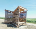
(8) At the Calvary crossroads (with the metal shed), turn right and walk for about a hundred metres.

(9) At the crossroads, turn left and continue to the next junction.

(10) Turn right and walk to the first houses in Rilly.

(11) Turn left. Walk past the picnic area and carry on until you turn right with the road to reach Rilly-la-Montagne station.

(12) Cross the tracks and carry on in the same direction along Rue Carnot. Keep to the right into Rue des Écoles, then carry on straight ahead along Rue Roger Salengro.

(13) When you reach a T-junction, turn right. Cross Rue de Chigny (D26), continue straight ahead and then turn slightly left onto Chemin des Wardes. You are still on the GRP® de l’Ardre, which is signposted.

(14) Enter Chigny via Rue Nicolas Jobert, take Rue du Châtaigner Fourchu and reach the junction with Rue Georges Legros, where you leave the GRP®.

(15) Turn right at a right angle, then immediately keep to the right to take the path that climbs through the vineyards and continues into the woods.

(16) Turn right at a right angle.

(17) When you reach the forest track, turn right.

(18) At the wayside cross (Croix Nicaise), carry on straight ahead. Walk alongside a small pond on your left and you’ll immediately reach the junction with a forest track.

(19) Turn left, then carry on straight ahead. You are now on a route leading to Santiago de Compostela.

(20) At the first houses in the hamlet of Les Haies (Germaine, with a station nearby), turn right onto the Chemin de la Haute Borne. Keep going in the same direction until you reach the D915 and the car park (S/E). 

Waypoints

  1. S/E : mi 0 - alt. 886 ft - Car park - Parking du Cadran
  2. 1 : mi 0.67 - alt. 732 ft - T-junction - Ardre (rivière)
  3. 2 : mi 0.87 - alt. 725 ft - Marked path on the right
  4. 3 : mi 1.8 - alt. 873 ft - Forest track
  5. 4 : mi 2.54 - alt. 663 ft - Junction of the GR 142 and GRP
  6. 5 : mi 2.9 - alt. 531 ft - Church
  7. 6 : mi 3.37 - alt. 476 ft - Sports ground and picnic table
  8. 7 : mi 4.63 - alt. 594 ft - D951
  9. 8 : mi 5.44 - alt. 568 ft - Crossroads (calvary)
  10. 9 : mi 5.51 - alt. 594 ft - Turn left at the fork
  11. 10 : mi 5.81 - alt. 597 ft - Turn right at the fork (PR)
  12. 11 : mi 6.13 - alt. 594 ft - Turn left at the fork
  13. 12 : mi 6.42 - alt. 515 ft - Gare de Rilly-la-Montagne
  14. 13 : mi 6.83 - alt. 525 ft - T-junction
  15. 14 : mi 7.53 - alt. 522 ft - Entrance to Chigny
  16. 15 : mi 7.9 - alt. 571 ft - Junction towards the vineyards
  17. 16 : mi 8.11 - alt. 663 ft - Turn right at the T-junction
  18. 17 : mi 8.55 - alt. 873 ft - Junction onto a forest track
  19. 18 : mi 9.11 - alt. 889 ft - Crossroads: Croix St Nicaise
  20. 19 : mi 9.5 - alt. 889 ft - Junction of the GR 142 and GRP
  21. 20 : mi 11.6 - alt. 591 ft - Crossroads - Gare de Germaine
  22. S/E : mi 13.38 - alt. 886 ft - Car park - Parking du Cadran

Notes

A shortcut is possible between point (19) and (S/E) by continuing straight on, then turning left. It is a monotonous, flat forest track.

Picnic areas are available at the Cadran car park, in Sermiers (sports ground), Villers-Allerand (sports ground), Rilly-la-Montagne (11) and Chigny-les-Roses, where there is a lovely pond near the point (15).

This route is similar to the hike from Le Cadran to Pourcy via the ‘remarkable trees’ trail, as it also passes through the hamlets of Rilly-la-Montagne and Germaine, but it focuses more on the wine-growing villages and does not take in the remarkable trees. It is possible to combine the two routes.

https://www.visorando.com/randonnee-du-c...

Worth a visit

Champagne by the glass in the village cafés or tastings at the winemakers’ estates.

Shops and restaurants in Villers-Allerand and Rilly-la-Montagne. Restaurant in Villers-Allerand. Pharmacy and cafés with terraces in Rilly-la-Montagne.

Reviews and comments

4.5 / 5
Based on 2 reviews

Reliability of the description
4.5 / 5
Ease of following the route
4.5 / 5
Route interest
4.5 / 5
virgule
virgule

It's done.

Machine-translated

Christelle1488
Christelle1488

Thank you on behalf of future walkers

Machine-translated

virgule
virgule

Thank you for this review. I did part of this route recently, and there are indeed some muddy patches, as we’ve had a rainy winter.

The point (1) is difficult to find, and for good reason: the GRP route has changed. You need to go a little further on, which avoids the very wet ground.

I’ll update the route.

Machine-translated

Christelle1488
Christelle1488

Overall rating : 5 / 5

Date of your route : Apr 01, 2025
Reliability of the description : ★★★★★ Very good
Ease of following the route : ★★★★★ Very good
Route interest : ★★★★★ Very good
Very busy route : Yes

Point 1 is a bit tricky to spot; however, if you miss it, you can turn off again a little further on to the right along a small path that takes you back to the original route.
There are quite a few people out walking at the start and end of the route, though this doesn’t detract from the peace and quiet at all.
There’s a lovely view over Reims, and walking through the villages is a real pleasure thanks to the beautiful architecture of the houses.
Best avoided in very hot weather as there’s no shade, though you can top up your water supplies in the cemeteries of the villages you pass through.
A bit of mud towards the end of the route in the woods at Germaine
No particular difficulty, apart from the distance – not everyone can manage 21 km in one go

Machine-translated

virgule
virgule

There’s a bit of slush between (16) and (17), but not as much as in some other areas.

Machine-translated

virgule
virgule
• Edited:

Good to know: the Cadran car park isn’t listed on car sat-navs. But it’s easy to find.

Machine-translated

virgule
virgule
• Edited:

The Cadran car park is in the municipality of Saint Imoges.

Machine-translated

ovil
ovil

Is that allowed? I wouldn’t want to get kicked out by a winegrower.
Another question: why does the walk’s title include ‘Saint-Imoges’ when we don’t actually go through that village?

Machine-translated

virgule
virgule
• Edited:

Accessible by TER from Rilly-la-Montagne station or Germaine station.

Machine-translated

virgule
virgule
• Edited:

Machine-translated

virgule
virgule

Thank you for this review.

The point (1) isn’t easy to find. It’s part of a signposted route, but the signposts are hard to spot. From the point (2), there are some magnificent oak trees.

Machine-translated

ovil
ovil

Overall rating : 4 / 5

Date of your route : Aug 25, 2020
Reliability of the description : ★★★★☆ Good
Ease of following the route : ★★★★☆ Good
Route interest : ★★★★☆ Good
Very busy route : No

The walk began under grey skies, which cleared up as the day went on.
We started and finished the route at Germaine station.
The narrow path (points 1 and 2) isn’t the easiest. It’s quite narrow and often bumpy. I noticed it was part of a mountain bike route and wondered whether the cyclists had piled up mounds of earth to create those bumps.
The rest of the route follows wide paths which are currently quite dry, though there are a few inclines.
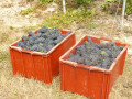
The grape harvest has begun. We were given two lovely bunches of small, very sweet grapes.
There are other spots where you can catch a glimpse of Reims, weather permitting, particularly after Chigny, just before entering the forest.

Machine-translated

virgule
virgule

Thank you

Top-notch after-sales service – well done!

Machine-translated

grandin
grandin ★

I’ve just deleted the review

Machine-translated

virgule
virgule
• Edited:

OK, all right.

We’ll have to take that one – you can see some magnificent trees in it.

Machine-translated

Other walks in the area

For more walks, use our search engine .

The GPS track and description are the property of this route's author. Please do not copy them without permission.