


 Country:
 City:
City:


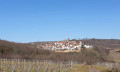
The start and finish are at the Krumbachtal car park on the L517 coming from the direction of Kleinkarlbach, just before the entrance to Bobenheim.
(S/E) At the car park, you’ll find several information boards; walk past them on the right along a grassy path through the vineyards towards Neuleiningen. After a while, you’ll cross a tarmac road and continue straight ahead (follow the signpost straight ahead towards Neuleiningen).
(1) You’ll reach the edge of the industrial estate. The signpost for the Leininger Burgenweg (a stylised black castle on a yellow background) points you to the left. However, simply carry on straight ahead here. In the gentle right-hand bend that follows, the Burgenweg rejoins the road. Walk on to the main road, turn left there and go under the railway bridge. After the bridge, it’s about 100 metres further; then cross the road and walk up a narrow path on the other side.
The path ends with a flight of steps. After the steps, turn left and continue up the path towards Neuleiningen. At the junction after the right-hand bend, keep to the right, then turn right, go up a flight of steps and, after St Nicholas’ Church, turn left.
(2) After a few metres, you’ll reach the entrance to the Neuleiningen castle ruins. The Burgensteig continues along Kirchengasse. Walk through the upper town gate; just before you reach the L 453, turn left and walk slightly downhill until you reach the junction with Dr-Konrad-Adenauer-Straße. Follow this road to the right. Carry on straight ahead along Dr-Konrad-Adenauer-Straße. At the end, turn left onto Altleininger Weg. At the fork in the path just before you leave the village, keep to the right. Continue straight ahead on the main path and keep to the right again at the next fork.
(3) About 30 metres after a path joining from the right, a narrow track leads you down to the left (follow the signposts). Please note – the turn-off and signposts are easy to miss. The track takes you along the slope and, after a while, back onto the main path via a few steps.
(4) Continue left along the main path. To help you find your way – there is an earth-built rainwater retention basin on your right; straight ahead you’ll come to a T-junction, where you turn left and then immediately right onto a farm track.
(5) The path leads slightly uphill. Before you walk along the edge of the wood, a rest area invites you to take a short break. Depending on the time of year and time of day, the area may still be in the shade. No problem – there’s another spot about 1 km further on. Stay on this path and leave the turn-off to the Nackterhof on your right.
(6) A little later, you’ll cross an open area; from the end of this, it’s about 150 metres to the next rest spot, where you’ll turn left again into the woods. The path leads slightly downhill, and you’ll cross a total of four forest tracks.
(7) Shortly after crossing the fourth forest track, you have the option to cut the walk short and head straight down to the car park on Talstraße. Passing the emergency descent, carry on along the path down the slope until you reach a road (Amselthal), which you cross and continue on the opposite side (Tränkwoog). The road curves to the left; at this bend, turn right onto a grassy path and climb the steps by the bench. Walk across the hilltop (on your left you’ll pass the riding stables of the Leininger Land Riding Club) and down to Altleiningen.
(8) You’ll reach the entrance to Altleiningen Castle. A visit to the castle is definitely worthwhile; the castle tavern offers a good opportunity to take a short break over coffee and cake. After this little refreshment, walk out of the castle courtyard back to the road, turn left, pass the outdoor swimming pool car park and then turn left onto a paved path leading down to Altleiningen.
(9) Once you reach the bottom, turn right. On the left-hand side of the road you’ll see the 20-pipe fountain; a information board tells you about its history. Before the local primary school, turn left into Schulstraße. Schulstraße leads onto a path; cross the Eckbach and walk up the gentle incline. At the end of the path, you’ll come to a junction; here, keep left (Zimmerbergstraße) and continue uphill. When you reach the edge of the village, take the second path on the right. Follow this straight on for about 150 metres, then turn right. Your path meets a forest track; here, turn right and, shortly afterwards, left again, heading downhill. You’ll reach the edge of the forest and keep to the left. After about 450 metres, you’ll come to a road; walk along it for a few metres to the left and, shortly afterwards, cross the Höninger Bach on your right. At the T-junction, turn left again towards the Langental hiking car park.
(10) Walk across the car park and, at the next junction, you’ll find the Ritterstein (knight’s stone) of the former village of Zwingweiler. An information board provides details about its history. At this junction, turn right and follow the Langentalbach stream. After a while, the Burgenweg branches off to the left, up the slope. You’ll come to a forest track, which you cross, and continue up the slope on the other side. At the next major junction, turn sharply left into a sunken path. The path leads you further uphill.
(11) After a right-hand bend, you’ll come to a rest area (table with benches) and, shortly afterwards, a rock formation which, on closer inspection and with a little imagination, looks like a camel’s head. Continue down the path. Shortly after the camel’s head, turn right at an acute angle. The path continues downhill to a gravel track. Follow this for a few metres, then turn left back onto a footpath. The footpath runs parallel to the gravel track and rejoins it at a junction. At the junction, a signpost points you left towards ‘Battenberg’. You pass a viewpoint with a place to rest (on your left) and continue along the path without turning off. After a while, you cross a forest track and carry on to the next junction. There, keep to the left. Shortly afterwards, turn left and, at the next junction, take the grassy path to the right.
(12) After a few metres, you’ll reach the Jägerkreuz. An information board tells of the various legends associated with the cross. A bench invites you to take a short break. A few minutes later, you’ll come to another junction and turn left. At the next fork, take the right-hand path again.
(13) Just before you leave the forest, there is another place to rest with a table and benches. You can already see Battenberg in the distance. At the next junction, head left initially. The path first curves to the right and then, shortly afterwards, to the left. At the next junction, turn right onto a gravel track which takes you across the Battenberg plateau.
(14) You’ll come to a car park. Here, keep left and walk across the car park. Follow the path to a junction. At the junction, continue straight on along a grassy path through the vineyards. At the end of the vineyards, turn right and, after about 100 metres, turn left into a residential area in Battenberg. Cross the “Steinbrunner Weg” and walk down the path “Am Hipperling”. The path curves to the right twice. After the second curve, turn left onto the “Kneipp Pfad” (it looks like a private road, but leads you between the houses). At the end of the “Kneipp Pfad”, turn left into “Kirchgasse”. The lane takes you past St Martin’s Church and behind the local cemetery. Below the cemetery, turn right. Here, carry on straight ahead; in the distance, you can already see the ruins of Battenberg Castle.
(15) Once you reach the castle ruins, the Gutschänke Burg Battenberg offers the chance to take a longer break and enjoy typical Palatinate specialities. Highly recommended. An information board in the castle courtyard tells you about the castle’s history. From the castle, walk straight on to the road, turn left there, and shortly afterwards keep left again and walk down the “Alte Straße” (signposted with a white/blue bar).
(S/E) The “Alte Straße” turns into a path at the edge of the village. Follow this path, keeping to the right, all the way down into the Krumbach Valley. Now turn left one last time and, after a few metres, you’ll reach the car park and the starting point of your walk.
 Visorando Member

 Moderate
 Easy
Easy 
