Country:
 City:
City:


The starting point is the Dannenfels car park, Donnersbergstraße 18, 67814 Dannenfels
(S/E) You start your walk at the Dannenfels car park and head towards the Hotel Kastanienhof. Walk past the Hotel Kastanienhof and follow the road uphill. You can follow the signs for the Pfälzer Höhenweg, marked by a white wave on a blue background. At a junction, turn right and follow the sign for ‘Adlerbogen’. The path continues uphill. You walk towards a gate; just before the gate, turn left. Of the two paths branching off to the left, take the one on the right (it looks like a gully).
(1) At the next junction, continue to follow the sign for the Pfälzer Höhenweg to the left. Passing a viewpoint with a bench, carry on uphill.
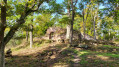
(2) You’ll reach the Moltkefelsen and find yourself at 545 m in front of the Adlerbogen. The Adlerbogen was erected in 1880 in honour of Field Marshal Moltke (1800–1891) and extensively restored in 2016. The two statues on the left and right depict Moltke and Bismarck. Above the Adlerbogen, you’ll come to a rest area with a table and several benches. Just beyond the rest area, at the junction, carry on straight ahead up the hill, following the markings for the Pfälzer Höhenweg. As you continue, you’ll walk parallel to the Celtic Sculpture Trail, which features various Celtic sculptures, each accompanied by an information board.
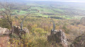
(3) After a short while, you’ll reach a mountain hut. From here, you can take a detour to the Hirtenfels (approx. 200 m) and enjoy the view across the Rhine Valley. In front of the mountain hut, the path continues to the left towards the Ludwigsturm. At the next two junctions, carry on straight ahead.
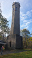
(4) You’ll reach the Ludwigsturm. You can climb the tower; the view from the top is well worth it in fine weather. At the kiosk in front of the Ludwigsturm, you can buy local specialities and pick up information about the tower and the area. With your back to the kiosk and the entrance to the tower on your left, you’ll see a covered table with two benches. Your route continues to the left past this area.
(5) You’ll walk towards a building; in front of it, turn left (towards Königsstuhl, Rockenhausen) and you’ll already see the Pfläzerwaldverein’s Celtic hut. Walk past it on the left, still following the signposts for the Pfälzer Höhenweg.
(6) You reach the summit of the Donnersberg, which, at 687 m, is the highest point in the Palatinate. You can climb straight up onto the rock and enjoy another beautiful panoramic view before descending on the other side of the rock and continuing along the original path. At the next junction, keep to the right. The path now leads slightly downhill. After a while, you’ll come to a wider forest track. Here, turn right and then immediately left onto a narrow path. From here, you can follow the red bar on a white background. After a few metres, you’ll reach a junction on a bend; the red bar guides you to the left, continuing downhill. You’ll cross a wider path twice and, on the other side, follow the red bar further downhill. At the third wider path, turn left. The path now leads you steadily uphill in a long right-hand bend, with no signposts.
(7) You reach the Hühnerberg. There, a table and bench provide a good spot to take a short break. At the signpost junction, take the first path on the left and continue uphill; you’ll now see the signs for the Pfälzer Höhenweg again. After a few metres uphill, you’ll come to a junction. Here, turn sharply right and follow the path into the wood. Just before a ‘Nature Reserve’ sign, the path forks and you turn left onto a narrow track. You’ll come to a fork with three options. Here, you continue to the right, following a curved path. After a while, you’ll reach a wider, gravelly path, which you cross diagonally and continue along on the other side. At the next junction, turn left, following the path as it climbs. You’ll reach a T-junction. Here, take the right-hand path, which leads slightly downhill.
(8) You’ll pass two turn-offs until the path curves to the left. As it curves to the left, leave the gravel path and continue straight ahead. The path has a distinct track, at least at the start (gravel on the right and left, grass in the middle).
(9) After a while, you’ll come to a gravel path. Directly opposite, you’ll see a narrow track (which can be hard to spot depending on the season). Continue along this track. The track is barely visible; at every apparent fork, keep to the left and after a few metres you’ll rejoin a paved path. Here, turn right. You are now back on the Pfälzer Höhenweg and are walking towards the Adlerbogen.
(2) Above the Adlerbogen, you’ll come back to the rest area you passed on the way up, with a table and several benches.
(1) From there, you walk down to the Adlerbogen and continue down the path, past the viewpoint with the bench. At the next junction, turn right and follow the path straight on along the slope until you come to a wider path again. Here, turn left and continue downhill. Without turning off again, you’ll now walk past the Hotel Kastanienhof back to your starting point (S/E).
 Visorando Member
 Difficult