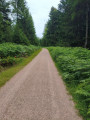
Waldeck Ruins and Europe’s largest millwheel

This circular walk takes us through beautiful mixed woodland and past red sandstone cliffs to the Waldeck ruins and to the largest wooden overshot waterwheel in Europe.

Details

n°29294616
Creation:
Last update:
Last review:
  • Walking
    Activity: Walking
  • ↔
    Distance: 9.80 mi
  • ◔
    Average duration: 5h 45 
  • ▲
    Difficulty: Average

  • ⚐
    Back to start: Yes
  • ↗
    Ascent: + 1,394 ft
  • ↘
    Descent: - 1,394 ft

  • ▲
    Highest point: 1,847 ft
  • ▼
    Lowest point: 1,125 ft

Description of the walk

Starting point: Calw-Stammheim Town Hall (Hauptstraße 24, 75365 Calw)

Parking:
Hiking car park at Stammheim outdoor swimming pool (Jahnstraße 10, 75365 Calw-Stammheim)

Public transport starting point: Town Hall stop

(S/E) We set off from Calw-Stammheim Town Hall and initially follow the Gäurandweg (green diamond with a rosehip) along Hauptstraße, then turn left into Jahnstraße.

(1) We’ll soon be walking past the outdoor swimming pool. We’ll make our way out of Stammheim and, before taking the fourth left-hand turn uphill, can refuel with some strawberries we’ve picked ourselves. As we gradually gain height, we should look to the left and let our gaze wander across the vast fields back towards Stammheim.

(2) Once at the top, the path leads us to the right and, a few metres later, onto a lovely meadow path running right along the edge of the wood. The view to the right is simply worth it!

(3) We then walk downhill along a wide path and turn left at the next junction. Shortly afterwards, a signpost points to the right towards the Waldeck ruins, but we ignore it

(4) We take the next turn-off, leaving the Gäurandweg behind and following the yellow diamond. After a steep downhill section, we reach the main road, which we follow to the right for about 100 metres.

(5) We then cross the Nagold via a bridge. Now we should pause briefly to admire the idyllic half-timbered house with its adjoining garden. A short break to gather our strength can’t do any harm anyway, as we’ll have to climb a steep hill afterwards to reach the ruins of Waldeck Castle.

(6) Once there, we’re quickly convinced that all the effort was worth it. The ruins of the castle, built around the year 1100, stand imposing and exceptionally well-preserved before us. A tour of the former knight’s castle is a must. There’s also a barbecue area where you can enjoy a leisurely rest.

We then climb the stone steps to the right of the ruins and walk along a ridge, passing a sort of rock outcrop.

(7) We then head downhill and pass the Geigerles Lotterbett rest area, where there is another barbecue area. Legend has it that the musician Geigerle once set up his bedchamber beneath two sandstone rocks. It really is a cosy spot!

After a brief stop, we turn right onto the access path towards Bad Teinach railway station (unmarked) and head down into the Nagold Valley, reaching the main road and the Teinachtal restaurant.

(8) From here, the blue diamond shows us the way; we follow the road to the right and then right again, crossing the Nagold.

(9) At the station, a lovely, almost inconspicuous meadow path leads us left along the river; however, we soon leave this behind and turn right, passing under the railway lines.

(10) Now we keep to the left and follow the yellow diamond once more, strolling leisurely up the hill.

For a while, we walk along a wide path above the Nagold and can always catch a glimpse of the river through the trees.

(11) We eventually reach the Schlittbachbrückle and, after crossing it, should take the opportunity to make a detour to the right. A few metres further on, on the right-hand side at the Untere Mühle in the Schleiftal, we can admire Europe’s largest wooden overshot waterwheel, which has a diameter of 11.50 metres. Gigantic!

(12) Back at the Schlittbachbrückle, we walk steeply uphill along the so-called ‘Himmelsleiter’ (Heaven’s Ladder ) and, after leaving the forest, pass an allotment garden. Shortly afterwards, we reach the Calw industrial estate and cross the B296 at a pedestrian crossing.

(13) We now follow Leibnizstraße for about 500 metres as it rises gently, then turn right onto Gottlob-Bauknecht-Straße, which takes us to the signpost at Im Feldle.

(14) There, we keep to the right and, 50 metres further on, turn right again straight away, so that we walk along the left-hand side of the industrial estate and past wide open fields. After about 400 metres, we turn left and, following a short, steeper uphill section, rejoin the Gäurandweg.

(15) We follow this back to Calw-Stammheim and to our starting point at the town hall (S/E).

Waypoints

  1. S/E : mi 0 - alt. 1,545 ft - Calw-Stammheim Town Hall
  2. 1 : mi 0.42 - alt. 1,499 ft - Outdoor swimming pool
  3. 2 : mi 1.34 - alt. 1,818 ft - Edge of the forest, Wiesenpfad
  4. 3 : mi 1.96 - alt. 1,847 ft - Wide path downhill
  5. 4 : mi 2.63 - alt. 1,650 ft - Yellow diamond
  6. 5 : mi 3.55 - alt. 1,188 ft - Nagold
  7. 6 : mi 3.86 - alt. 1,398 ft - Waldeck Castle Ruins
  8. 7 : mi 4.12 - alt. 1,375 ft - Geigerles Lotterbett motorway service station
  9. 8 : mi 4.75 - alt. 1,138 ft - Restaurant Teinachtal
  10. 9 : mi 4.98 - alt. 1,135 ft - Railway station – Wiesenpfad
  11. 10 : mi 5.16 - alt. 1,165 ft - Yellow diamond
  12. 11 : mi 7.27 - alt. 1,325 ft - Schlittbachbrückle
  13. 12 : mi 7.34 - alt. 1,342 ft - Himmelsleiter
  14. 13 : mi 7.94 - alt. 1,552 ft - Leibnizstraße
  15. 14 : mi 8.42 - alt. 1,591 ft - Signpost location: Im Feldle
  16. 15 : mi 9.11 - alt. 1,745 ft - Gäurandweg
  17. S/E : mi 9.8 - alt. 1,545 ft - Calw-Stammheim Town Hall

Notes

Travelling by car:

  • A8 motorway from Karlsruhe: take the Pforzheim-West exit (approx. 35 km); continue on the B463 towards Calw and then on the B296 towards Calw-Stammheim.
  • A8 motorway from Ulm/Stuttgart: Take the Leonberg exit (approx. 25 km), then continue along the B295 towards Weil der Stadt to Calw, then take the B296 to Calw-Stammheim.
  • A81 motorway from the south/Lake Constance: Take the Gärtringen-Stadtmitte exit (approx. 20 km), then continue via the K 1075; near Deckenpfronn, take the first exit at the roundabout and continue on the B 296 towards Calw-Stammheim.

Parking at the starting point:
Freibad Stammheim hiking car park
Jahnstraße 10
75365 Calw-Stammheim

Further parking options in Calw-Stammheim:

Galgenberg hiking car park
Lindachhof Hiking Car Park
Rottannen hiking car park
Brenntenwald hiking car park
Town Hall car park

Travelling by train:

  • Pforzheim – Calw – Horb – Tübingen route (Kulturbahn).
  • The best way to reach long-distance train services (EC, IC, ICE) is to travel to Karlsruhe and then take connecting trains via Pforzheim (Kulturbahn) to Calw.
  • If travelling via Stuttgart, we recommend continuing your journey on the S6 S-Bahn from Stuttgart to Weil der Stadt, then changing to bus route 670 to Calw.

Travelling by bus:

  • Greater Stuttgart area: Bus route 670 (DB Bahn Regiobus / Volz); (Calw–Weil der Stadt) connection to the S6
  • Böblingen / Sindelfingen area: Bus route 763, DB Bahn Regiobus; Calw–Böblingen (connection to the S1)
  • From Calw Central Bus Station (ZOB), you can reach Stammheim on bus route 773 or 763, getting off at the Rathaus stop.

ℹ️ Contact:
Calw Tourist Information
Marktplatz 7
75365 Calw

Worth a visit

ℹ️ Places of interest:
St Martin’s Church, Stammheim
Pfarrgäßle 9
75365 Calw-Stammheim

Waldeck Castle Ruins
75365 Calw

🍽️ Places to stop for refreshments:
Kimmichstub’n
Kimmichwiesen 1
75365 Calw-Stammheim

Ristorante Pizzeria Prima Fila
Herrenberger Straße 22
75365 Calw-Stammheim

Ristorante Pizzeria Eiscafé da Romeo
28 Hauptstraße
75365 Calw-Stammheim

Reviews and comments

4.3 / 5
Based on 2 reviews

Reliability of the description
4.5 / 5
Ease of following the route
5 / 5
Route interest
3.5 / 5
User 28044420

Overall rating : 4.3 / 5

Date of your route : Nov 10, 2025
Reliability of the description : ★★★★☆ Good
Ease of following the route : ★★★★★ Very good
Route interest : ★★★★☆ Good
Very busy route : No

Autumnal hike with many unmarked obstacles due to tree felling work

Machine-translated

canardo
canardo

Overall rating : 4.3 / 5

Date of your route : Apr 20, 2025
Reliability of the description : ★★★★★ Very good
Ease of following the route : ★★★★★ Very good
Route interest : ★★★☆☆ Average
Very busy route : No

We set off from the swimming pool car park, where we were able to park without any problem, as it was impossible to park in the town centre.
This trail is interesting in parts 1 to 12 (pleasant scenery, discovery of the ruins of Waldeck castle, then the ridge path overlooking the valley). At point 12, you have to leave the route for 200 m without any problems as far as the mill wheel in the Schlei valley, but here it is more pleasant to continue straight ahead along the path that takes you back to the swimming pool car park in 2.5 km than to go back and continue along the proposed route through the industrial estate to see the Gaürandweg (from point 12 go straight back to point 1).

Machine-translated

Other walks in the area

For more walks, use our search engine .

The GPS track and description are the property of this route's author. Please do not copy them without permission.