


Rivington Reservoirs (8.0 Miles) BL6 7SE
Details
Creation:
Last update:
–
–
-
 Activity: Walking
 -
 Distance: 8.06 mi
 -
 Average duration: 4h 10
 -
 Difficulty: Not specified
 -
-
 Back to start: Yes
 -
 Ascent: + 512 ft
 -
 Descent: - 525 ft
 -
-
 Highest point: 787 ft
 -
 Lowest point: 423 ft
-
 Country:
United Kingdom
Country:
United Kingdom
-
 City:
Rivington
City:
Rivington -
 Start/End: N 53.621055° / W 2.562154°
 -


 Hour-by-hour weather


Waypoints
- S/E : mi 0 - alt. 495 ft - Start out going southwest.
- 1 : mi 0.03 - alt. 489 ft - Turn left onto Rivington Lane.
- 2 : mi 0.41 - alt. 472 ft - Turn right onto Sheep House Lane.
- 3 : mi 0.43 - alt. 482 ft - Turn left onto walkway. Proceed north (See map for details).
- 4 : mi 0.68 - alt. 453 ft - Turn left.
- 5 : mi 0.73 - alt. 466 ft - Turn right onto walkway. Proceed north (See map for details).
- 6 : mi 1.54 - alt. 574 ft - Turn left onto Parson's Bullough Road.
- 7 : mi 1.77 - alt. 564 ft - Stay straight to go onto walkway. Proceed northeast (See map for details).
- 8 : mi 2.75 - alt. 784 ft - Turn slight right onto Moor Road.
- 9 : mi 3.95 - alt. 476 ft - Turn slight left onto Moor Road.
- 10 : mi 4.12 - alt. 466 ft - Stay straight to go onto walkway. Proceed west (See map for details).
- 11 : mi 5.69 - alt. 453 ft - Turn left
- 12 : mi 7.08 - alt. 446 ft - Turn right onto Horrobin Lane.
- 13 : mi 7.31 - alt. 430 ft - Turn left.
- 14 : mi 7.32 - alt. 430 ft - Turn left.
- 15 : mi 7.39 - alt. 453 ft - Turn right.
- 16 : mi 7.92 - alt. 472 ft - Turn right.
- 17 : mi 7.99 - alt. 482 ft - Walk north-west on Rivington Ln
- 18 : mi 8.02 - alt. 489 ft - Turn right
- S/E : mi 8.06 - alt. 495 ft
Other walks in the area
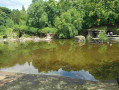
Rivington Gardens Circular
 Visorando Member
 3.94 mi
+486 ft
-482 ft
2h 15
3.94 mi
+486 ft
-482 ft
2h 15
 Average
 Departure from Rivington (Lancashire)
A circular walk starting from Rivington Information Center before following the Eastern side of Rivington Reservoir to Liverpool Castle then gently ascending to the site of Rivington Japanese gardens. Descent is via Levers Bridge and Rivington Hall back to start.
Rivington Park
4.52 mi
+666 ft
-666 ft
2h 40
 Easy
Departure from Rivington (Lancashire)
Easy
Departure from Rivington (Lancashire)
Great walk to see Rivington Castle, Rivington Pike and walk along Rivington Reservoir
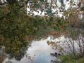
Adlington Red Rock Circular
 6.54 mi
+200 ft
-200 ft
3h 10
Average
Departure from Adlington (Lancashire)
6.54 mi
+200 ft
-200 ft
3h 10
Average
Departure from Adlington (Lancashire)
A circular walk starting from Adlington to briefly follow the bank of River Douglas before ascending onto disused rail track leading to Red Rock and onto School Lane with good 270 degree views over Winter Hill, Beacon and Billinge Fells. A series of footpaths and farm tracks cross farmland leading back to Adlington.
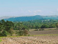
Adlington Hic Bibi Circular
 6.86 mi
+157 ft
-164 ft
3h 20
Average
Departure from Adlington (Lancashire)
6.86 mi
+157 ft
-164 ft
3h 20
Average
Departure from Adlington (Lancashire)
This circular walk starts at Adlington to initially follow the Leeds Liverpool Canal before heading via Arley Wood to Worthington Lakes. The route then ascends over farmland to Hic Bibi Nature Reserve on the top of Coppull Hill giving extensive views over Winter Hall. The final section of the walk descends back to the canal.
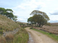
Great Hill from White Coppice
 7.47 mi
+988 ft
-978 ft
4h 20
Average
Departure from Heapey (Lancashire)
7.47 mi
+988 ft
-978 ft
4h 20
Average
Departure from Heapey (Lancashire)
The walk starts from White Coppice cricket ground and follows the clockwise circular route via Wheelton Moor, Tockholes Plantation and Great Hill.
Jubilee Tower Darwen from Ryal Fold
 4.33 mi
+600 ft
-610 ft
2h 30
Average
Departure from Tockholes (Lancashire)
4.33 mi
+600 ft
-610 ft
2h 30
Average
Departure from Tockholes (Lancashire)
The walk starts from Ryal Fold, Tockholes Road and follows the anticlockwise circular route via Duckshaw Moor, Darwin Tower and Earnsdale Reservoir.
For more walks, use our search engine .
The GPS track and description are the property of this route's author. Please do not copy them without permission.

