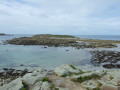
Left bank of the Aber-Ildut and the countryside

A lovely circular route along the left bank of the Aber-Ildut and the Anse de Milin an Aod.
Explore the old granite quarry on the edge of this aber.

Details

4004329
Creation:
Last update:
Last review:
  • Walking
    Activity: Walking
  • ↔
    Distance: 4.59 mi
  • ◔
    Average duration: 2h 20 
  • ▲
    Difficulty: Easy

  • ⚐
    Back to start: Yes
  • ↗
    Ascent: + 210 ft
  • ↘
    Descent: - 210 ft

  • ▲
    Highest point: 194 ft
  • ▼
    Lowest point: 10 ft
  • ⚐ Country: France
  • ⚐ City: Plouarzel (29810)
  • ⚑
    Start/End: N 48.470875° / W 4.746728°
  • ❏
    IGN map(s): Ref. 0317OT, 0416ET, 0417ET
  • Hour-by-hour weather

Photos

Description of the walk

From Lannildut, head towards Plouarzel via the D28; turn right at the sign for Kerglonou slipway, where the starting car park is located.
GR®®34, marked in white and red

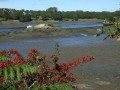
(S/E) From the car park, take theGR®® heading due west and follow the shaded path between the fields on your left and Aber-Ildut on your right. You’ll reach the landing stage where the crossing between the two shores (Plouarzel and Lanildut) used to take place. A beautiful view of the seaweed-harvesting harbour at Lanildut.

(1) Continue due south along the Milin an Aod cove, ignoring a road branching off to the left, until you reach the Kernezet signpost. Cross a footbridge and continue along this cove until you reach the Milin an Aod signpost, where you leave the cove’s edge.

PR® marked in yellow

(2) At this hiking junction, let theGR®® continue to the right and take the road to the left, following the yellow markings. Please note: another yellow-marked path also branches off opposite. Follow this winding road, which gradually offers a lovely view of Melon Island. At the first junction, take the first turn right then left, then continue along a lovely straight stretch, still climbing gently, and pass the Kergoff farm.

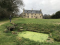
(3) Turn left at the sign for “Cale de Kerglonou” and head towards this hamlet, where you can see a fine Early Medieval cross. The nearby stone, which might be mistaken for a menhir, is simply a natural stone that has been set upright.

(4) Carry on straight ahead, ignoring the road that leads down to Cale de Kerglonou. Descend into the valley and then climb back up to a small cross-road.

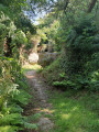
(5) Turn left, pass through the hamlet of Keréarnin and, at the next houses, turn right to reach a gate at the start of a sunken path that descends to the edge of the aber.

GR® ®34 marked in white and red

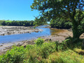
(6) Turn left onto the path that runs alongside the Aber-Ildut, following the river’s various bends to reach a gate marking the boundary of the site of the old Kerglonou quarry.

(7) Turn left onto theGR®® to cross the site of this former granite quarry and see the impressive quarry face. Numerous information boards explain the colossal work that took place here. Continue along the wide path to return to the car park at Kerglonou slipway (S/E).


Waypoints

  1. S/E : mi 0 - alt. 16 ft - Kerglonou slipway
  2. 1 : mi 0.42 - alt. 23 ft - Cale du Passage
  3. 2 : mi 1.5 - alt. 23 ft - Milin an Aod signpost
  4. 3 : mi 2.2 - alt. 194 ft - Kergoff Farm
  5. 4 : mi 2.79 - alt. 105 ft - The hamlet of Kerglonou
  6. 5 : mi 3.18 - alt. 115 ft - Junction towards Keréarnin
  7. 6 : mi 3.72 - alt. 16 ft - Edge of the aber - Ildut (fleuve)
  8. 7 : mi 4.31 - alt. 16 ft - Kerglonou quarry site
  9. S/E : mi 4.59 - alt. 16 ft - Kerglonou slipway

Notes

NB: between (2) and (5), this route follows quiet country lanes.

Worth a visit

Always be cautious and plan ahead when you're outdoors. Visorando and the author of this route cannot be held responsible for any accidents occurring on this route.

The GR® and PR® markings are the intellectual property of the Fédération Française de Randonnée Pédestre.

Reviews and comments

4 / 5
Based on 2 reviews

Reliability of the description
3.5 / 5
Ease of following the route
5 / 5
Route interest
3.5 / 5
User 13289964

Overall rating : 4.3 / 5

Date of your route : Jul 20, 2026
Reliability of the description : ★★★★☆ Good
Ease of following the route : ★★★★★ Very good
Route interest : ★★★★☆ Good
Very busy route : No

The stretch along the aber is lovely and pleasant, and makes up a third of the walk. However, the rest of the route is only along small, interesting roads. It’s a bit of a shame.

Machine-translated

FLOCH
FLOCH ★

Thank you for this review
I have corrected the two errors in the directions.

Machine-translated

chrilad
chrilad

Overall rating : 3.7 / 5

Date of your route : Oct 04, 2021
Reliability of the description : ★★★☆☆ Average
Ease of following the route : ★★★★★ Very good
Route interest : ★★★☆☆ Average
Very busy route : No

There are some errors in the direction.
The start is due west, not east.
After the farm, turn left, not right.
The first part of the trail is pleasant, but then it turns into tarmac, which isn’t much fun.
Kind regards

Machine-translated

Other walks in the area

For more walks, use our search engine .

The GPS track and description are the property of this route's author. Please do not copy them without permission.