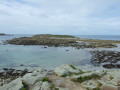
North of Lanildut, between the land, the aber and the sea

This circular route starting from Lanildut takes you along a section of the GR® 34 coastal path, then off on a short detour inland where the countryside, with its sunken paths, remains unspoilt; you’ll finish by following the winding path that runs alongside the Aber Ildut to reach the port of Lanildut, Europe’s leading port for seaweed unloading.

Details

n°69528929
Creation:
Last update:
Last review:
  • Walking
    Activity: Walking
  • ↔
    Distance: 6.62 mi
  • ◔
    Average duration: 3h 15 
  • ▲
    Difficulty: Moderate

  • ⚐
    Back to start: Yes
  • ↗
    Ascent: + 240 ft
  • ↘
    Descent: - 240 ft

  • ▲
    Highest point: 144 ft
  • ▼
    Lowest point: 13 ft
  • ⚐ Country: France
  • ⚐ City: Lanildut (29840)
  • ⚑
    Start/End: N 48.471001° / W 4.757318°
  • ❏
    IGN map(s): Ref. 0317OT, 0416ET, 0417ET
  • Hour-by-hour weather

Photos

Description of the walk

Park at the “Vers les Îles” car park near Crapaud Beach on the outskirts of Lanildut, heading towards Porspoder.

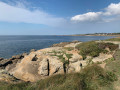
(S/E) With your back to the car park, head right towards the GR® 34 coastal path, 50 metres away, then follow it to the right.

Red and white markings

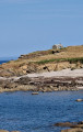
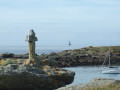
Walk past the defence battery and continue to the guardhouse.

(1) Continue along the coastal path, which leads onto a departmental road.

(2) Turn left onto this road and follow it for approximately 460 m; after the O’Porsmeur Restaurant, leave the coastal path by taking the road on the right.

End of red and white markings, start of yellow markings

(3) Follow this Promenade and Hiking (PR®) route along this road, which climbs slightly. After the houses, it continues along a track to a junction of two PR® paths.

(4) Continue straight on along the PR® 28 and, after a bend at the junction, turn right. After about 100 m, turn left into the sunken lane and follow the sign for “Chapelle Saint-Ourzal”. At the next fork, turn right for 100 m.

No further signposting 

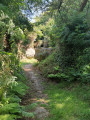
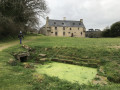
(5) After taking a look at the Saint-Ourzal Chapel and the fountain, continue in the same direction along the sunken path until you reach a road. Turn right onto it and follow it for about 100 m.

(6) At the mobile phone mast, turn left onto the path and follow it to a junction. 

Yellow PR® 27 signposting

(7) At the junction, follow the road to the left for about 900 m until you reach the junction with the Route de Kerambellec.

(8) Follow this road down to the right for 400 m.

(9) Turn left onto the path and follow it until you reach the D27 departmental road.

(10) Follow it to the left for 60 m and take the path on the left which climbs diagonally. It is shared by a PR® and a GRP® (yellow markings and red and yellow markings). When you reach a road, take the hairpin bend and head down to the right. Cross the D27with care and continue downhill to Aber Ildut. 

Red and white markings

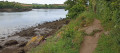
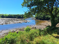
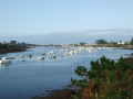
(11) Turn right and follow the Aber towards Lanildut, enjoying the lovely views of the Aber as you walk to the church. Cross the cemetery.

(12) Continue to follow the GR®, taking the main street in Lanildut on the left with care for 1.1 km.

(13) Turn left onto the path (marked in red and white) which leads down towards the harbour master’s office and the seaweed processing centre. On weekdays, don’t miss the constant comings and goings of the seaweed boats as they unload their cargo onto articulated lorries. Continue until you reach the car park where you started (S/E).


Waypoints

  1. S/E : mi 0 - alt. 33 ft - “Départ vers les Îles” car park - Ildut (fleuve)
  2. 1 : mi 0.71 - alt. 43 ft - Coastguard station
  3. 2 : mi 1.14 - alt. 43 ft - Arrival via the county road
  4. 3 : mi 1.41 - alt. 30 ft - O’Porsmeur Restaurant. Junction
  5. 4 : mi 1.94 - alt. 98 ft - PR28
  6. 5 : mi 2.52 - alt. 102 ft - Saint-Ourzal Chapel
  7. 6 : mi 2.92 - alt. 121 ft - Mobile phone mast. Fork in the path
  8. 7 : mi 3.09 - alt. 115 ft - Return via the PR27
  9. 8 : mi 3.65 - alt. 138 ft - Kerambellec Road
  10. 9 : mi 3.91 - alt. 79 ft - Path on the left
  11. 10 : mi 4.23 - alt. 62 ft - D27
  12. 11 : mi 4.95 - alt. 26 ft - Arrival at Aber Ildut
  13. 12 : mi 5.78 - alt. 56 ft - Aber Ildut Road - Église Saint-Ildut (Lanildut)
  14. 13 : mi 6.3 - alt. 43 ft - Path to the harbour
  15. S/E : mi 6.62 - alt. 33 ft - “Départ vers les Îles” car park - Ildut (fleuve)

Notes

In winter, the sunken paths can be a little muddy. In February 2025, a very wet winter, they were easily passable.

Worth a visit

Always be cautious and plan ahead when you're outdoors. Visorando and the author of this route cannot be held responsible for any accidents occurring on this route.

The GR® and PR® markings are the intellectual property of the Fédération Française de Randonnée Pédestre.

Reviews and comments

3.8 / 5
Based on 2 reviews

Reliability of the description
4 / 5
Ease of following the route
4 / 5
Route interest
3.5 / 5
jpierre.c
jpierre.c

Thank you for your feedback and thank you for the photos. I’m sorry, it’s difficult to plan a circular route without tarmac roads; I did my best.

Machine-translated

Angèle 2
Angèle 2

Overall rating : 3 / 5

Date of your route : Jul 09, 2026
Reliability of the description : ★★★☆☆ Average
Ease of following the route : ★★★☆☆ Average
Route interest : ★★★☆☆ Average
Very busy route : No

The first section along the aber is very pretty with its jagged coastline. Further inland, the route continues along lovely paths lined with ferns, as well as tarmac roads. Apart from St Ourzal’s Chapel, this section is of little interest. We mainly used the GPS tracker to navigate the route on the map, as the route description is a bit vague. We returned along the road to the village in intense heat.

Machine-translated

Kiki29
Kiki29

Overall rating : 4.7 / 5

Date of your route : May 01, 2025
Reliability of the description : ★★★★★ Very good
Ease of following the route : ★★★★★ Very good
Route interest : ★★★★☆ Good
Very busy route : No

A very pleasant walk: it starts with sea views, follows a lovely, peaceful route along sunken paths, and returns along the Aber Ildut via a section of the GR34 that is truly delightful.
Best done after several days without rain, as the unpaved section and its sunken paths are likely to be impassable.
Thank you for this lovely walk

Machine-translated

Other walks in the area

For more walks, use our search engine .

The GPS track and description are the property of this route's author. Please do not copy them without permission.