Rifugio Deffeyes – Laghi di Bellacomba

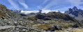
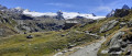
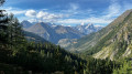
A magnificent, fairly challenging circular route. This route follows the Alta Via No. 2 from the Aosta Valley to the Rifugio Deffeyes. A path, almost like a balcony, will take you into the Bella Comba valley, home to two superb lakes. During the ascent to the refuge, you’ll discover numerous viewpoints over the Mont Blanc massif on the Italian side. The scenery changes at the refuge, where the Ruitor Glacier will accompany you all the way to Lago dei Seracchi.

Details

3991835
Creation:
Last update:
Last review:
  • Walking
    Activity: Walking
  • ↔
    Distance: 9.46 mi
  • ◔
    Average duration: 7h 30 
  • ▲
    Difficulty: Difficult

  • ⚐
    Back to start: Yes
  • ↗
    Ascent: + 3,602 ft
  • ↘
    Descent: - 3,596 ft

  • ▲
    Highest point: 8,199 ft
  • ▼
    Lowest point: 5,249 ft
  • ⚐ Country: Italy
  • ⚐
    Area: Alps
  • ⚐ City: La Thuile (73190)
  • ⚑
    Start/End: N 45.68993° / E 6.960527°
  • ❏
    IGN map(s): Ref. 3531ET, 3531ETR, 3532ET, 3532ETR
  • Hour-by-hour weather

Photos

Description of the walk

From the village of La Thuile, take the road to the ski lifts and head up the valley to La Joux.
Park at the first car park, just before the restaurant.

(S/E) From the car park, join the path on the left signposted Alta Via No. 2 (a ‘2’ on a Yellow Triangle), No. 3 (Refugio Deffeyes) and No. 8 Laghi di Bellacomba. Follow this pleasant path until you reach the first waterfall.

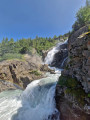
(1) Turn left and, still following the Alta Via No. 2, continue to a junction signposting thethird waterfall (Terza Cascata del Ruitor).

(2) Leave the path to the waterfall on your right and continue to the left until you reach another fork where paths No. 3 and No. 8 split.

(3) Carry on straight ahead towards the refuge (signposted AV2 and No. 3). After a few bends, you’ll gradually emerge from the woodland onto a small plateau (Pian de la Liere) and reach the small Glacier Lake, a perfect spot for a break.

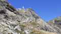
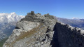
(4) From this point, the rest of the route is easy to follow. Resume the ascent towards the refuge and, via numerous bends through the rocky terrain, reach the Alpeggio del Ruitor, a small pass offering panoramic views of the Mont Blanc massif to the north-west and the Ruitor Glacier to the south-east. Continue along the path to the Rifugio Deffeyes, which is now very close by.

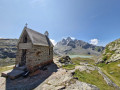
(5) Walk round the refuge and, heading south-west, take the path leading to the Santa Margherita Al Rutor Chapel.

(6) Return to the path towards the western end of Lago Inferior del Ruitor and continue to the left.

(7) Still heading south-west, walk towards another lake, Lago dei Seracchi. Walk past it and come to a fork in the path.

(8) Leave the path for the standard route up the Grand Assaly on your left, and continue westwards on the path signposted ‘Laghi di Bellacomba’. Enter the Vallone Di Bella Comba, reach a small bridge over a stream and cross it.

(9) Turn left onto path No. 8 towards the first Lake Bellacomba.

(10) The second lake is easily reached.

(11) Return along the same route.

(9) Stay on the left bank of the stream, following path No. 8 straight on, and descend to a junction.

(12) Turn right towards the east and, still on path No. 8, continue to another junction.

(13) Ignore the path on the left, cross the Ruitor stream and rejoin Path No. 3, which you used for the ascent to the refuge.

(3) Take your time returning along the same route you took on the way up to the car park (S/E).

Waypoints

  1. S/E : mi 0 - alt. 5,266 ft - La Joux car park
  2. 1 : mi 0.54 - alt. 5,446 ft - First waterfall
  3. 2 : mi 1.62 - alt. 6,539 ft - Third waterfall, on the left
  4. 3 : mi 1.85 - alt. 6,916 ft - Junction of trails no. 3 and no. 8
  5. 4 : mi 2.24 - alt. 7,047 ft - Glacier Lake
  6. 5 : mi 3.16 - alt. 8,146 ft - Rifugio Deffeyes
  7. 6 : mi 3.34 - alt. 8,100 ft - Chapel
  8. 7 : mi 3.44 - alt. 8,018 ft - Lago Inferiore del Ruitor
  9. 8 : mi 3.99 - alt. 7,789 ft - Lago dei Seracchi / path to the Grand Assaly
  10. 9 : mi 4.93 - alt. 7,598 ft - Bellacomba Lakes junction
  11. 10 : mi 5.47 - alt. 7,894 ft - First lake
  12. 11 : mi 5.71 - alt. 7,822 ft - Second lake
  13. 12 : mi 7.14 - alt. 7,090 ft - Junction; turn right
  14. 13 : mi 7.26 - alt. 6,985 ft - Junction, go straight on
  15. S/E : mi 9.46 - alt. 5,276 ft - La Joux car park

Notes

? The IBP statistics for the route give an index of 148 HKG.
? The IBP statistics for the route show an elevation gain of 1,287 metres and an elevation loss of 1,286 metres, which are closer to reality.

? Mountain kit, particularly good footwear.

? No water available along the entire route, except at Rifugio Deffeyes.

? Food and drink available at the Rifugio Deffeyes.

Worth a visit

- The village of La Thuile.
- The three Ruitor waterfalls.
- The Deffeyes mountain hut.
- The Santa Margherita Al Rutor Chapel.
- The Ruitor Glacier.
- The Bellacomba lakes.
- The Tête du Ruitor
- The Grand Assaly.

Reviews and comments

4.5 / 5
Based on 2 reviews

Reliability of the description
4 / 5
Ease of following the route
4.5 / 5
Route interest
5 / 5
fudji
fudji

Overall rating : 4.7 / 5

Date of your route : Aug 21, 2024
Reliability of the description : ★★★★★ Very good
Ease of following the route : ★★★★☆ Good
Route interest : ★★★★★ Very good
Very busy route : Yes

An absolutely stunning walk, but also quite a challenge: I wouldn’t recommend it if you have weak knees or very loose ankles.

I’d also advise you to park in the free car park set up in a field on the right, about 1 km before the start of the walk (in August). In fact, if you head to the stated starting point, there are very few spaces available – they were all taken when I arrived at around 9.45 am. If you park further up the hill, you’ll need to add just over 2 km to the walk.

Regarding point (2), which advises you to leave the path to the waterfall on your right and continue to the left. Honestly, if you’re going to do the walk, you might as well make a round trip to the third waterfall – it takes 10–15 minutes at most, including photos – and this waterfall is well worth the time.

As for the distance covered and the elevation gain: having done the round trip to this famous third waterfall twice (going up, then coming down), my Garmin watch recorded 21.5 km with 1,350 m of elevation gain.
It’s also worth noting that the first two hours are almost entirely uphill. The break indicated at Lac du Glacier, at point (3), is recommended. This is followed by another short hour’s climb up to the refuge.
Over the first three hours of my hike, I covered 950 metres of elevation gain

It’s quite busy up to Lac du Glacier – which is to be expected at this time of year – but if you carry on up to the refuge, you’ll find it much quieter.

Machine-translated

Frajun
Frajun

Overall rating : 4.3 / 5

Date of your route : Jul 20, 2023
Reliability of the description : ★★★☆☆ Average
Ease of following the route : ★★★★★ Very good
Route interest : ★★★★★ Very good
Very busy route : No

A lovely walk featuring the magnificent Ruitor waterfalls and the Bellacomba Lakes.
That said, I’m rather sceptical about the advertised 7-hour duration. We only covered part of the walk, heading straight from the start to the Bellacomba Lakes, and it took us 6 hours to get there and back. Admittedly, we did take the time to admire the waterfalls...
Enjoy the walk!

Machine-translated

Other walks in the area

For more walks, use our search engine .

The GPS track and description are the property of this route's author. Please do not copy them without permission.