Chalance Mountain Hut

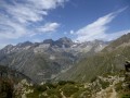
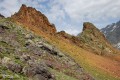
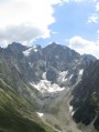
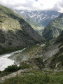
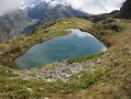
Hidden away in this magnificent Alpine valley – described by Lionnel Terray as ‘the most Himalayan of the Alps’ – lies a real gem. But this gem has to be earned, as, at an altitude of 2,550 metres, it is the highest mountain refuge in the Valgaudemar. And up there, comfortably settled on the sun-drenched terrace, you’ll find pure bliss as you take in the breathtaking panorama.

Details

n°64808183
Creation:
Last update:
Last review:
  • Walking
    Activity: Walking
  • ↔
    Distance: 6.00 mi
  • ◔
    Average duration: 6h 05 
  • ▲
    Difficulty: Difficult

  • ⚐
    Back to start: Yes
  • ↗
    Ascent: + 3,855 ft
  • ↘
    Descent: - 3,835 ft

  • ▲
    Highest point: 8,301 ft
  • ▼
    Lowest point: 4,659 ft

Photos

Description of the walk

Leave the N85 and drive up the Valgaudemar Valley to the small hamlet of Rif du Sap, where you can park.

(S/E) From the tiny roadside car park, look for the start of the path heading due north. This well-marked path climbs and crosses a few streams until it reaches a flat area.

(1) From the flat area, you can see the stone hut at La Muande. Be careful not to head straight for the hut, but look out for the cairns on the left and the continuation of the path. Climb along the hillside to the small pass.

(2) Continue through the grass, heading due north; then, as you approach the rocky area, do not take the path branching off to the left, but take the one on the right (signposted ‘Chalanche’) and climb up the rock face, following the cairns and using your hands for support. After this short section, the path winds upwards in switchbacks to a small flat area.

(3) From there, the path veers left and runs along the hillside. Keep a close eye on the cairns, cross several small streams, then climb up to reach a rocky area.

(4) The path descends slightly, then climbs again whilst overlooking rocky outcrops. Stay alert. After this section, the path winds its way up until, at last, the refuge comes into view. Continuecarefully to the wooden terrace, which is accessed from the right. We have finally arrived at Chalance.

(5) From the refuge, for the descent, carefully follow the path back the way you came to the car park (S/E).

Waypoints

  1. S/E : mi 0 - alt. 4,659 ft - Rif du Sap car park
  2. 1 : mi 1.68 - alt. 6,568 ft - La Cabane de la Muande plateau
  3. 2 : mi 1.89 - alt. 6,837 ft - Small pass
  4. 3 : mi 2.32 - alt. 7,582 ft - Short Flat Section
  5. 4 : mi 2.66 - alt. 8,009 ft - The rocks
  6. S/E : mi 6 - alt. 4,659 ft

Notes

  • For water: top up your supplies just after the ‘3 ’, at the start of the traverse. Look out for a large rock on the right-hand side of the path (as you ascend), beneath which a spring flows and crosses the path. A sign may have been put up to mark the spot. Beneath the rock, you can even take bottles, fill them up, carry them up to the refuge and, on the way down, leave them there for the next hikers. This is because at the refuge, depending on the season and the condition of the water supply, there may or may not be water available.
  • The refuge is managed by the FFCAM in Gap (CAF). It is unstaffed, but volunteers regularly visit during the opening season from June to October. Please note that it has a capacity of 11 beds. Please feel free to visit the FFCAM website dedicated to the refuge for further useful information.
  • Do not underestimate the difficulty of this hike; there is a significant ascent and descent in a very alpine setting. You must have sure-footedness, not be prone to vertigo, and be properly equipped for the season. However, this is not a mountaineering expedition.
  • Please note that you are in the Écrins National Park; please respect the relevant regulations (no dogs, etc.).

Worth a visit

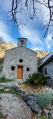
Visit the hamlet of Rif du Sap and its chapel.

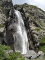
At the end of the road, head up to see the Cascade du Voile de la Mariée waterfall and enjoy a break at the Refuge-Hôtel du Gioberney.

Reviews and comments

5 / 5
Based on 1 review

Reliability of the description
5 / 5
Ease of following the route
5 / 5
Route interest
5 / 5
olivier aix
olivier aix

Overall rating : 5 / 5

Date of your route : Jul 05, 2026
Reliability of the description : ★★★★★ Very good
Ease of following the route : ★★★★★ Very good
Route interest : ★★★★★ Very good
Very busy route : No

A lovely walk, but do take care when crossing the streams – some of them can be treacherous

Machine-translated

Other walks in the area

For more walks, use our search engine .

The GPS track and description are the property of this route's author. Please do not copy them without permission.