


Refine your search for walks in Refuge des Estagnols (Sansa)
Refuge des Estagnols (Sansa) walks


 Loop from the Col de Creu to the Estagnols refuge
 Visorando Member
 6.50 mi
 +1,020 ft
 -1,020 ft
 5 hrs
5 hrs
 Moderate
 Departure from Matemale (Pyrénées-Orientales)
A lovely circular route to do on snowshoes (or on foot in summer) starting from Matemale.The return via the other track requires a certain level of fitness if there are no tracks in the snow. From the Col de La Sansa, follow the yellow-red markings.You must also follow the route description carefully; otherwise, you’ll have to return to the bottom of the road and walk back up to the pass to retrieve your cars.
 Around Sansa
 9.11 mi
+1,644 ft
-1,644 ft
5h 35
Moderate
Departure from Sansa (Pyrénées-Orientales)
9.11 mi
+1,644 ft
-1,644 ft
5h 35
Moderate
Departure from Sansa (Pyrénées-Orientales)
This route, starting from Sansa, will take you on a tour of the surroundings of the northernmost village in the Garrotxes. A fairly long and challenging hike.
The Refuge des Estagnols from Sansa
 7.06 mi
+1,532 ft
-1,549 ft
4h 35
Moderate
Departure from Sansa (Pyrénées-Orientales)
7.06 mi
+1,532 ft
-1,549 ft
4h 35
Moderate
Departure from Sansa (Pyrénées-Orientales)
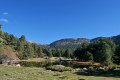
A lovely walk taking in some of the Catalan heritage sites of the Garrotxes.Route marked in yellow, with directional and information signs that are either recent or in very good condition.No signposting between (7) and (9), but it is impossible to go wrong. The yellow markings indicated, and present in November 2022, are not guaranteed to remain in place over time (disappearance, destruction).Paths are in perfect condition. This walk can be shortened as desired.The most challenging part is returning to Sansa via the small D4/D4e road: allow half an hour’s drive from Olette.
From Sansa to the Estanyols Lakes
5.54 mi
+1,562 ft
-1,552 ft
3h 55
Moderate
Departure from Sansa (Pyrénées-Orientales)
A family hike accessible to all in the wild Garrotxes valley. From the village of Sansa, on a forest trail on the way there, the route leads to the Estagnols Lakes, where there is also a refuge.
Walks near Refuge des Estagnols (Sansa)
Chemin Vauban From Formiguères to Rouze
13.74 mi
+1,286 ft
-3,018 ft
7h 25
Moderate
Departure from Formiguères (Pyrénées-Orientales)
This section of the Chemin Vauban links Formiguères to Rouze, crossing the Capcir and then the Donezan. The route, which is generally easy and pleasant, alternates between forest tracks, sections through the undergrowth, paths along ridges and more open stretches offering beautiful panoramic views. The route runs alongside the Galbe river, crosses the Col des Ares – which marks the border between the Pyrénées-Orientales and Ariège – and then continues through the Donezan region via Carcanières and Le Puch. It also takes you past the magnificent Château d’Usson before reaching the village of Rouze.
Crossing from Balcère to Les Angles
4.84 mi
+489 ft
-755 ft
2h 40
 Easy
Departure from Les Angles (Pyrénées-Orientales) (Pyrénées-Orientales)
Easy
Departure from Les Angles (Pyrénées-Orientales) (Pyrénées-Orientales)
An easy, two-thirds shaded route suggested by a Year 3 class. Superb views to help children from the countryside discover the mountains: lake, forests.
Chemin Vauban: from Olette to Sauto
10.54 mi
+4,596 ft
-1,398 ft
8h 50
 Difficult
Departure from Olette (Pyrénées-Orientales)
Difficult
Departure from Olette (Pyrénées-Orientales)
This section of the Chemin Vauban links Olette to Sauto via a route that is much better signposted than the previous one. The route remains, however, long and challenging, with some steep ascents and descents, but in return offers sumptuous and varied scenery. In particular, it takes you through the villages of Canaveilles and Llar, before gaining altitude towards the Serre de Clavera, then beginning the final descent towards Sauto.⚠️ Warning: the route runs alongside and crosses a military firing range between (10) and (11). Before setting out on this route, it is essential to check the days and times of firing exercises to ensure that passage is permitted.
Thués-Entre-Valls - Carança refuge
 5.40 mi
+3,832 ft
-653 ft
5h 50
Moderate
Departure from Thuès-Entre-Valls (Pyrénées-Orientales)
5.40 mi
+3,832 ft
-653 ft
5h 50
Moderate
Departure from Thuès-Entre-Valls (Pyrénées-Orientales)
This is the first stage of the Thués - Fillols loop, which takes you up the Carença Gorge to the refuge of the same name.
Thués-Entre-Valls – Fillols Route
34.29 mi
+14,088 ft
-14,383 ft
5 days
Moderate
Departure from Thuès-Entre-Valls (Pyrénées-Orientales)
A 5-day route in the Catalan Pyrenees, offering the chance to explore the stunning Carença Gorges before finishing with an ascent of the Catalan giant: the Canigou.
Chemin Vauban: From Sauto to Formiguères
14.63 mi
+1,112 ft
-1,401 ft
7h 40
Difficult
Departure from Sauto (Pyrénées-Orientales)
This section of the Chemin Vauban links Sauto and Formiguères, passing through La Llagonne, the Col de la Quillane, Lake Matemale and the village of Matemale. The route, which is generally easy and accessible to all, alternates between balcony paths, woodland trails and sections along the shores of Lake Matemale, offering beautiful panoramic views of the surrounding peaks and providing an opportunity to explore the Tour de Creu.Please note that the route passes through the La Quillane ski resort, which means it is impassable whilst the resort is open for the winter season. The final section between Lake Matemale and Formiguères, which mainly follows a forest track, offers little shade and should therefore be avoided in very hot weather.
Camporells Refuge - En Beys Refuge
 6.82 mi
+1,562 ft
-2,490 ft
4h 30
Moderate
Departure from Formiguères (Pyrénées-Orientales)
6.82 mi
+1,562 ft
-2,490 ft
4h 30
Moderate
Departure from Formiguères (Pyrénées-Orientales)
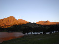
Second stage of the Tour Des Pérics.This stage should only be undertaken in good weather and when there is no fog.Otherwise, you must use the Visorando app or a GPS device to track your route.
⚠️ You are entering the Orlu National Hunting and Wildlife Reserve, where certain regulations must be observed. See practical information.
Camporells Refuge - Lac des Bouillouses via Petit Peric
 7.14 mi
+1,503 ft
-2,267 ft
6 hrs
7.14 mi
+1,503 ft
-2,267 ft
6 hrs
 Very difficult
Departure from Formiguères (Pyrénées-Orientales)
Very difficult
Departure from Formiguères (Pyrénées-Orientales)
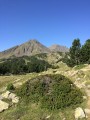
Part of the long itinerary (9 days) around Carlit, hiking from refuge to refuge, based on the Peyrics tour and using various marked trails.
Chemin Vauban from Mont-Louis to La Llagonne
2.00 mi
+344 ft
-72 ft
1h 15
Easy
Departure from La Cabanasse (Pyrénées-Orientales)
This section of the Chemin Vauban links Mont-Louis to La Llagonne via an easy and pleasant route. After skirting the ramparts of the fortified town of Mont-Louis, the route crosses the River Têt before reaching the village of La Llagonne. One-way walk: leave a car at La Llagonne (car park near the post office) to return to Mont-Louis.
Vauban Trail from Rouze to Aunat
9.41 mi
+1,414 ft
-1,585 ft
5h 35
Moderate
Departure from Rouze (Ariège)
This section of the Chemin Vauban links Rouze to Aunat, gradually leaving the Donezan behind to reach the Aude Pyrenees. The route, which is generally easy and accessible, alternates between sections through woodland and pleasant paths, notably crossing the border between Ariège and Aude. The section between Campagna-de-Sault and the Col de la Clause is particularly interesting for its heritage and numerous information boards, which provide a better understanding of the areas passed through, especially around the Dournes tunnel.From the Col de la Clause, the route continues mainly downhill through woodland before gradually reaching the village of Aunat.