Country:

 City:
City:


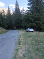
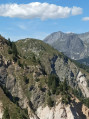
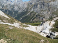
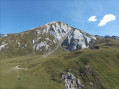
Access from Pralognan: at the entrance to the village, turn right towards Les Prioux; park in the car park on the left, after two hairpin bends, at the start of the track leading to the hamlet of La Chollière on the D124.
(S) From the car park, walk up the road for a few dozen metres until you find, on the right, the very well-marked and pleasant path through the woodland leading to the Col de Napremont. Climb steeply, traversing and zigzagging, until you reach a rocky ridge.
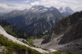
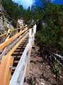
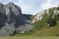
(1) Cross this ledge via a wooden staircase – its 175 steps will really give your thighs a workout. The climb then continues to the Col de Napremont, with the majestic, ever-present and magnificent Grande Casse accompanying you up this slope.
(2) From the pass, descend about a hundred metres to find the start of the path leading to the Col du Biol and the Brèche Portetta; you can see the switchbacks of this path opposite.
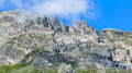
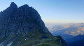
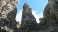
(3) Make sure you follow the path, which is less clearly marked through the vegetation, to the left. You’ll arrive below the Aiguille d’Août, with the Brèche Portetta to your left.
(4) From this point, there is no longer a clear path, so you have two options:
1) Choose whether to head directly for the Brèche Portetta (following the “Brèche Portetta and Col de Grande Pierre” route).
2) Continue the ascent beneath the Aiguille d’Août (aptly named), the option chosen on the map and in the description.
This narrower section becomes steeper and more slippery; climb up the left-hand side of the gully to reach grassy slopes with easier footholds. You’ll reach a scree slope.
(5) Climb straight up through this scree field, then turn left towards the Col du Biol and its distinctive pass. The col is easily reached via the grassy slopes on the left.
(6) From the pass, the descent of about 100 m is a little steep. You’ll rejoin the path coming from the Vallée des Avals and Courchevel.
(7) Then turn left onto the steep climb, marked with orange and then green dots, where the reward of the scenery fully justifies the effort required. A sign points to the Brèche Portetta on the left and the Col de Mey on the right.
(8) Without going all the way to the pass, do take a stroll amongst the boulders and peaks – it’s simply magnificent. The view of Mont Blanc through the breach is unexpected and fantastic.
Then head back down, stopping to see the very narrow exit from the Brèche Portetta, and return to the previous junction.
(7) Turn left onto the path leading to the memorial stone at the Passage de Plassa.
(9) The Rocher de Plassa is very close by and it would be a shame not to climb at least to the southern summit via the relatively easy ridge.
(10) From the summit, the view is stunning and offers a 360° panorama. Enjoy the view, then head back down to the memorial stone.
(9) Head left towards the Plan des Baux, accompanied by the whistles of the marmots, then on to the Col des Saulces Supérieur.
(11) This marks the start of the final descent. It first passes the junction with the path to the Col des Saulces inférieur.
(12) A sign warns of a difficult descent; this is certainly the case – the obvious path straight ahead is very slippery, and it’s easy to find yourself on the ground. The descent is rapid down to the Route des Prioux.
(13) Cross the road, then take the path beneath it towards Pralognan, which leads to the D124 and the car park (S/E).


 Visorando Member
 Difficult
 Moderate