From the Château d’Ardennes to the Bois de Benêt

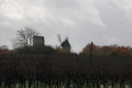
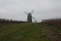
A pleasant walk in Saintonge through a hilly, wooded area. This route allows you to discover the mix of vineyards and small woods, as well as the pretty Château d’Ardennes, the Manoir des Augers and various traditional buildings.

Details

n°1855514
Creation:
Last update:
Last review:
  • Walking
    Activity: Walking
  • ↔
    Distance: 6.81 mi
  • ◔
    Average duration: 3h 20 
  • ▲
    Difficulty: Moderate

  • ⚐
    Back to start: Yes
  • ↗
    Ascent: + 253 ft
  • ↘
    Descent: - 230 ft

  • ▲
    Highest point: 262 ft
  • ▼
    Lowest point: 82 ft

Photos

Description of the walk

The car park is situated in the spaces between the church and the village hall. Other options are available on Rue du Vieux Pont (at the end of Rue de la Boulangerie).

(S/E) Leave the car park and head towards Rue de l’Église, further east. Turn right in front of the church, then left into Rue du Vieux Pont. Continue to the junction with Rue du Château on the right.

(1) Turn right onto Rue du Château, which leads out of Fléac-sur-Seugne. Turn left onto Route de Marignac le Seuil, just before the cemetery, and continue until you reach a farm track on the right.

(2) Turn right onto this track and carry on straight ahead until it joins a small road, the Chemin du Crapaud. Follow this for about fifty metres, turning slightly to the right.

(3) Turn left onto a farm track leading towards the hamlet of Le Breuil. When you reach a road at a T-junction, carry on straight ahead to join the Route de Saint-Grégoire. Follow this road carefully until you reach a crossroads near Chez Nolin.

(4) Turn left onto Rue de Chez Nolin. Continue by keeping to the left and proceed to the junction with the Route d’Ardenne, which leads to the Château d’Ardennes: there are lovely views of the château (private property).

(5) Continue carefullystraight on along the Route de Chez Nolin, then, from the next junction with a road on the left, carry on along the Route de Marignac to Saint Blaise (D249).

(6) In Saint Blaise, at the junction of the D249, where there is a farm track on either side of the road, turn left and take the track uphill towards the woods, running alongside a vineyard plot after the houses. 
Turn left at the corner of the vineyard plot (before Bois Chauvin). At the next corner of the vineyard plot, there is a lovely view of Les Augers (a 17th-century château). Turn left again onto the downhill track, which soon joins a farm track. Follow this track to the right, then take the road, passing in front of Les Augers. Follow it to the first path on the left, just after the hairpin bend in the road.

(7) Turn left onto the uphill track (GR®360) and head towards the four-way junction, almost at the top of the hill. Leave the GR®360 by turning left onto a flat track, before heading down into the woods. Carry on straight ahead until you reach a road, Les combes d’Aunat, and follow this road to the left, towards Chez Godon.

(8) Just before Chez Godon, take the path on the right heading west. At the corner, after the small wood on your left, turn left onto the path running along the edge of the wood. At the next T-junction, turn right and continue to a sharp-angled crossroads at the end of a road, where the path meets a wood on your left.

(9) Take the path on the left, running along the edge of Bois Bénet, which is now on your right. The path enters the woods. At the next junction, take the path on the left, until you reach a T-junction in the Bois du Prêtre.

(10) Turn right and follow the path to the D249 road. Follow it to the left for about forty metres, taking care, until you reach the second path on the right at the edge of the Bois de Fléac. The path winds round a clearing to a T-junction.

(11) Turn right onto the path at the edge of the woodland, which soon runs alongside a vineyard on your right, until you reach a road. Turn right towards Les Forges and follow the road to Fléac-sur-Seugne, until you reach the junction where you started.

(1) Go straight across the junction and continue along Rue du Vieux Pont. Immediately after passing the first building on the right, turn right into the lane that goes round the church. Cross Rue de l’Église and continue straight ahead towards Rue de la Boulangerie to reach the village hall car park (S/E). 

Waypoints

  1. S/E : mi 0 - alt. 89 ft - Car park at the Salle des Fêtes opposite the church
  2. 1 : mi 0.07 - alt. 92 ft - Junction of Rue du Château d’Eau and Rue des Forges
  3. 2 : mi 0.66 - alt. 102 ft - Junction of the Marignac–Le Seuil road and the access road
  4. 3 : mi 1.33 - alt. 128 ft - Junction of Chemin de la Prairie and Chemin
  5. 4 : mi 1.9 - alt. 108 ft - Junction of three roads near Chez Nolin
  6. 5 : mi 2.16 - alt. 112 ft - Crossroads near Château d’Arden.
  7. 6 : mi 2.57 - alt. 128 ft - D249 road x path on the left in Saint Blaise
  8. 7 : mi 3.5 - alt. 200 ft - Road–path junction
  9. 8 : mi 4.5 - alt. 161 ft - Junction of the Route de Chez Godon and the Chemin d’Exploit.
  10. 9 : mi 5.38 - alt. 105 ft - Junction of two paths with a Y-shaped road
  11. 10 : mi 5.83 - alt. 151 ft - Crossroads
  12. 11 : mi 6.26 - alt. 144 ft - T-junction
  13. S/E : mi 6.81 - alt. 89 ft - Car park at the Salle des Fêtes opposite the church

Notes

This walk across varied terrain requires suitable footwear.

This route is only partially signposted: a section of the GR® 360 – GRP® de Saintonge, marked in yellow and red, from just before Les Augers to just past point (7). Consequently, it is advisable to follow the directions in the route description and on the map, whilst also paying close attention to the landscape. The waypoints (with their GPS coordinates and the distance from the starting point) serve as aids for walkers exploring the route for the first time.

Hike completed by the author on 6 December 2022

Worth a visit

Fléac-sur-Seugne
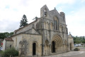
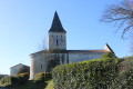
Saint-Pierre Church.

Ardennes Castle.

Other civil structures.
Near the church lie the ruins of Fléac Castle, with an underground entrance. The village also features a small medieval residence, the Manoir des Forges, which dates from the 15th century.
Source: Wikipedia (excerpts)

Always be cautious and plan ahead when you're outdoors. Visorando and the author of this route cannot be held responsible for any accidents occurring on this route.

The GR® and PR® markings are the intellectual property of the Fédération Française de Randonnée Pédestre.

Reviews and comments

3.7 / 5
Based on 2 reviews

Reliability of the description
4 / 5
Ease of following the route
3 / 5
Route interest
4 / 5
barate
barate
• Edited:

Overall rating : 4 / 5

Date of your route : Jun 21, 2026
Reliability of the description : Not used / Not applicable
Ease of following the route : Not used / Not applicable
Route interest : ★★★★☆ Good
Very busy route : No

https://www.visorando.com/images/smileys...
Hello, part of the walk is still doable, but several sections through the undergrowth have become impassable. Nature has reclaimed its territory!!
I strongly advise against this walk.
If, like me, you enjoy mapping out your own routes, this one is a good starting point.
Thanks to the author for sharing so many excellent walks in the area.
Happy hiking to you all

Machine-translated

User 15337110

Overall rating : 3.7 / 5

Date of your route : Jun 08, 2025
Reliability of the description : ★★★★☆ Good
Ease of following the route : ★★★☆☆ Average
Route interest : ★★★★☆ Good
Very busy route : No

A 3-hour walk. Be careful, some of the paths in the forest are very seldom used, so you really have to thread your way through the foliage.
I had to make a diversion because I couldn't find the path leading to point 10. Some parts of the forest are muddy but it's easy to cross.
It was a very pleasant walk overall and easy to do.

Machine-translated

Other walks in the area

For more walks, use our search engine .

The GPS track and description are the property of this route's author. Please do not copy them without permission.