


Refine your search for walks in Porte de Pierre
Porte de Pierre walks


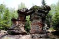
 The Mutzig Rock and the Porte de Pierre from the Place des Musiciens
 Tourist office
 9.67 mi
 +2,106 ft
 -2,133 ft
 6h 15
6h 15
 Difficult
 Departure from Lutzelhouse (Bas-Rhin)
A very pretty hike on the western side of the Bruche Valley. The Mutzig Rock, rising to 1,010 metres, offers remarkable views of the valley and the surrounding mountains, such as the Donon, the Schneeberg and the Champ du Feu. The Porte de Pierre is a natural monument of pink sandstone sculpted by erosion. It is an astonishing discovery, this block perched there as if it came from nowhere, plunging you into a half-dream.
Stone Gate and Mutzig Rock from Place des Musiciens
 Visorando Member
 8.00 mi
+1,965 ft
-1,982 ft
5h 25
8.00 mi
+1,965 ft
-1,982 ft
5h 25
 Moderate
Departure from Lutzelhouse (Bas-Rhin)
Moderate
Departure from Lutzelhouse (Bas-Rhin)
The Porte de Pierre, a natural wonder sculpted by the elements, and the Rocher de Mutzig, rising to 1,009 m, offering a breathtaking panorama of the Bruche Valley, the Alsace plain, the Black Forest and the surrounding peaks: Donon, Champ du Feu, Climont, Brézouard...
Walks near Porte de Pierre
 Oberhaslach, Col des Pandours, Wangenbourg, Oberhaslach
16.30 mi
+2,451 ft
-2,431 ft
2.5 hrs
Difficult
Departure from Still (Bas-Rhin)
A lovely circular route from Oberhaslach to Wangenbourg, passing through the Col des Pandours on the way out. Then on to Bergbieten by mountain bike before returning to Oberhaslach.Most of the route follows tracks suitable for vehicles. There are a few technical sections on fairly short single tracks.
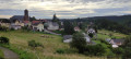
Wangenbourg Engenthal - Urmatt
 Tourism professional
 11.13 mi
+1,696 ft
-2,418 ft
6h 35
Difficult
Departure from Wangenbourg-Engenthal (Bas-Rhin)
11.13 mi
+1,696 ft
-2,418 ft
6h 35
Difficult
Departure from Wangenbourg-Engenthal (Bas-Rhin)
From the ‘Little Switzerland’ of Alsace to the Bruche Valley, this seventh stage of the journey through the Vosges, presented by Passion Vosges magazine published by DNA and L’Alsace, takes you through the wild heights of the Schneeberg and introduces you to the castles and the Nideck Waterfall between Wangenbourg-Engenthal and Urmatt. A stage narrated by Romain Gascon. The entire route follows the Red Rectangle, unless otherwise stated.
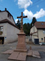
Between the Col du Donon, Col du Prayé and Col du Hantz to Saint-Blaise-la-Roche
 14.61 mi
+1,427 ft
-2,444 ft
8h 00
Difficult
Departure from Grandfontaine (Bas-Rhin) (Bas-Rhin)
14.61 mi
+1,427 ft
-2,444 ft
8h 00
Difficult
Departure from Grandfontaine (Bas-Rhin) (Bas-Rhin)
A long hike that will take you from the Col du Donon to Saint-Blaise-la-Roche in the Schirmeck valley, via the Col du Prayé and the Col du Hantz. You’ll follow the old 1871 border between France and Germany along the ridges, which is still marked by several boundary stones. In August, the high moors are dotted with flowering heather, creating a beautiful pink hue that contrasts with the green of the fir trees, the blue of the sky and the white clouds.
Three days around the Val de Senones with bivouacs
 33.33 mi
+5,928 ft
-5,945 ft
3 days
Difficult
Departure from La Broque (Bas-Rhin)
33.33 mi
+5,928 ft
-5,945 ft
3 days
Difficult
Departure from La Broque (Bas-Rhin)
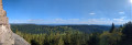
Three days of hiking and camping around the Val de Senones, passing by beautiful viewpoints. Campsites at the Tête du Coquin and the Haute Loge.
From Salm to the Tête du Coquin
10.34 mi
+2,963 ft
-2,349 ft
7h 20
Difficult
Departure from La Broque (Bas-Rhin)
This first stage is probably the hardest day of the route. Beautiful views, pleasant trails and few forest roads. A steep climb at the end of the day explains the "Difficult" rating.
Mountain biking in the Vosges, Day 4: Hohwald - Chatenois (Part 1)
7.84 mi
+840 ft
-1,558 ft
2.5 hrs
Moderate
Departure from Le Hohwald (Bas-Rhin)
This route is the first part of thefourth stage of a seven-day tour of the Alsatian side of the Vosges mountains. Most of the route is on forest roads in good condition. The signage is excellent, consisting of signs with an orange or red mountain bike logo and the letters TMV (Traversée du Massif Vosgien).
Lutzelbourg to Saverne
9.94 mi
+3,294 ft
-3,428 ft
7h 25
Moderate
Departure from Lutzelbourg (Moselle)
A lovely walk between Lutzelbourg station and Saverne station, taking in the castles of Lutzelbourg, Petit and Grand-Geroldseck, and Haut-Barr, an archaeological site with Gallo-Roman ruins, and passing by the Tour du Brotsch.