Country:
 City:


Introduction
This entire route will take walkers across numerous streets, avenues and other roads. To avoid repetition, it is stated here once and for all that you must exercise the utmost caution whenever crossing the road, ensuring you only do so at pedestrian crossings and/or traffic lights.
Start at the Porte de la Chapelle. Access via the metro (line 12) or the tram (line T3b).
(S) On exiting the metro, head north along Rue de la Chapelle. Then cross the tram tracks and Boulevard Ney and follow the boulevard to the right. Walk past a football stadium, then turn left onto Rue Charles Hermite. At the end of the street, cross Avenue de la Porte d’Aubervilliers and the Jardin Anaïs Nin.
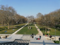
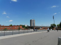
(1) Continue along the Mail Émile Bollaert. Go straight on, passing the Square Claude Bernard. Carry on along Rue Émile Bollaert. You’ll reach the Quai du Lot, a wide esplanade alongside the Canal Saint-Denis.
(2) Turn right and walk alongside the canal. Pass under a road bridge and continue along the Quai de la Gironde. You’ll reach the bridge on Avenue Corentin Cariou, just before the Porte de la Villette. Cross the avenue and enter the Parc de la Villette opposite. Walk straight on for about a hundred metres.
(3) Then turn left towards the entrance to the Cité des Sciences et de l’Industrie. Retrace your steps to the previous junction.
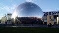
(3) Turn left into a wide covered passageway – this is the Galerie de la Villette. As you approach a playground, turn left to reach the platform opposite the Géode. Turn right and head towards the Canal de l’Ourcq. Turn right and walk alongside the canal for about fifty metres.
(4) Take the footbridge to cross the canal and continue for a few dozen metres. Then leave the gallery on the left. After about a hundred metres, turn right and walk alongside the Grand Halle de la Villette. At the end of this hall, turn left to reach the forecourt of the Philharmonie de Paris.
(5) Then turn right, walk along Boulevard Sérurier, cross Avenue Jean Jaurès and pass in front of the Church of Saint-Claire.
(6) Continue parallel to Boulevard d’Indochine. Keep going straight on and cross Avenue de la Porte Brunet. Carry on for about fifty metres, now walking alongside Boulevard d’Algérie.
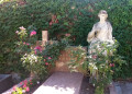
(7) Turn right into the Square de la Butte du Chapeau Rouge. Head south and follow Allée Michel Serrault. Then take a sharp left and turn right to walk alongside the playgrounds. You will reach the Monument to the Victims of North Africa. Continue eastwards, then turn left and walk slightly downhill to the large fountain. Leave the square and you will emerge onto Boulevard d’Algérie.
(8) Cross the boulevard and turn right onto a pedestrian path. Keep walking parallel to the boulevard and the tram line. You’ll reach the Robert Debré Hospital and then the Church of Notre-Dame-de-Fatima.
(9) Continue alongside Boulevard Sérurier and you’ll see the large drinking-water reservoir on your left. Immediately after that, you’ll come to the Paris Archives building; carry on along the boulevard for about thirty metres.
(10) Then turn left, cross over the ring road and enter the Serge Gainsbourg Garden. When you reach a small pond, turn right. Leave the garden, follow Avenue de la Porte des Lilas to the right, cross over the ring road again and reach the Porte des Lilas.
(11) Cross the avenue to the left, then Boulevard Mortier and the tram tracks to the right. Then turn left onto Avenue Gambetta. Take the second left, Rue des Tourelles. Join Boulevard Mortier and follow it to the right. Pass between the Mortier barracks on your left and the Tourelles barracks on your right. You’ll reach a junction at the corner of these two barracks.
(12) Turn left, cross Boulevard Mortier and take Rue de Guébriand. Continue straight on into Rue Léon Frapier. As you approach the ring road, turn right. First turn left then right to cross Rue de Noisy-le-Sec and enter the Parc Canin de la Porte de Ménilmontant. Head right to enter Square Emmanuel Fleury. Go straight on, along the edge of the park, then turn left, running parallel to Rue Le Vau. Find the last exit from the square, between a playground and a sports hall.
(13) Leave the square, cross Rue Le Vau and follow it to the left. Carry on straight ahead and stay on this street until you reach Square Séverine.
(14) Enter the square and go round the playground on the right. Then turn left to exit at the Porte de Bagnolet roundabout.
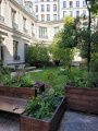
(15) Cross over to the opposite side of Avenue de la Porte de Bagnolet, then turn right onto Boulevard Davout and cross the tram tracks. Then turn left onto Rue de Bagnolet. At the next set of traffic lights, turn left into the Jardin de l’Hospice Debrousse. Walk through the garden, making a circular loop to the right and keeping the Pavillon de l’Ermitage on your right. Leave the garden, cross Rue des Balkans and then Place Pierre Vaudrey.
(16) Enter Square Antoine Blondin. Cross the square and exit on the right. Then turn left, pass by the foot of the Church of Saints Cyril and Methodius on your left, and arrive opposite the Church of Saint-Germain-de-Charonne on your right.
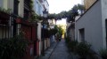
(17) Turn left into the picturesque Rue Saint-Blaise. Continue straight on, then turn right into Rue Vitruve. Take the first left, Rue Roger Bissière. Enter Square de la Salamandre, turn right then left to exit via Rue Paul-Jean Toulet. You’ll come out onto Rue du Clos; follow it to the right. At the traffic lights, pass under the viaduct of the old Petite Ceinture railway line and you’ll immediately come to a junction.
(18) Turn left into Rue des Maraichers. Take the first left, Rue de la Croix Saint-Simon, and walk past Saint-Charles Church. At the next junction, turn right into Rue des Rasselins. Continue to Rue d’Avron and follow it to the left to quickly reach Porte de Montreuil metro station, today’s destination (E).
Return by metro (line 9) or tram (line T3b).

 Visorando Member
 Easy