


Refine your search for walks in Port d'Urets (2512 m)
Port d'Urets (2512 m) walks


 Tuc or Pic de Maubermé
 Visorando Member
 14.66 mi
 +6,601 ft
 -6,601 ft
 12h 30
 Very difficult
 Departure from Sentein (Ariège)
The highest point in the Val d'Aran and Couserans, Maubermé is often overlooked in favour of Mont Valier. However, unlike Valier, the path climbs steadily and pleasantly to Port d'Urets (and its small hut where you can spend the night), then becomes a little steeper to reach the summit, which may prove a little difficult for those who are not used to it.
Walks near Port d'Urets (2512 m)
From the Refuge d’Eylie to Sentein via the Bois de Laspé and the Col des Cassaings
 10.40 mi
+2,825 ft
-3,684 ft
7h 15
10.40 mi
+2,825 ft
-3,684 ft
7h 15
 Difficult
Departure from Sentein (Ariège)
Difficult
Departure from Sentein (Ariège)
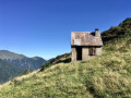
Second day of this trip to the Refuge d’Eylie. A day not to be underestimated.Classified as difficult due to an average gradient (slope) of 24% from (1) to (3). Afterwards, the GR®10 access trail – GRP® Tour du Biros – is very narrow, poorly maintained and at times dangerous due to low-lying, slippery rhododendrons: it is a north-facing slope. There are moments of respite in the woods, where the path is fairly wide and very well signposted. From the Col des Cassaings onwards, conditions improve. The highlights of this balcony trail are the numerous viewpoints from (3) to (4) and from (4) to (6).After at least 6 hours’ walking, including breaks, with 900 m ascent and 1,150 m descent, the arrival at the Ostal du Biros in Bonac is a welcome relief. From there, it’s a 25-minute drive along a very quiet road back to Sentein (E).
The Anglade car park from the Eylie stopover lodge via the Col des Cos
 7.41 mi
+2,267 ft
-2,858 ft
5h 25
7.41 mi
+2,267 ft
-2,858 ft
5h 25
 Moderate
Departure from Sentein (Ariège)
Moderate
Departure from Sentein (Ariège)
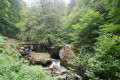
Third and final stage of the short Tour du Biros.The return route follows a very interesting and well-marked path, passing through Col des Cos.A lovely hut with a new roof, open to the public, is available at this pass as a new hut has been refurbished for the shepherd(s). There is also a water source at this spot.A very beautiful descent until you reach the GRP® Tour du Biros.Pass by the lovely Passerelle des Pichès footbridge.You pass through the hamlets of La Peyre and Frechendech before arriving at the car park.This stage is only possible when there is no snow, from late May until the mountain huts close or the first snowfall begins.
The Eylie stopover lodge from the Étang d'Araing refuge
 6.16 mi
+1,824 ft
-5,000 ft
4h 25
Moderate
Departure from Sentein (Ariège)
6.16 mi
+1,824 ft
-5,000 ft
4h 25
Moderate
Departure from Sentein (Ariège)
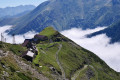
Second day of the Petit Tour de Biros.From the refuge, head due east along theGR®®10to the junction at the foot of the dam (passed the previous day).Continue uphill along theGR®®10. Reach a fork at the Col de la Serre d’Araing.Head left for a round trip to the Pic de l'Har. A stunning 360° view.Then descend via theGR®®10to the Mines de Bentaillou.Head north and follow theGRP®® to the Col de la Catauère (Plateau de Rouge).Then head down theGR®®10to Eylie.This stage is only feasible when there is no snow, from late May until the mountain huts close or the first snowfall begins.
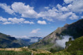
The Étang d'Araing Refuge as seen from the Anglade car park
 6.20 mi
+4,065 ft
-305 ft
6h 25
Difficult
Departure from Sentein (Ariège)
6.20 mi
+4,065 ft
-305 ft
6h 25
Difficult
Departure from Sentein (Ariège)
First stage of the Petit Tour du Biros.From the Anglade car park, a steady climb along theGRP®® Tour du Biros to the Passerelle des Pichès, then a detour via the Chapel and the Cabane Forestière de l'Isard.Then, after returning to theGRP®®, you arrive at the Cabane d'Illau.This is followed by a steep climb up to just below the Étang d’Araing dam and finally the arrival at the Refuge Jacques Husson de l’Étang d’Araing.This stage is only feasible when there is no snow, from late May until the huts close or the first snowfall begins.
From Sentein to the Refuge d’Eylie via the Vallée de l’Isard and the Col des Cos
 8.68 mi
+3,747 ft
-2,864 ft
7h 15
Difficult
Departure from Sentein (Ariège)
8.68 mi
+3,747 ft
-2,864 ft
7h 15
Difficult
Departure from Sentein (Ariège)
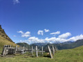
First day of this trip to the Refuge d’Eylie. A day not to be underestimated.Set off from Sentein along an old track, then take the small road up to Bencarrech, joining the GRP® Tour du Biros. The GRP® in the Isard Valley crosses to the other bank via the Illa Maria footbridge. It then passes the Passerelle du Pichès on the right and begins a steep climb. From there, a PR® trail leads to the Col des Cos (mountain hut, fountain). This is followed by a tricky descent due to fallen trees blocking the path (PR®). After at least 6 hours’ walking, including breaks, with 1,200 m of ascent and 900 m of descent, the Eylie restaurant and bar is a welcome sight.
From the Maison du Valier to the Col de la Core – update to the GR®10 route
8.66 mi
+4,692 ft
-3,192 ft
8h 05
Very difficult
Departure from Les Bordes-sur-Lez (Ariège)
Since the fire in July 2026, the terrain has been very unstable (frequent rockfalls) on the GR®10 towards the Ayes Lake, and this section of the path is therefore closed. Consequently, the ONF recommends an alternative route, the details of which are given below, between the Maison du Valier and the Col de la Core. The start and finish points of this stage are accessible by car.
From Banhs de Tredos to Refugi Saboredo via Port de Ratera
7.66 mi
+2,822 ft
-1,076 ft
6h 00
Difficult
Departure from Naut Aran (Lleida)
A lovely walk featuring a fairly steep climb to the Port de Ratera, but no other difficulties. Magnificent scenery of lakes, pine trees and rhododendrons (early in the season). A good overview of the Aigues Tortes park and the Encantats.
From the car park to the start of the 7 lakes route
3.22 mi
+955 ft
-223 ft
2h 20
Moderate
Departure from Naut Aran (Lleida)
No particular difficulty and a beautiful hike.
There is a taxi service that will take you from our departure point to our arrival point for €5 per person.
It is not possible to drive your car to the arrival point for the start of the lake hike.
From the Refugi de Saboredo to Banhs de Tredos via the Tuc Gran de Sandrosa
5.49 mi
+1,365 ft
-3,120 ft
3h 45
Difficult
Departure from Alt Àneu (Lleida)
This second stage offers a return route to the Banhs de Tredos via the Sendrosa Pass (Coth deth tuc Gran de Sendrosa).
The ascent of the Tuc Gran de Sendrosa is optional for hikers with sure-footedness. This option, which is well worth the detour for the exceptional view from the summit, involves a 300-metre climb along the rocky ridge and requires using your hands on relatively easy climbing holds (PD), though there are a few exposed sections where a sure footing is essential. The descent is always slightly more technical than the ascent. Not recommended for inexperienced walkers or those prone to vertigo.
This route is well worth the effort for its wild scenery, the flowers and the abundant vegetation in June. The descent from the pass is quite long and a little steep before rejoining the Day 1 trail, just below the Taxis car park.
Saboredo Refuge - Mallafré Refuge
 6.69 mi
+2,011 ft
-3,346 ft
4h 50
Difficult
Departure from Alt Àneu (Lleida)
6.69 mi
+2,011 ft
-3,346 ft
4h 50
Difficult
Departure from Alt Àneu (Lleida)
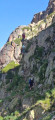
Third and penultimate stage of this loop in the Encantats. Still lots of beautiful lakes and magnificent jagged peaks silhouetted against the sky. Significant elevation gain and sometimes tricky paths with steep slopes, scree and sections with ropes, which fortunately were already in place.